

“Great East Japan Earthquake Tour” (3.11) Fukushima, Japan All Reports
JPA has visited the affected areas 8 times in 7 years from March 2013 to March 2020 with the purpose of sharing what we saw, heard, and felt in the disaster areas with our families, acquaintances, and friends, telling about the disaster and Fukushima, and considering how each one of us can support the affected areas. This is a record of those tours.
Map(Fukushima)
★:ViewPoint
![]()
The First “Great East Japan Earthquake Tour” (3.11) Fukushima, Japan
| Dates | Saturday, March 23 and Sunday, March 24, 2013 |
| Tour Participants | 21 People |
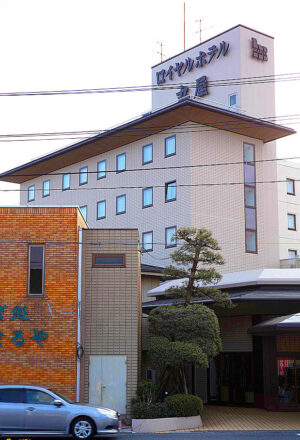
| Accommodations | Royal Hotel Maruya, (Haramachi, Minamisoma City), Hotel Raphine Haranomachi, (Haramachi, Minamisoma City) |
| Itinerary (Day 1) | JR Koriyama Station (10:00 a.m.) → Kawamata Town (rest at Silk Pier) → Iitate Village → Minamisoma City (lunch at a roadside station, visit temporary housing, and drive along the coastline in Odaka area) → Namie Town (Hope Farm, etc.) → Hotel (Minamisoma City) for study session, exchange meeting, etc. |
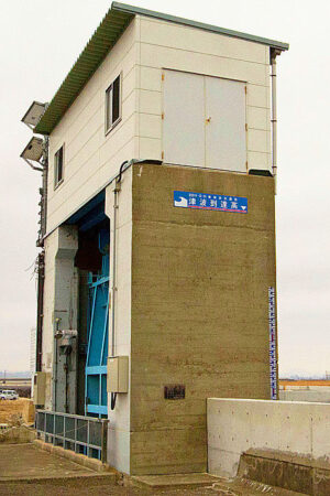
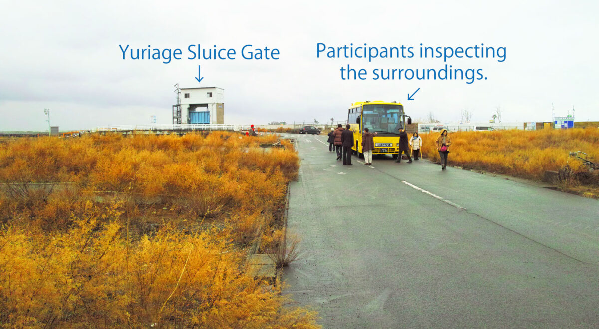
| Itinerary (Day 2) | Depart from hotel (8:30 a.m.) → Matsukawaura, Soma City (former site of seafood market) → Yamamoto Town, Miyagi Prefecture (JR Yamashita Station area) → Yuriage, Natori City (Yuriage Sluice Gate, Mt. Hiwa area) → Sendai Airport / JR Sendai Station (15:00 p.m.) |
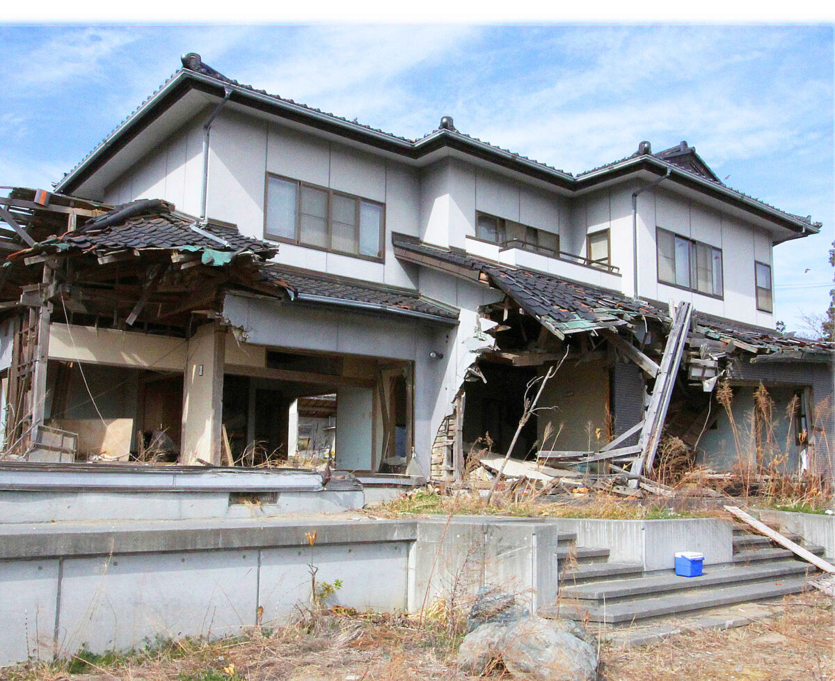
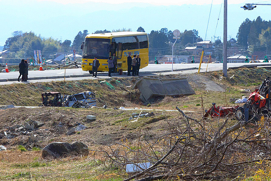
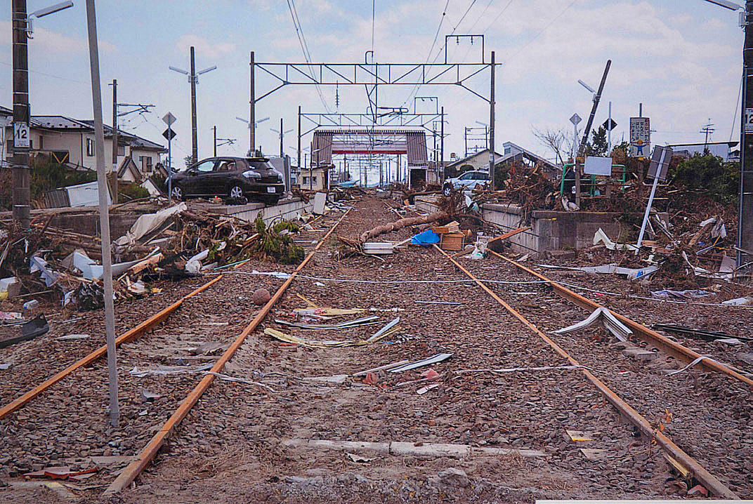
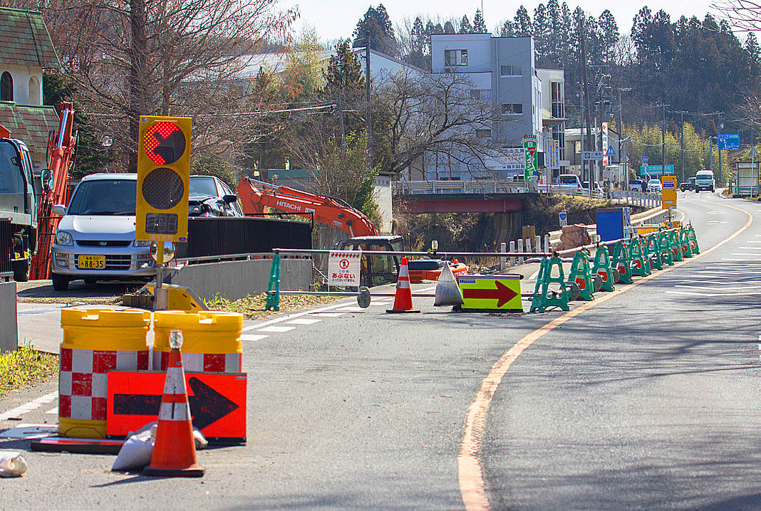
The inaugural tour was held in Namie Town (Futaba County, Fukushima Prefecture), two years after the earthquake, where radiation levels were still high due to the accident at the Fukushima Daiichi Nuclear Power Plant. Due to delays in the clean-up work, many traces of the disaster could be seen everywhere including cars and houses damaged by the tsunami.
Many of the tour participants were surprised and shocked at the difference between the media reports and reality. The visit to the disaster-stricken areas has had a dramatic impact on our lives and sense of values. The tour was well attended and received a great response.
From JR Koriyama Station through Kawamata Town to Iitate Village
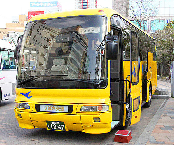
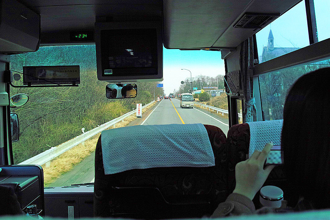
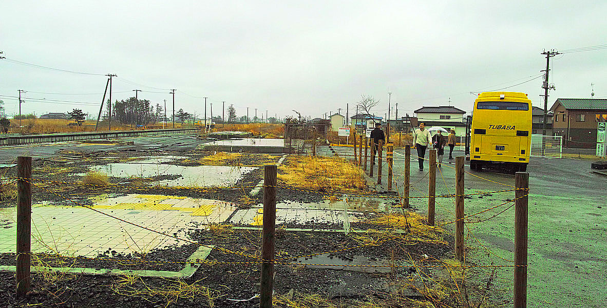
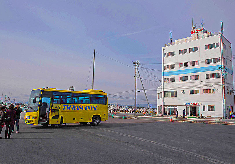
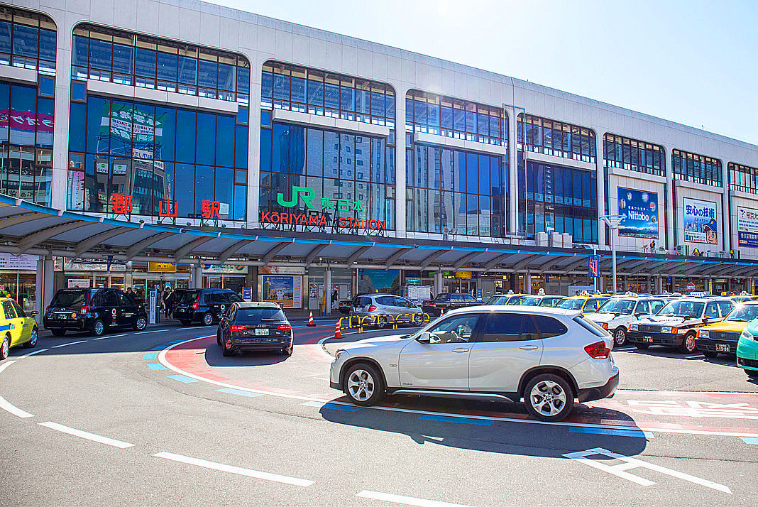
The area in front of Koriyama Station was sparse and subdued. We boarded a yellow Tsubasa Kanko bus at the west exit and left at 10:00 a.m.. We headed north on National Route 4, then turned onto Prefectural Route 39 in Nihonmatsu City, heading for our first destination, Kawamata Town and Iitate Village.
The radiation dose in Kawamata town was 1.05 μSv/h (Sievert/hour). Incidentally, Tokyo’s dose is about 0.04 μSv/h and when we reached Iitate village, the dose rose to 2.7 μSv/h. Iitate Village has been under evacuation order since the nuclear accident, there was no sign of people around the houses and the farmland is in ruins. The Iitate Village Office was a base for the police force that came from all over Japan to support the village. Unfortunately, due to the earthquake, I am visiting this stricken area and will return in the future to monitor the progress of reclamation.


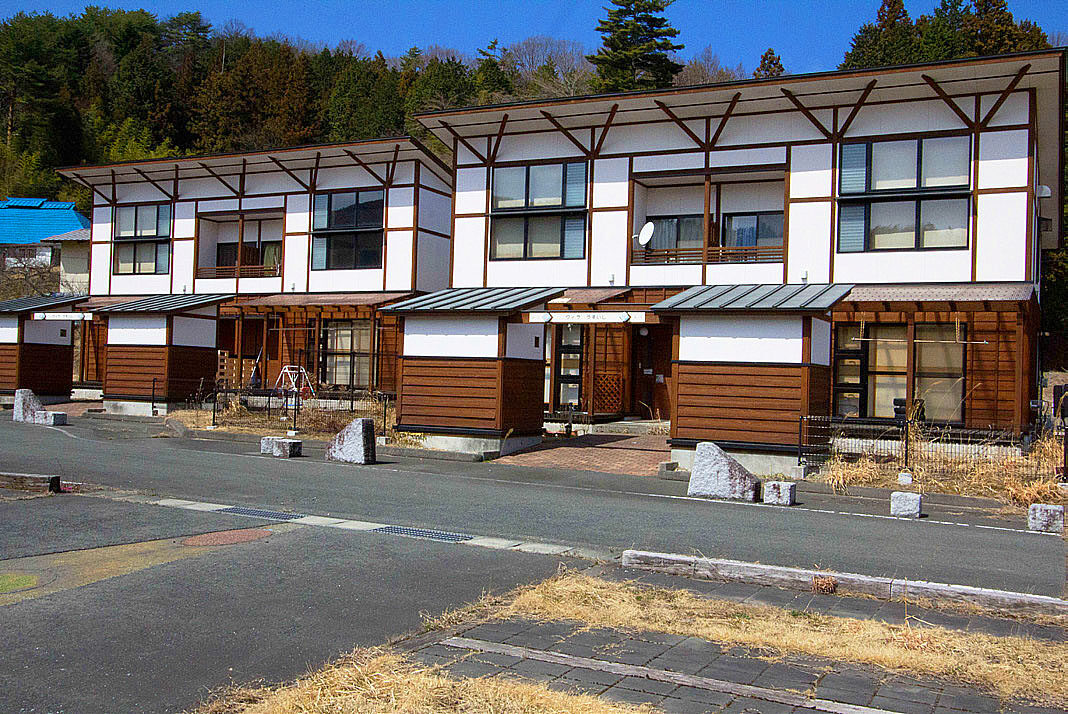
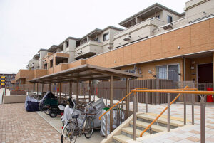
Temporary housing
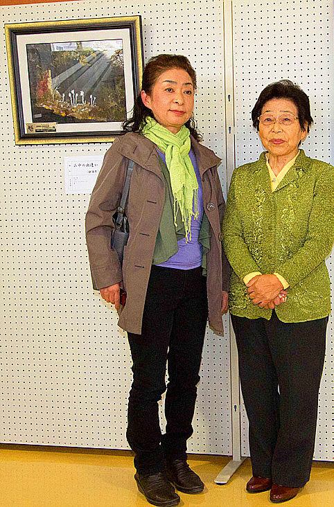
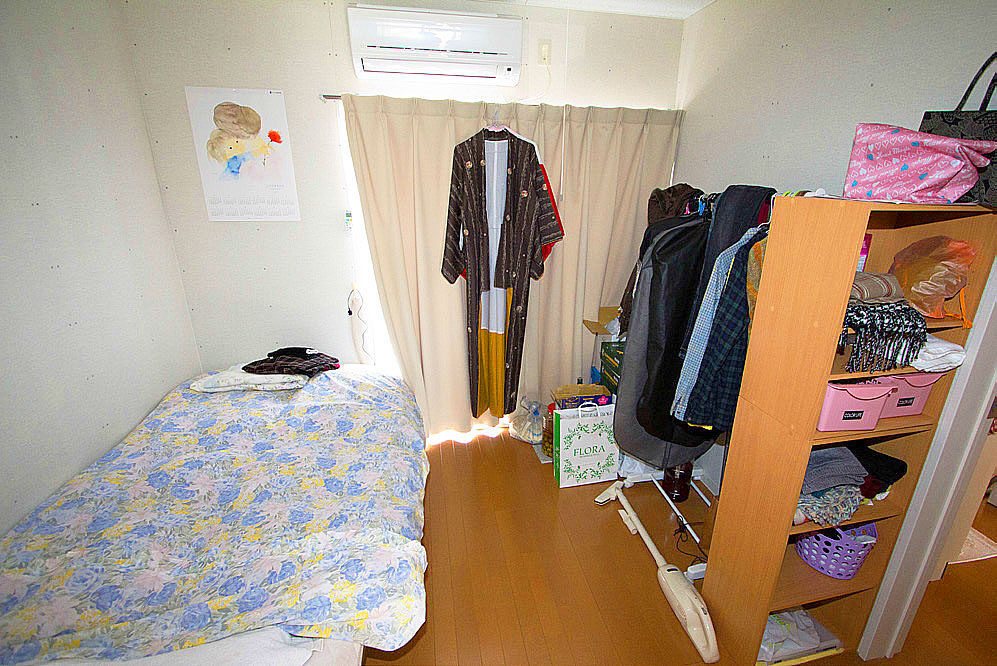
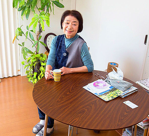
In Minamisoma City, we visited the temporary housing of Ms. Keiko Enei (evacuated from Odaka area), which was built next to the “Road Station”.
The brightly lit interior of the residence was clean and felt more comfortable than I expected. However, according to Ms. Enei, “I can hear my neighbors’ voices and noises because there is only one wall between us, so it is quite stressful. Ms. Enei’s family of five has three rooms, and since they are new, they are still one of the better ones in the temporary housing.(P.S. Unfortunately, her mother passed away in 2018). We pray for her soul.

Study session and exchange meeting at the hotel in Namie-cho and Haramachi from Odaka-ku
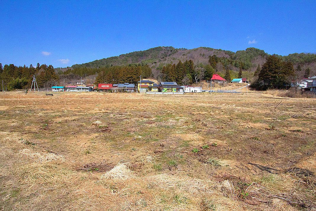
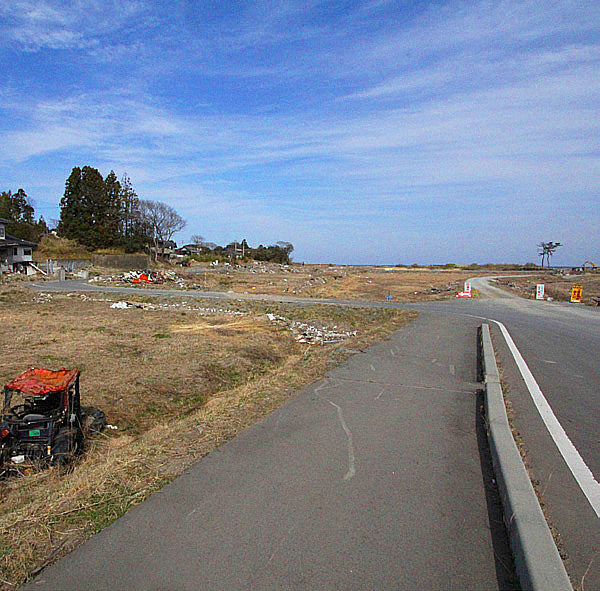
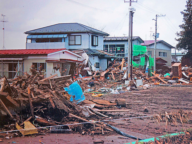
The coastline in the Odaka area of Minamisoma City suffered triple damage from the earthquake, tsunami, and radiation contamination. It has already been two years since the earthquake, but the area is still in the same state as it was when the disaster struck. I saw many damaged houses and cars.
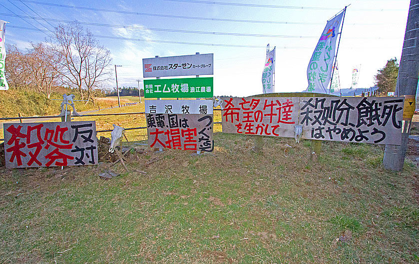
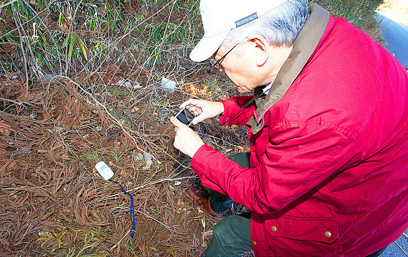
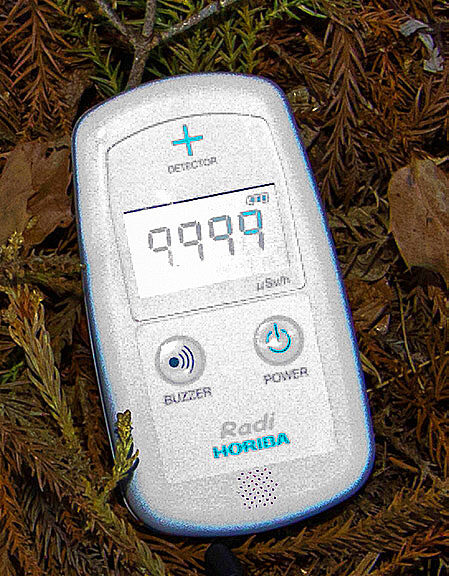
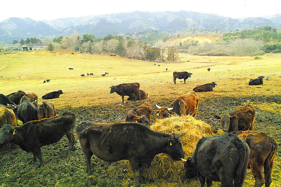
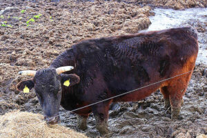
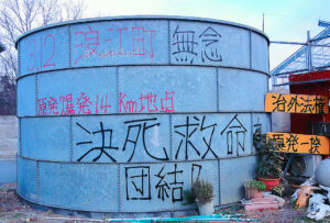
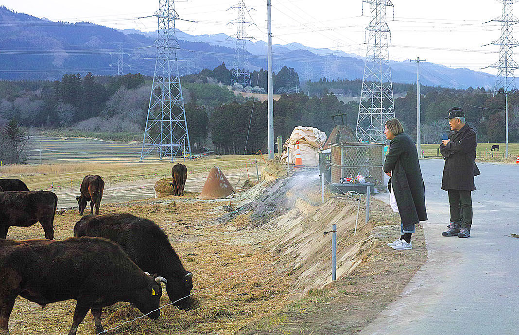
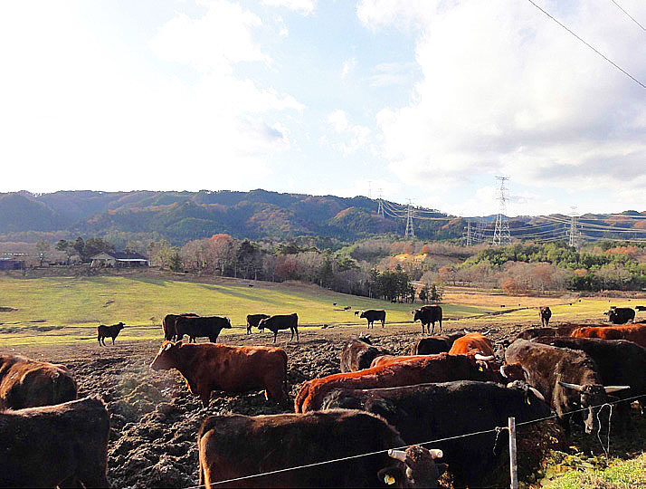
At the Farm of Hope (Yoshizawa Farm) in Namie Town, 14 km from the Fukushima Daiichi Nuclear Power Plant, the dosimeter read 9.999 μSv/h, which was unmeasurable. The high radiation level made us feel anxious. Radiation has no color or smell, but this only amplified our quiet fear. At the Farm of Hope, cows that were exposed to the radiation are kept in accordance with Mr. Yoshizawa’s belief that “cows cannot be killed or injured because of human selfishness. This time, we were able to observe the ranch from a distance.
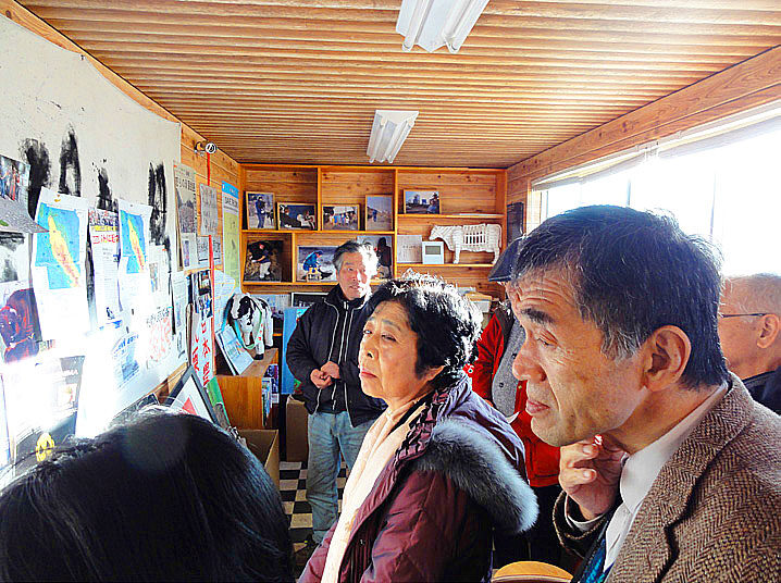
As soon as we arrived at the hotel in Haramachi after the inspection, we had a study session. First, we listened to Ms. Keiko Enei (a rheumatism patient) from the Odaka area talk about her experience. Next, Ms. Miki Aoki, a reporter for the Asahi Shimbun newspaper, shared information she had obtained from her newspaper interviews and other sources, such as “cutting corners on decontamination”. Ms. Enei’s story is included in the lecture proceedings (page 64).

Matsukawaura
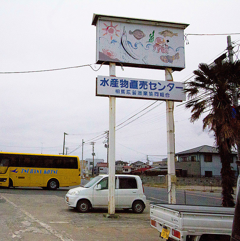
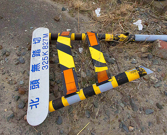
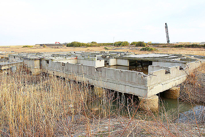
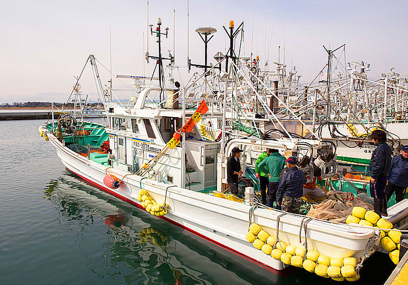
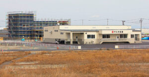
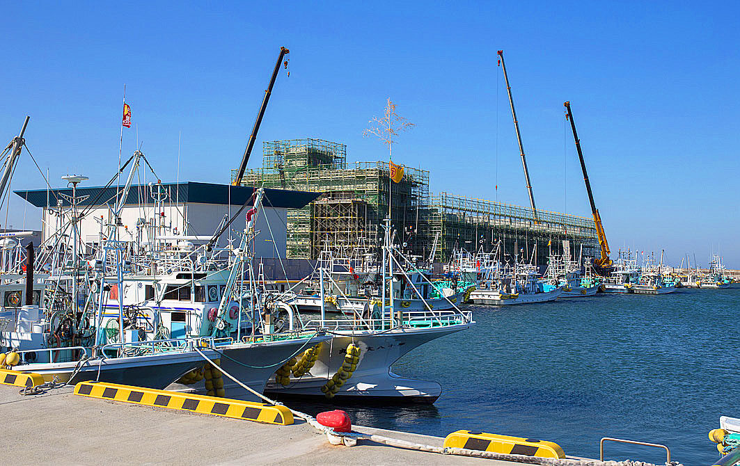
On the second day, we headed further north. In Matsukawaura, Soma City, the building of the fishery direct sales center at the fishing port was destroyed by the tsunami and only a signboard was left. Due to marine pollution, fishing is no longer possible, but there are still many fishing boats lined up. At present, we are conducting weekly test operations to measure radiation levels. We were told that the situation is gradually recovering, but some young fishermen are quitting to help with decontamination in the area.


Yamamoto-cho
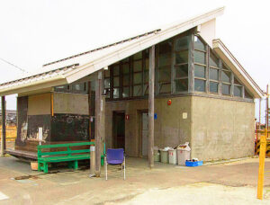
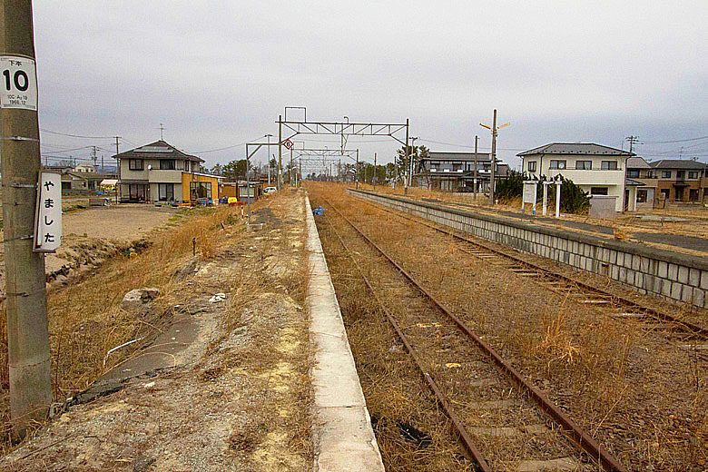
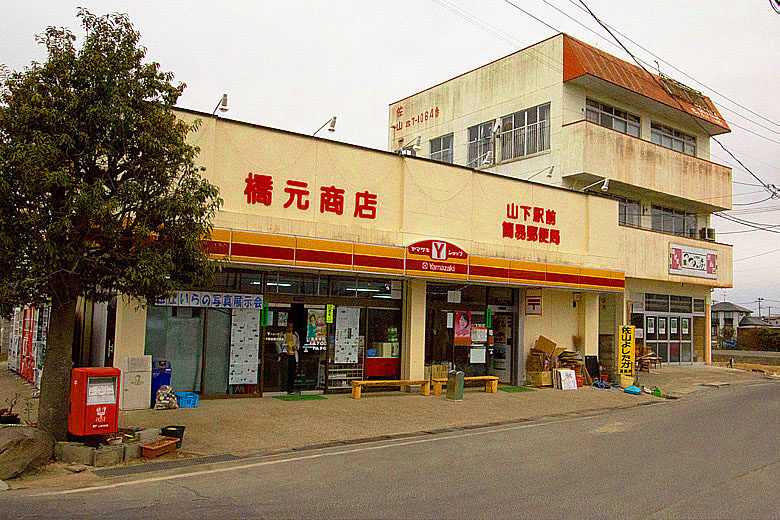
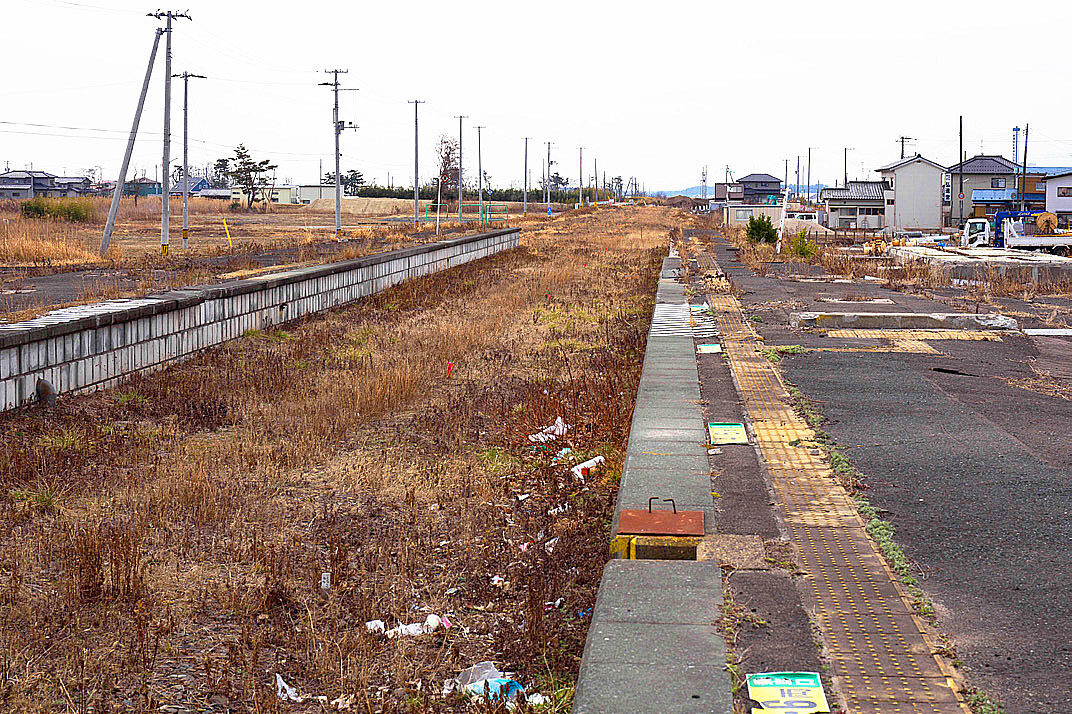
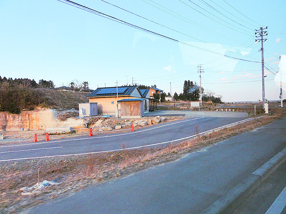
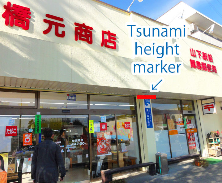
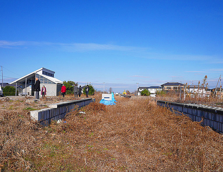
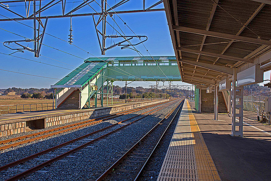
JR Yamashita Station and its surrounding area in Yamamoto-cho, Miyagi Prefecture was severely damaged by the tsunami due to its proximity to the coastline. At the time of the inspection the station building and the overpass had been removed but the tracks and signals were still intact. In addition, the toilet rooms at the station, which were originally planned to be removed by JR, were retained at the strong request of the local residents. In Yamamoto-cho, famous for its strawberries, work is underway to remove ocean salt damage from the fields in order to resume farming. The Hashimoto Store in front of the station had reopened for business. Mr. Hashimoto, the owner of the store, said, “We don’t have many customers because our neighbors have moved to reconstructed houses, but we are doing our best for the recovery of the town. He said that sometimes volunteers come by bus. At the moment, there are no reconstruction plans for the town. Nearby was the site of the Fuji Kindergarten where five children were killed and four others are missing after their bus was swallowed by the tsunami.
Yuriage area
(Underlined in red)
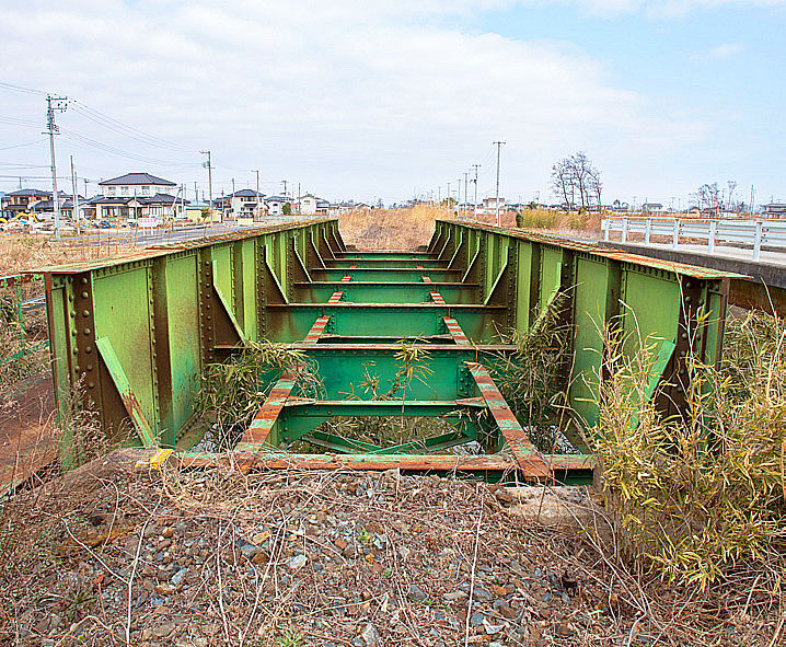
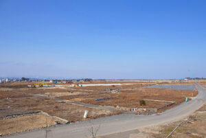
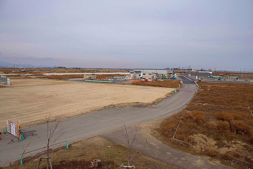
In Natori City, Miyagi Prefecture, 911 people were killed by the tsunami, most of them in the Yuriage area. The number of victims in Yuriage increased due to its proximity to the coast and its dense population. It was as if an entire town was lost. At the time of our visit, the debris from the buildings had been removed, but the reconstruction had not progressed and there was a vast area of land that had been cleared. It was a sight that brought tears to my eyes.
Overall, I had a strong impression that even though it had been two years since the earthquake, the recovery had not progressed much.
(Reported by Masaru Fujiwara)

The 2nd “Great East Japan Earthquake Tour” (3.11) Fukushima, Japan
| Dates | Saturday, March 1 and Sunday, March 2, 2014 |
| Tour Participants | 8 people |
| Accommodations | Royal Hotel Maruya, (Haramachi, Minamisoma City) |
| Itinerary (Day 1) | JR Koriyama Station (10:00 a.m.) → Kawamata Town (rest at Silk Pier) → Iitate Village → Namie Town → Odaka District → Hotel |
| Itinerary (Day 2) | Depart from the hotel (8:30 a.m.) → Matsukawaura, Soma City (visited seafood market) → Yamamoto Town, Miyagi Prefecture (JR Yamashita Station area) → Yuriage, Natori City (Yuriage Sluice Gate, Hiyoriyama area) → Sendai Airport / JR Sendai Station (15:00 p.m.) |
From JR Koriyama Station through Kawamata Town to Iitate Village
When we arrived at Koriyama Station, the same yellow bus and driver as last year was waiting for us. It was a good omen for the trip. The journey to Kawamata town went smoothly. The gaps in the road that we felt right last year seemed to have lessened. We took a break at the Roadside Station Kawamata. While eating a famous snack we listened to a story by a driver who was also affected by the earthquake. He was very considerate and patient with all the participants, even though some of them were on crutches. After taking a short break we headed for Iitate Village. The radiation level in Iitate village was still high, more than 8 μSv/h in the grass and 1.03 μSv/h in the air. It was not a livable condition. Even though, grass was still growing in the fields and rice paddies, it was a depressing sight.
At the Roadside Station in Minamisoma, we met up with Mr. Masao Sato who lived in Namie Town and Ms. Keiko Enei who lived in Odaka, Minamisoma City. Ms. Enei will not be able to live in her house in Odaka until the decontamination process is completed. So she is living in temporary housing near the roadside station and we visited her house as we did last year. I thought it was an adequate house compared to other temporary housing I’d seen in terms of size and construction.

Namie Town
As we drove south on Route 6, Mr. Sato showed us a “Namie Town Pass” valid from January 1 to March 31, 2014. It includes the license plate number of the designated vehicle without which you cannot go to your home. As we crossed the Ota River he told us the following. “The number of animals and their ecology are changing” and there are finally many salmon in the Ota River. But, we can’t catch them because of the radiation contamination. We don’t know what will happen to them in the future because we are not in the business of releasing them. We could see many dragonflies and other animals perched on telephone poles. We headed for the Hope Farm, but it took almost twice as long to get there as usual due to the road construction on Route 6. On the way there, we noticed a signboard saying that passes will be checked, so we changed direction. We also saw a police vehicle with Obihiro plates in the parking lot. Police cars from other prefectures are often seen on the coastal roads of Miyagi as the police are helping out during this crisis. Cows not being shipped were relaxing at the Hope Farm. The scene reminded me of a passage from Tatsuji Miyoshi’s “Oaso”. However, in the grass at the entrance, a dosimeter was vibrating with a warning sound, showing a high value of 11.1 μSv/h.
From JR Odaka Station area to the Horse stable at Ms. Enei’s house
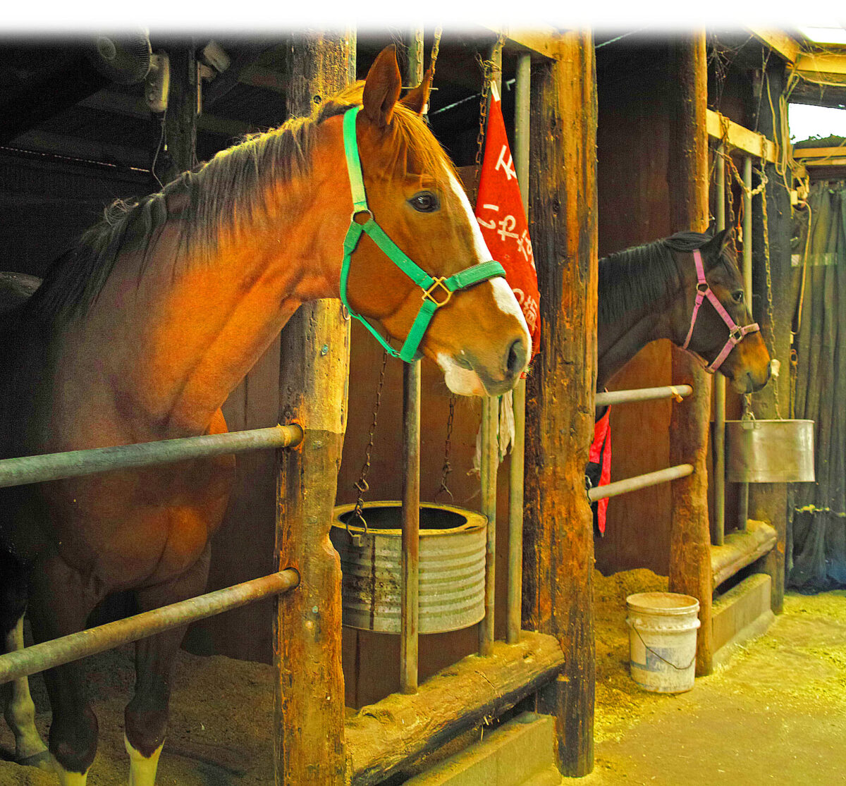
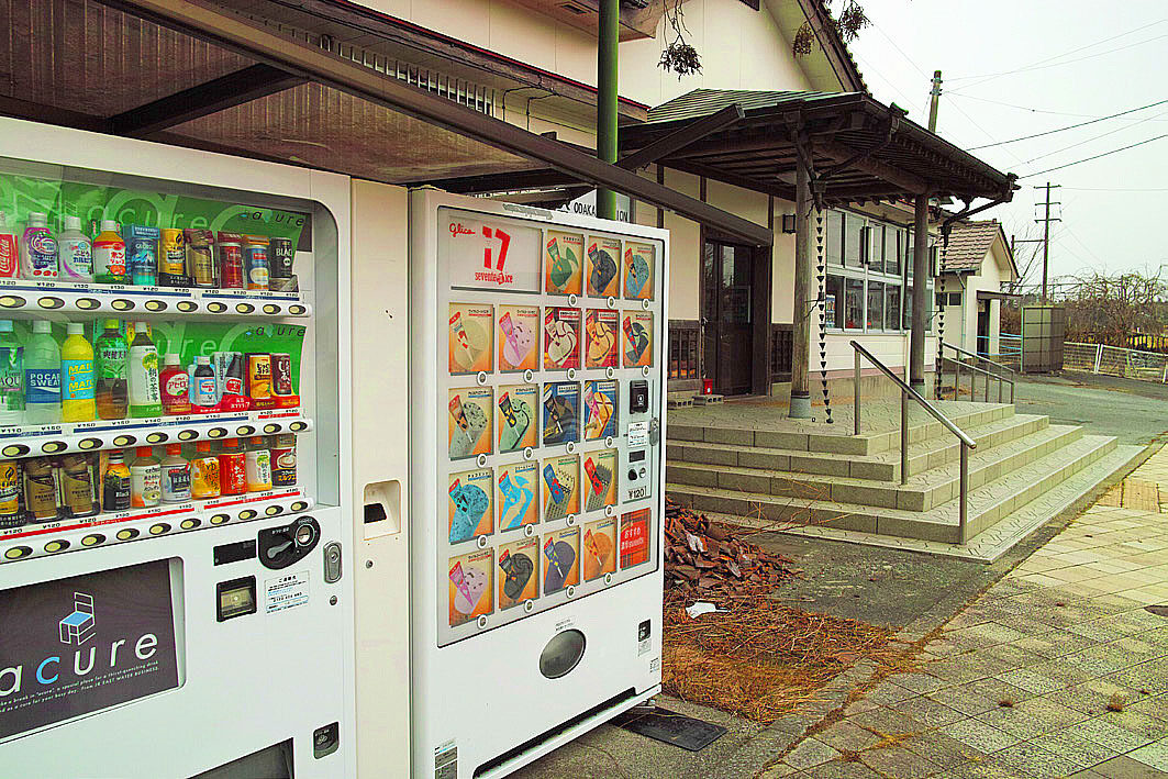
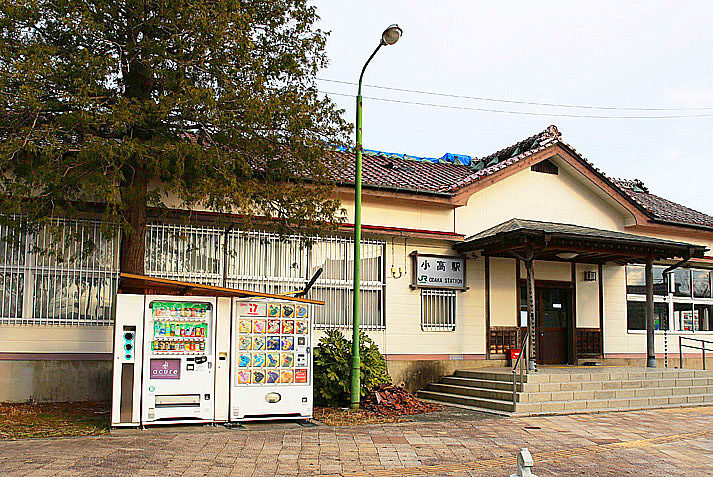
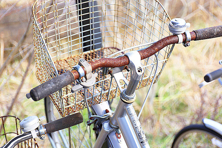
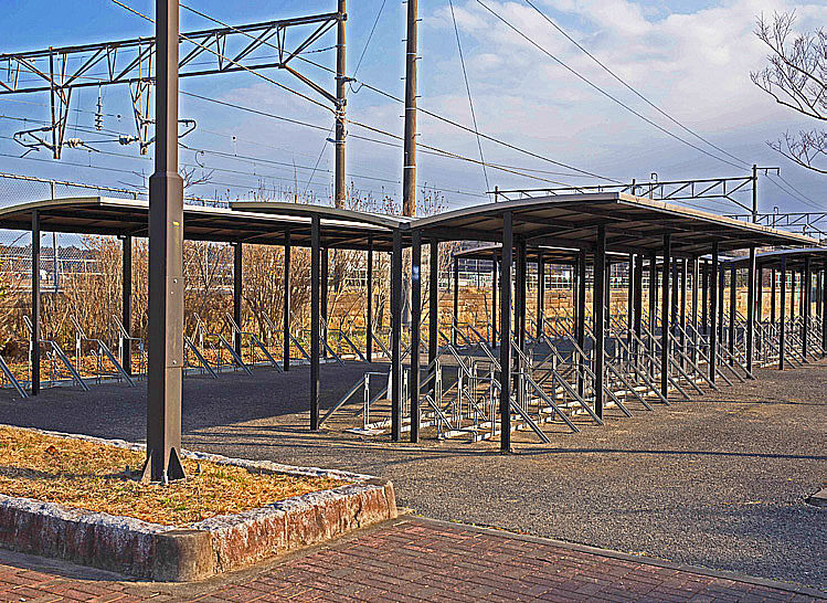
The road to Odaka station was desolate, the surrounding fields and rice paddies were covered with weeds and only decontamination vehicles and workers were visible. Odaka station was quiet. We were able to enter the station freely. The grounds were covered with weeds and the railroad tracks were still rusty. The front of the station was vacant, there was a vending machine that did not work. In the distance we could see a traffic light and a few cars were. In the bicycle parking lot there were many bicycles that weren’t used since the earthquake. We left Odaka station and headed for Ms. Enei’s house. We took a small bus, which was twice as big as a regular car and arrived at the house on top of a small hill. The dog, wagging it’s tail, approached me but the cat ran off looking at me sideways. Across from the main house are the stables. In the back, there is a small open space for horses to run. I was told that they participate in the Soma Nomaoi festival every year, so there were several horses there. When we entered the stables, despite the large number of people, the horses were sniffing happilly and begging to be petted. I approached them with trepidation, touched their noses and they shook their heads in delight. They were really cute. I heard that some of the horses were saved from the tsunami after the earthquake. I felt the inexplicable unreasonableness of not being able to live in a house, garden or farm yet horses are living there in a somewhat normal life.
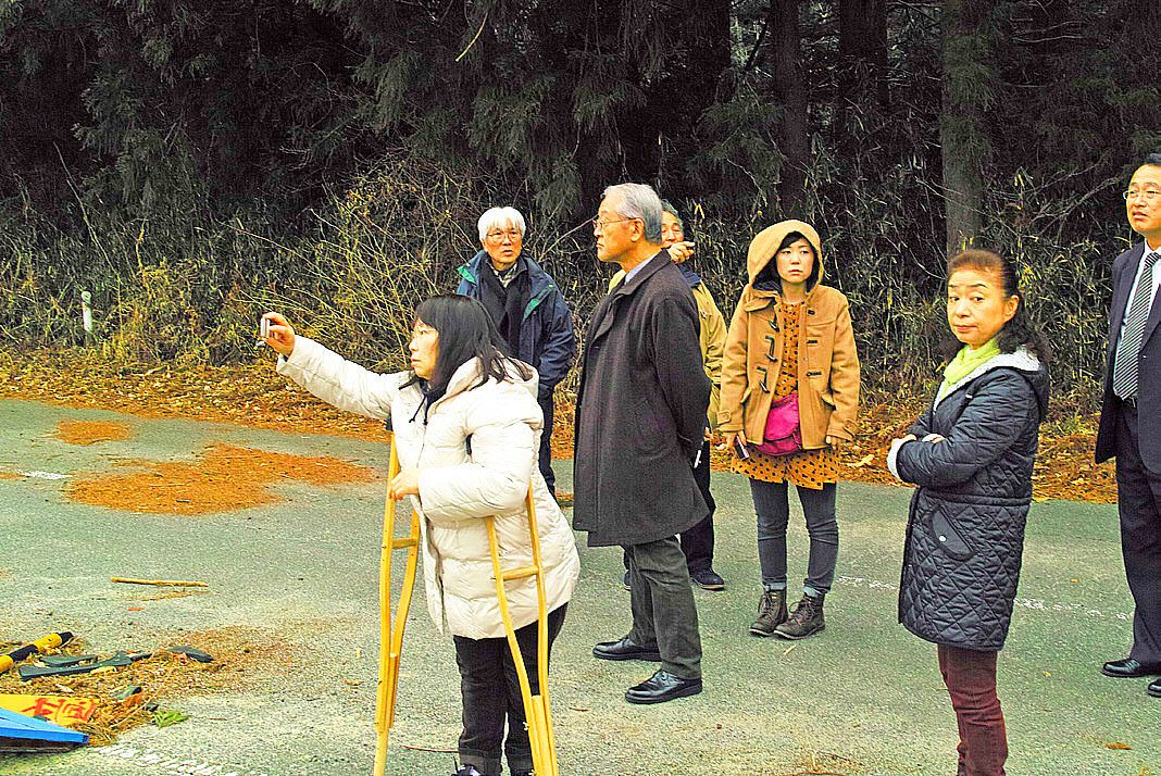
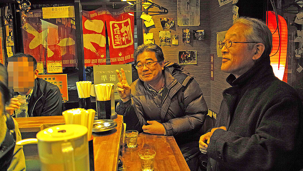
We returned to the hotel for dinner and a get-together. I listened to everyone’s impressions with great interest. Young people from distant areas wondered how they would best be able to tell about the disaster. One person who had taken refuge in a shelter with crutches said that it was the first time he had seen the actual damage caused by the earthquake. Afterwards, we went to a food stall village (Machinaka Hiroba) where many of the bars, damaged by the disaster, were. I wondered how long these small, crowded pubs would survive.
Yamamoto-cho
After breakfast, we headed north on Route 6 to the former JR Yamashita Station in Yamamoto-cho, Miyagi Prefecture. I was relieved to see that strawberry greenhouses were under restoration along the road as we headed toward the coast from the national highway in Yamamoto-cho. It reminded me of the time I went strawberry picking with my family before the earthquake.
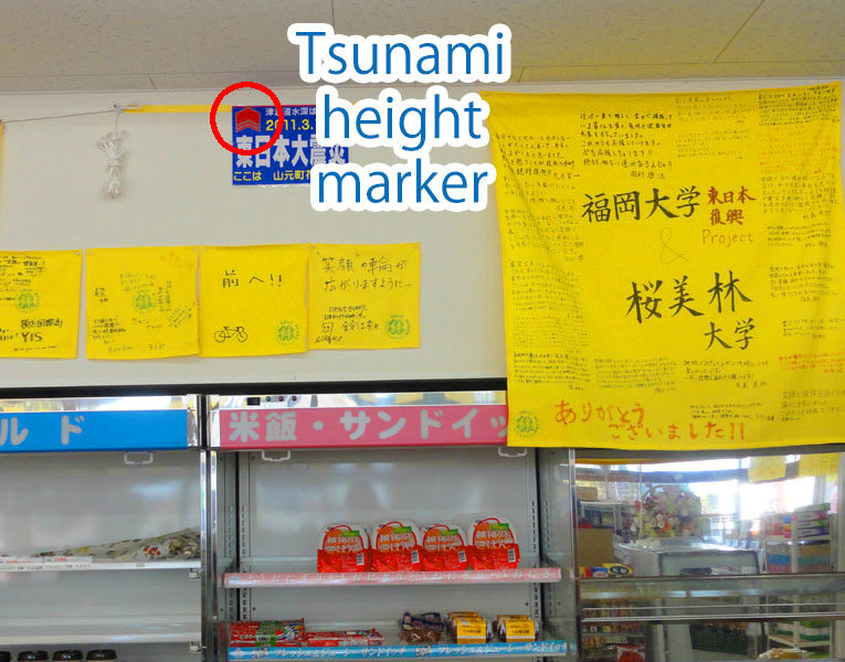
At the old Yamashita Station I entered the “Photo Gallery for Everyone” which is run by the Hashimoto Shop in front of the station. There are photos from before and after the disaster on display, but it was difficult to look directly at them. The signboard in front of the station says that the Joban Line should take its original route, but I wonder if that will actually happen.
Yuriage

(Report by Mr. Osamu Koseki)
The 3rd “Great East Japan Earthquake Tour” (3.11) Fukushima, Japan
| Dates | Saturday, March 14, and Sunday, March 15, 2015 |
| Participants | 9 people |
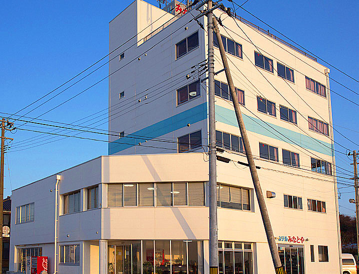
| Accommodations | Hotel Minatoya (Obama, Minamisoma City) |
| Itinerary (Day 1) | JR Koriyama Station (10:00 a.m.) → Iwaki City → Namie Town, Futaba Group, Fukushima Prefecture (Karino Elementary School, Sato's house, Hope Farm) (Take the Ban-Etsu Expressway → Joban Expressway "Hirono/Naraha" Interchange and drive north on Route 6 into Namie Town) (Ban-Etsu Expressway → Joban Line JR Odaka Station and surrounding area, coastline) → "Hotel Minatoya" in Matsukawaura, Soma City (5:30 p.m.) |
| Itinerary (Day 2) | Depart from the hotel (9:00 a.m.) → Yamamoto-cho, Watari-gun, Miyagi Prefecture (former site of JR Yamashita Station on Joban Line, Yaegaki Shrine) → Yuriage area, Natori City (Hiyoriyama and Suimon area) → Breakup at JR Sendai Station (2:00 p.m.) |
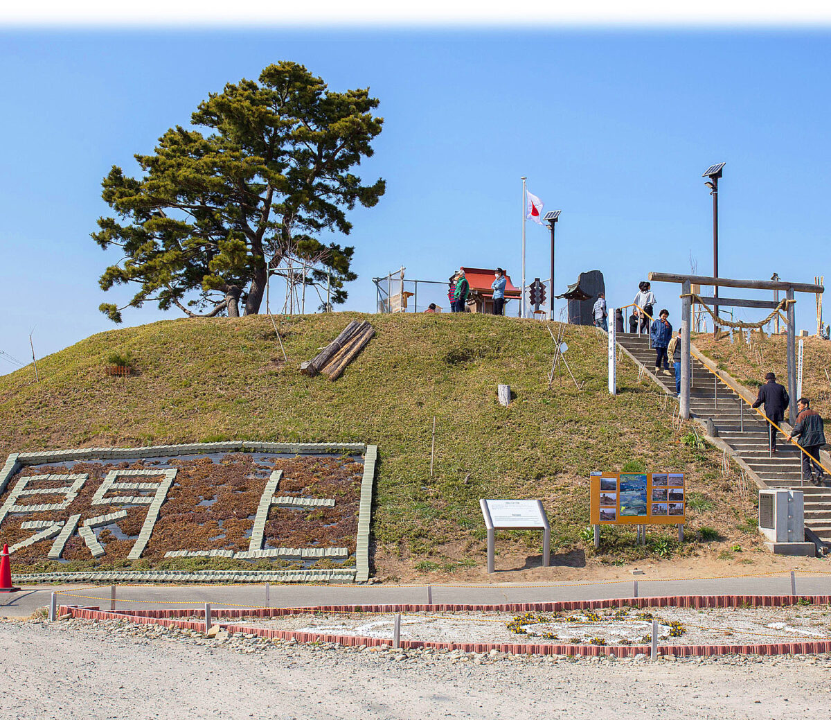
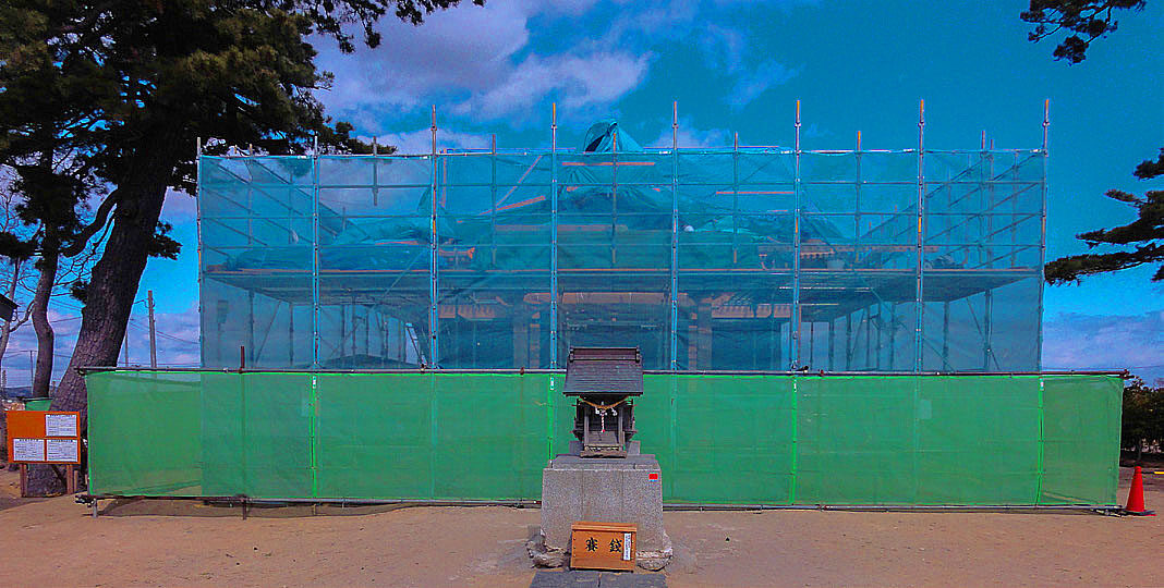
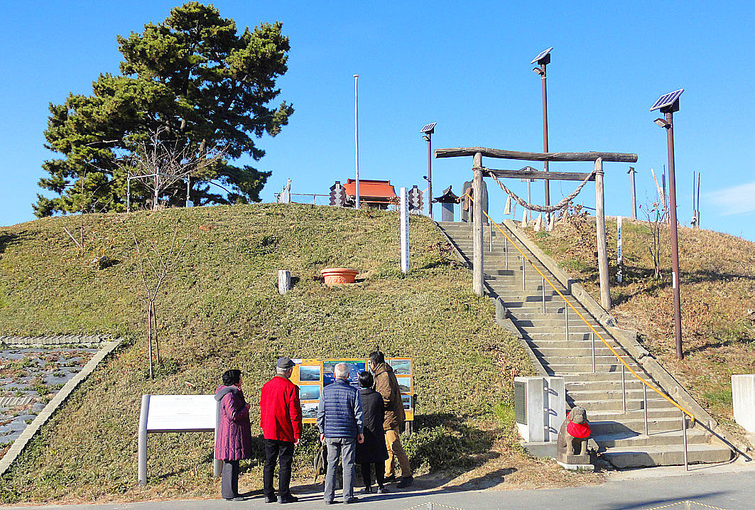
At the top of the 6.3-meter-high formation is Tominushihime Shrine, which has been a popular recreational spot for local residents.
However, it was swallowed up by the tsunami that followed the Great East Japan Earthquake on March 11, 2011, the shrine building was destroyed and the stone monument collapsed.
The current shrine building was rebuilt in May 2013 and many people visit it, making it an important place for the repose of souls and a symbol of recovery of Natori city.
March 11, 2015
Ichijuro Sasaki, Mayor of Natori City
(Reproduced from the information board)
From Koriyama Station (JR)
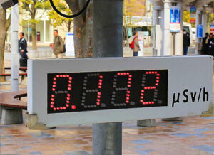
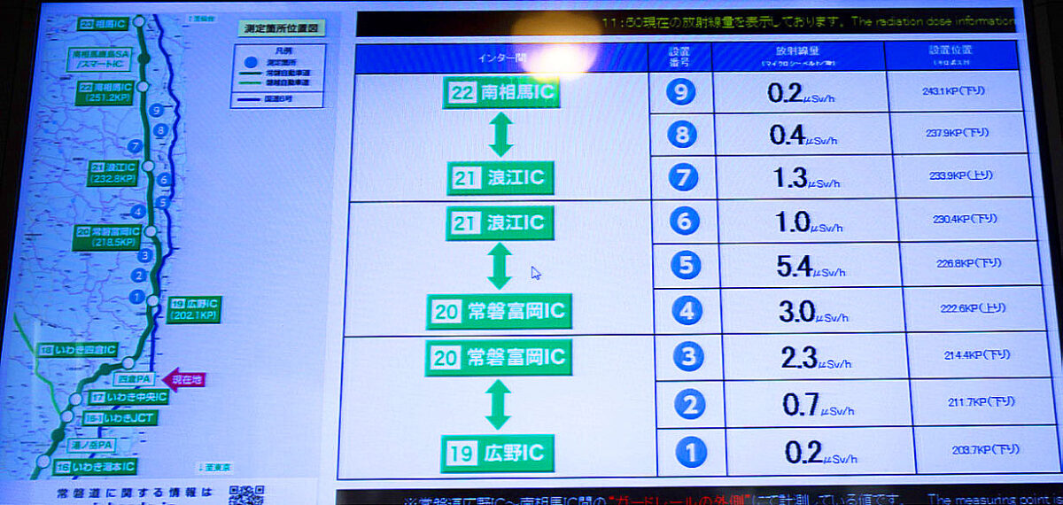
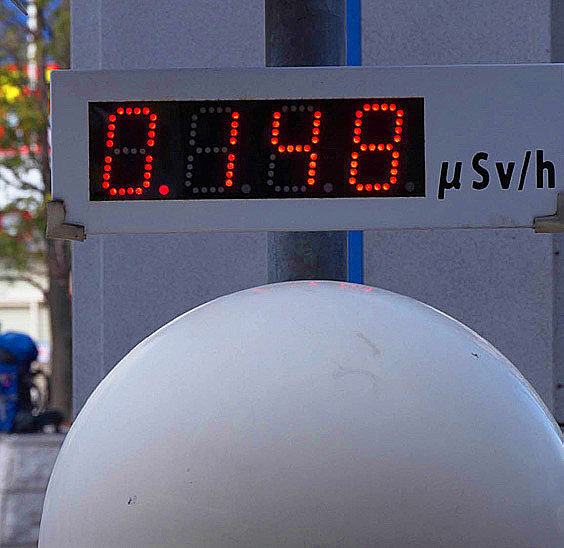
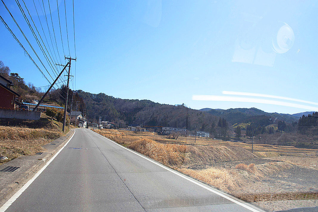
The dosimeter in front of JR Koriyama station read 0.172 μSv/h, which was a little high since Tokyo is around 0.04 μSv/h. This time, we left at 10:00 a.m. in a 10-seater rental van. We took a southbound route. First, we drove the Ban-Etsu Expressway south from Koriyama, and then took the Joban Expressway north to Iwaki City. The road between Tomioka IC and Namie IC had just reopened on March 1. Along the way, we stopped at the Yotsukura Parking Area and instead of a closed store there was a mobile car, sales stand. The radiation levels posted on the bulletin board were as high as 3.0 μSv/h at the Joban-Tomioka IC and 5.4 μSv/h at the Namie IC. We went out from the Hirono Interchange to the open road (Route 6) to inspect the situation around us and witnessed decontamination work here and there. When we got close to Namie Town there were “Off-limit area” signs and guards were on duty. The atmosphere was somber. Even so, I was surprised to see a lot of traffic on the main road. Motorcycles and pedestrians are prohibited.


Namie Town
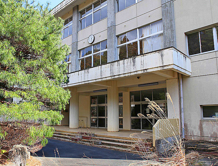
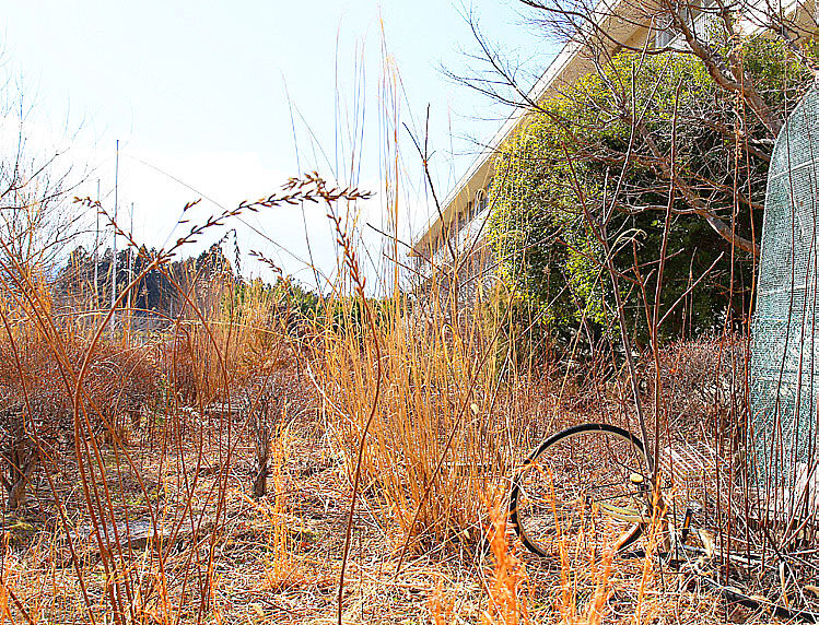
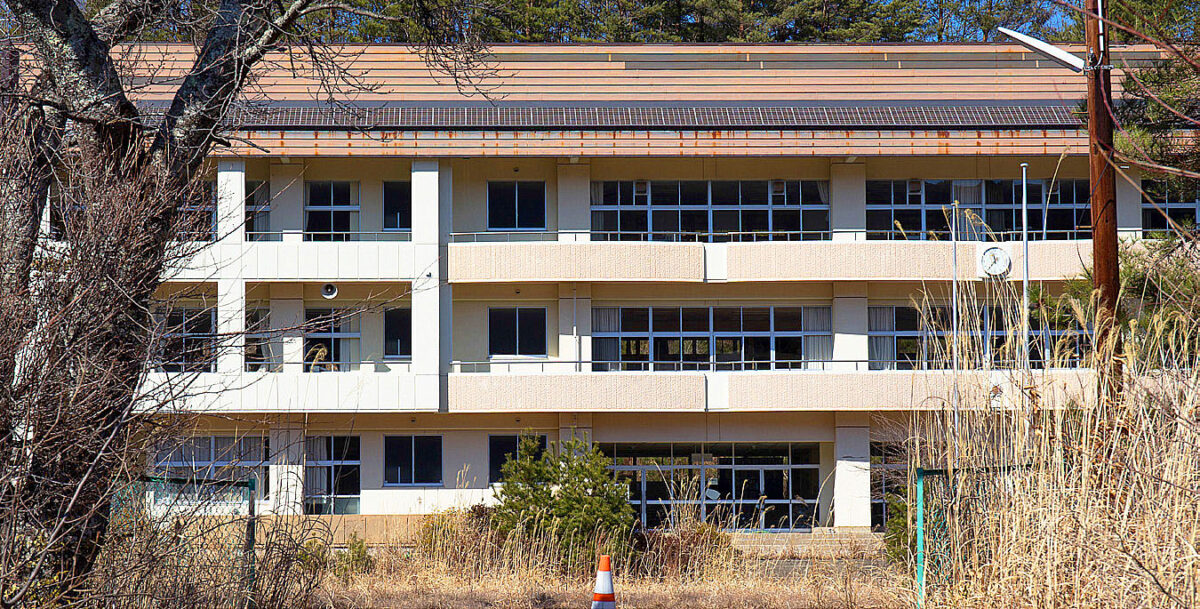
In Namie Town, with the help of a local resident, Mr. Masao Sato, we visited Karino Elementary School which is located in the restricted residential area. The school temporarily housed evacuated residents who were unaware of the high level of radiation due to the lack of information at the time of the nuclear accident. The school is now abandoned, and the grounds are overgrown. At the time of the disaster the government and TEPCO were slow to respond to the situation in Namie, unlike the towns of Futaba and Okuma where nuclear power plants are located. One of the typical examples is the evacuation of areas with high radiation levels.
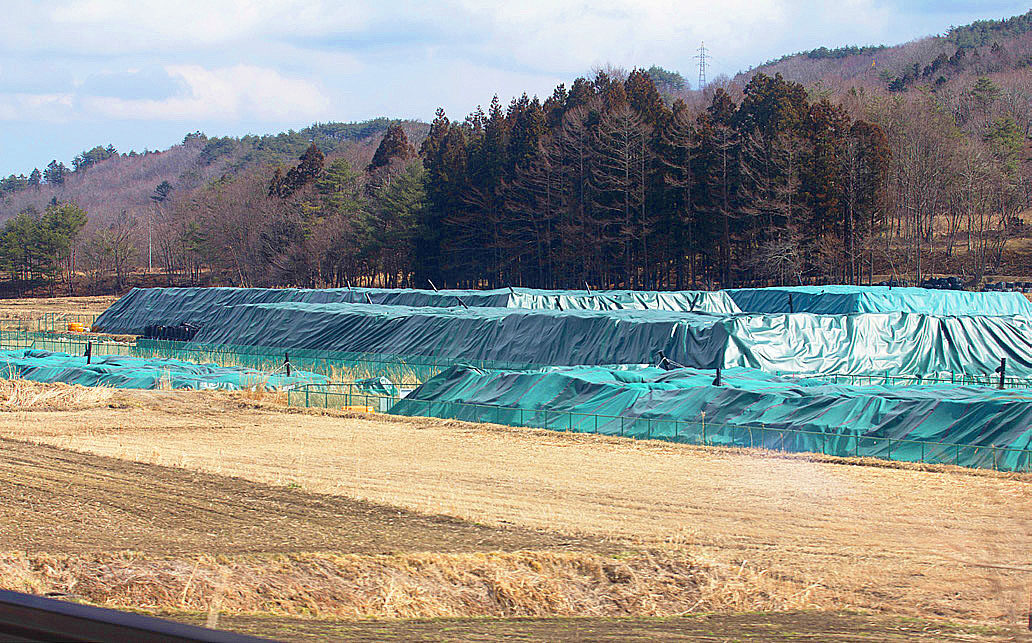
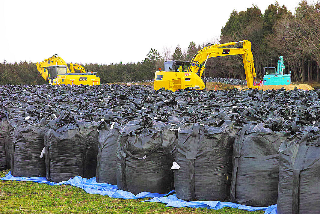
In Namie Town, decontamination activities were also underway, stripping the soil and weeds from the ground surface and piling them up in black storage bags called flexible container bags.
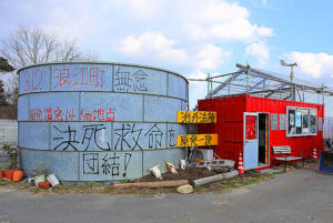 Next, we visited the Farm of Hope (Yoshizawa Farm), where we were able to hear directly from the representative, Mr. Masami Yoshizawa. The ranch is still raising 300 cows that have lost their economic value due to the radiation exposure. Mr. Yoshizawa said, “The restart of the nuclear power plants around the country are about to begin with no consideration of the people still suffering in Fukushima. One need to to actually experience the evacuation to understand their point of view. Agricultural dams are contaminated and can’t be used, and we can’t grow rice here. Consequently, the price of rice has plummeted and it is not feasible to grow. Ninety percent of the boats at the fishing port in Namie town have been destroyed. What are they going to do when they return to the town? In the future, only the elderly will return to their homes when the government lifts the ban. The building of reconstructed housing will be further delayed by the limited construction capabilities due to the building of Olympic venues. Decontamination is a deception. “They say, “Decontaminate where you can see it” and “We are doing decontamination.” I think it would be more honest to say that Namie is a town of death, a town of despair. “This was a straightforward message.
Odaka Ward
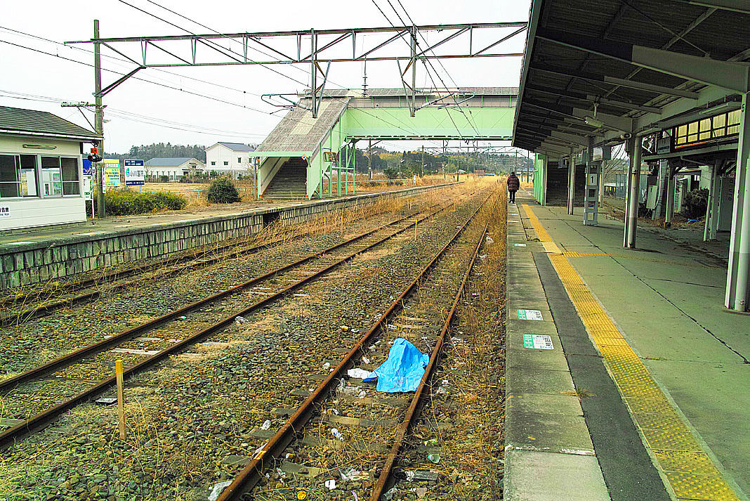
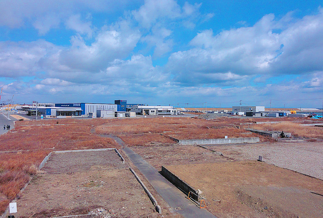
The area around JR Odaka Station in Minamisoma City is in the area preparing for the lifting of the evacuation order. Houses damaged by the earthquake have been removed and roads have been repaired, but there was not a soul to be seen except for us. It was like something out of a science fiction movie. The station was closed and trains were out of service.
In the areas near the coastline, damaged cars were being removed and infrastructure such as roads and utility poles were being built, but there were no signs of progress in reconstruction.
Matsugawaura
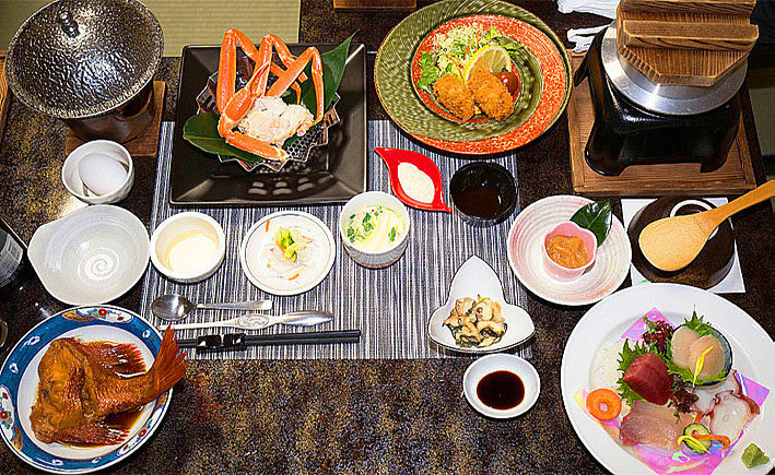
We were treated to a very fine dinner at the “Hotel Minato-ya” in Matsugawaura, Soma City, where we stayed. Minatoya was also affected by the earthquake. We watched a video of the tsunami that was taken from the hotel and felt empathy for the people who suffered from the disaster. In Matsugawaura, other hotels and inns that were also affected, were reopening for business. Work to repair the buried fishing port had begun making me realize that even in Fukushima Prefecture, reconstruction has progressed. However, according to the proprietor, the fishing boats are only allowed to go out once a week. When I asked her why, she said that even if they catch many fish, they can’t sell them from Fukushima.
Yamamoto Town
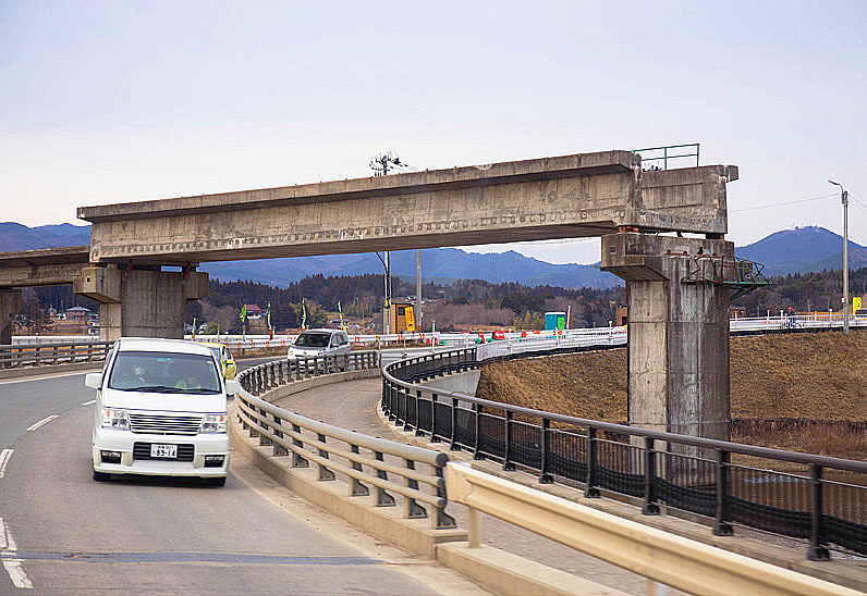
In Yamamoto Town, Miyagi Prefecture, the JR Joban Line was undergoing restoration work this time with elevated tracks. In line with the reconstruction plan of Yamamoto town, JR East is also relocating the tracks to the land side by elevating part of the track to prevent the recurrence of tsunami damage. In front of the former JR Yamashita Station, the Hashimoto Store was one of the first businesses to reopen after the earthquake, but in the future reconstruction plan, the center of the town, including the station, will be moved inland. There is a regular bus service and housing is being rebuilt little by little. In the farmland, strawberries in greenhouses had begun to grow utilizing hydroponic cultivation which is less susceptible to salt damage. The tracks of the old railway line have been removed.
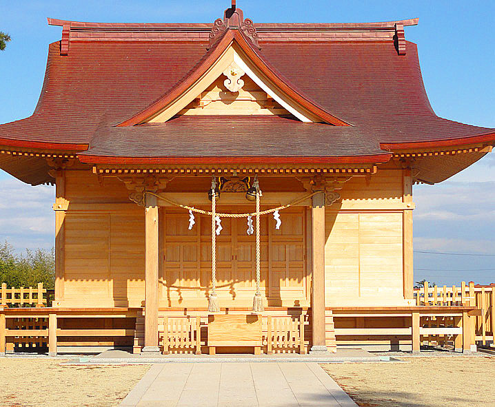
Near the beach, there was a shrine whose main building was washed away by the tsunami. It was called Yaegaki Shrine, and when we looked it up later, we found out that it was an historic shrine built in 1855. We all prayed for recovery at the small shrine that had been rebuilt.


Yuriage Area
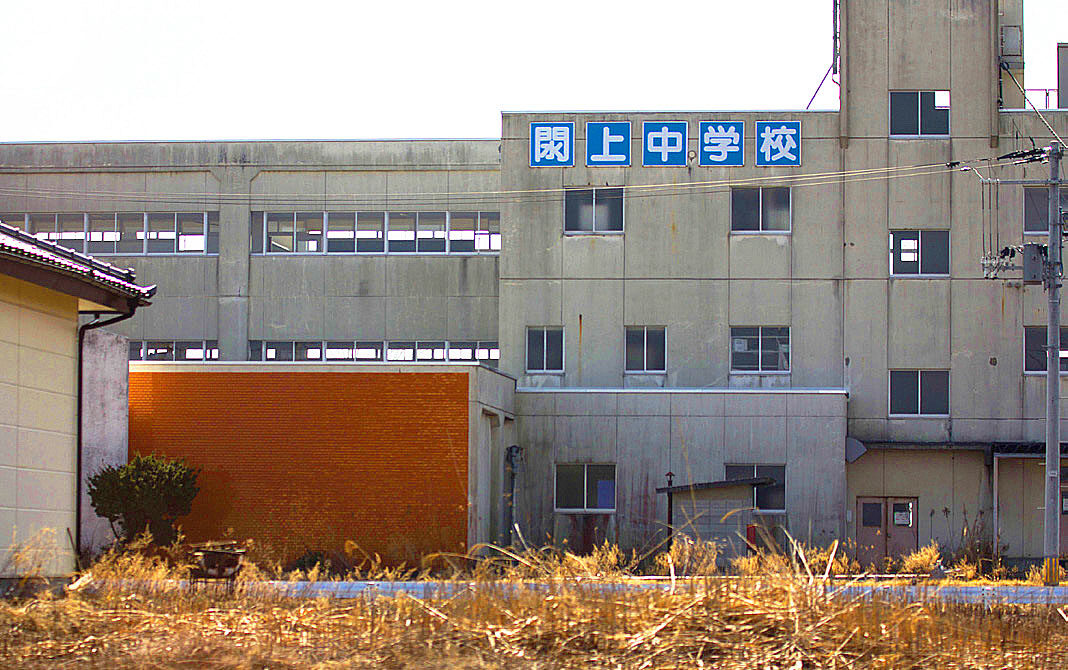
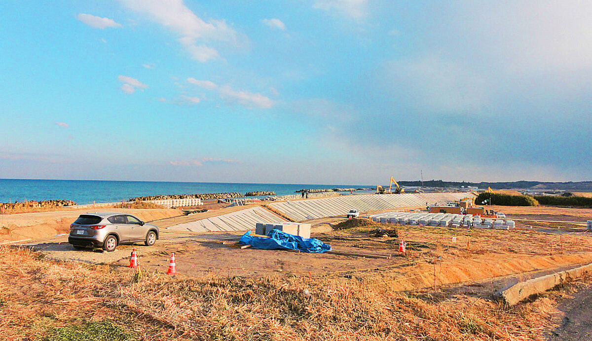
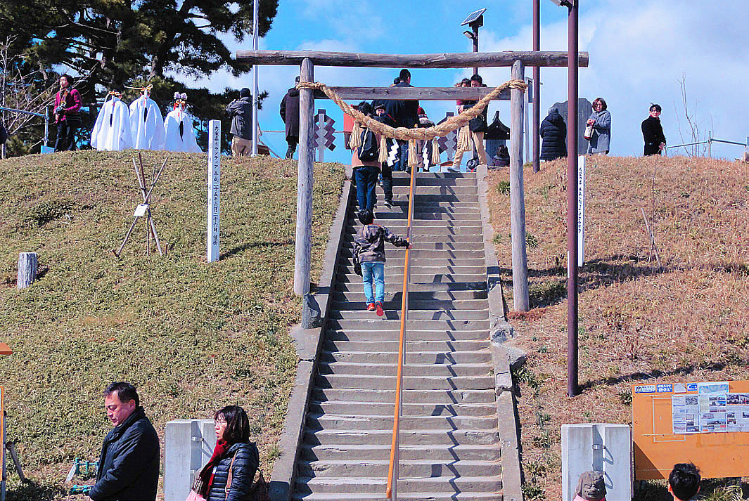
Hiyori-yama in Yuriage, Natori City (see the photo at the beginning of this article) has become a symbol of the reconstruction of the entire city, and many people were there to pay their respects to the victims on the fourth anniversary of the disaster. The weather was fine and I had the impression that the overall atmosphere was brighter or a little different compared to my first tour in 2013. There was also a morning market operating nearby. What also caught my attention was the construction of a huge seawall being built on the coast. Most of the residential areas were empty. The Yuriage Junior High School, where many of the victims died, still remains as it was when it was hit by the tsunami, and even though we only drove by it, we sensed the terror of the tsunami.
During this third tour, we noticed the reconstruction in Miyagi was more advanced than in Fukushima prefecture where the earthquake, tsunami and radiation contamination from the nuclear power plant accident occurred.

A lot of people were killed because they were led astray.
In the Yuriage area of Natori City, Miyagi Prefecture, which was severely damaged by the Great East Japan Earthquake, many people were swept away by the tsunami right in front of Yuriage Junior High School, a designated evacuation site. People who had evacuated to Yuriage Community Center were directed to Yuriage Junior High School and were moving according to the instructions when the tsunami hit. The community center is also a designated evacuation site, and evacuation guidance is not stipulated in the city’s disaster prevention plan. The main roads in the area were congested due to an accident and downed traffic lights. Evacuees were in chaos in an area where there is no elevated ground nearby.
(Reprinted from Kahoku Shimpo)
(Report by Masaru Fujiwara)
The 4th “Great East Japan Earthquake Tour” (3.11) Fukushima, Japan
| Ministry of Health, Labour and Welfare (MHLW) subsidized project "Nanbyo Patient Support Project" in 2015 | |
| Dates |
|
| Co-sponsored by | The Fukushima Prefecture Council of Intractable Disease Organizations, Miyagi Prefecture Patients and Families Association (NPO), Iwate Prefecture Council of Intractable Diseases and Related Disorders |
| Participants |
|
| Accommodations |
|
| Itinerary (Day 1) | Depart JR Koriyama Station (10:00 a.m.) → Kawamata Town (rest at roadside station “Silk Pier”) → Iitate Village → Minamisoma City (Odaka Area Coastline) → Namie Town (Exhibition Hall of Memories, Farm of Hope) → Minamisoma City (around JR Odaka Station) → Arrive at Hotel (4:15 p.m.), Symposium, Networking Session |
| Itinerary (Day 2) | Depart from the hotel (8:35 a.m.) → Matsugawaura, Soma City → Yamamoto Town, Miyagi Prefecture (JR Yamashita Station and vicinity) → Yuriage, Natori City (Hiyoriyama area) → Sendai Airport (0:35 p.m.)
|
| Itinerary (Day 3) |
|
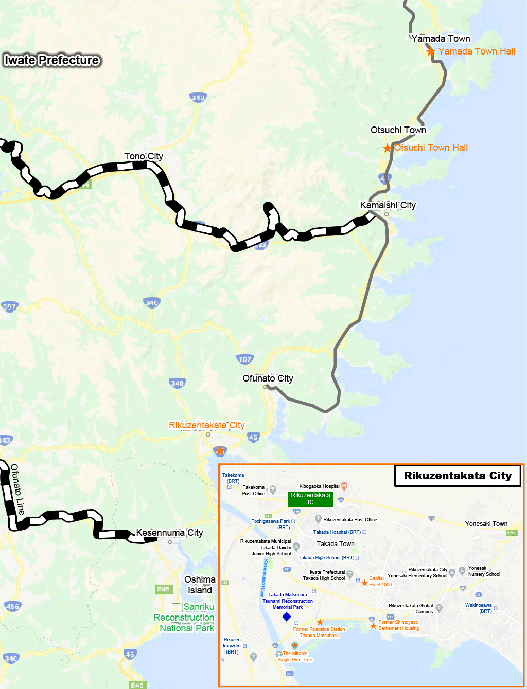
It has been five years since the earthquake. We visited the disaster areas in Fukushima and southern Miyagi prefectures again. As an optional tour, we also stayed overnight and visited a wide area from northern Miyagi prefecture to Rikuzentakata City, Otsuchi Town and Yamada Town in southern Iwate Prefecture. The contents of the tour were also enriched by listening to the experiences of people who are working in the disaster areas and those who have suffered from the disaster.
JFrom JR Koriyama Station through Kawamata Town to Iitate Village
After nearly two hours of driving, we arrived at Iitate Village, located in the northern part of the Abukuma Mountain Range. We arrived at a restricted residential area called Usuishi, at the intersection of Route 399 and Prefectural Road 12. The radiation level was 2.07μSv/h. The surrounding area was deserted due to the evacuation of the entire village, but some businesses were open during the day. The village seemed to have been decontaminated, and the area around the uninhabited houses was clearer than before.


Odaka Coastline
On the coastline of Odaka Ward, Minamisoma City, several damaged houses that we saw during our tour last year had been removed. This area is a preparation zone for the lifting of the evacuation order. The tsunami-damaged area has been cleared and the seawall is still intact. Houses on slightly higher ground have been spared from collapse.


Namie Town
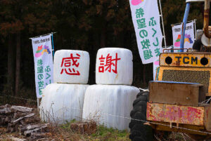
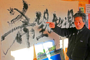
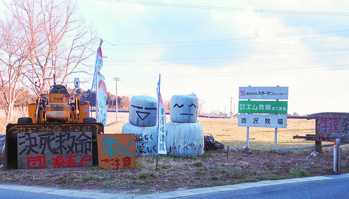
At the entrance of the Farm of Hope (Yoshizawa Farm), which I also visit every year, there were two kanji representing the word “Thanks”. I wanted to ask Mr. Yoshizawa personally if he was gradually becoming less hopeful, but unfortunately, he was on a business trip at the time. We were able to see a lot of stock of hay rolls to feed the 300 cows, and they seemed to be doing well. The radiation level is still high at 4.70 μSv/h, almost the same as last year.
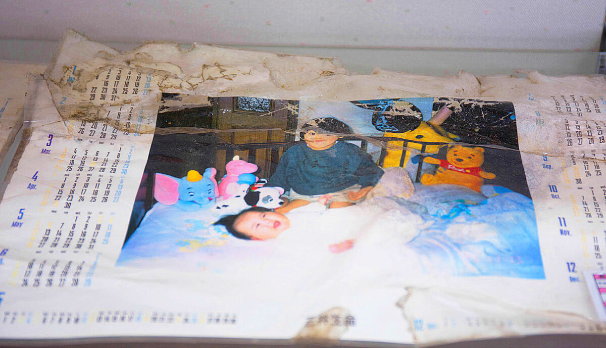
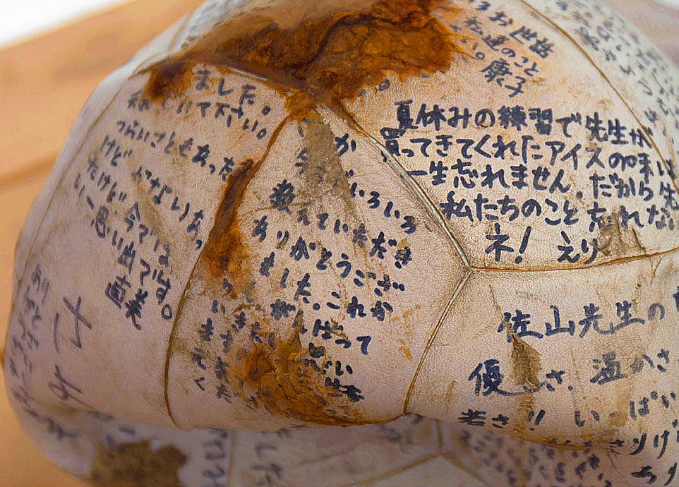
Next, we returned downtown and visited the Memorabilia Exhibition Hall, which is open to the public free of charge. Here, we were struck by the vivid exhibits collected from the disaster area, especially the tiles and photographs of people.
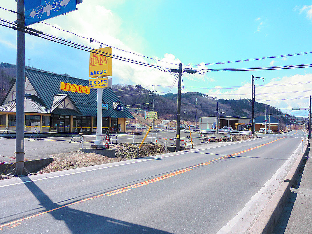
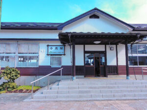
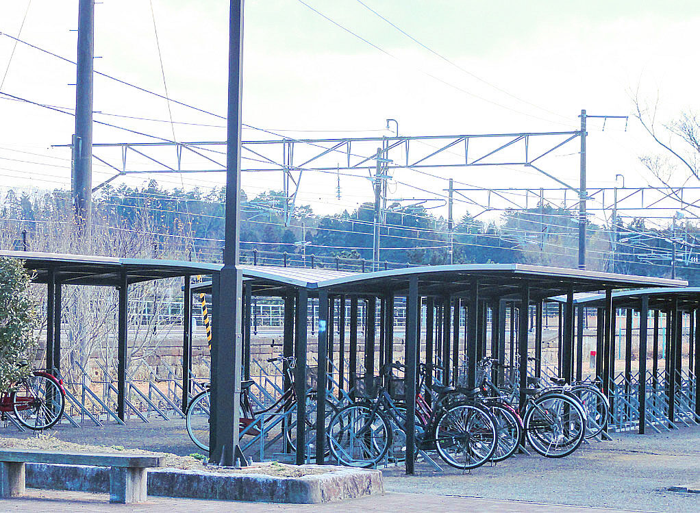
Around JR Odaka Station
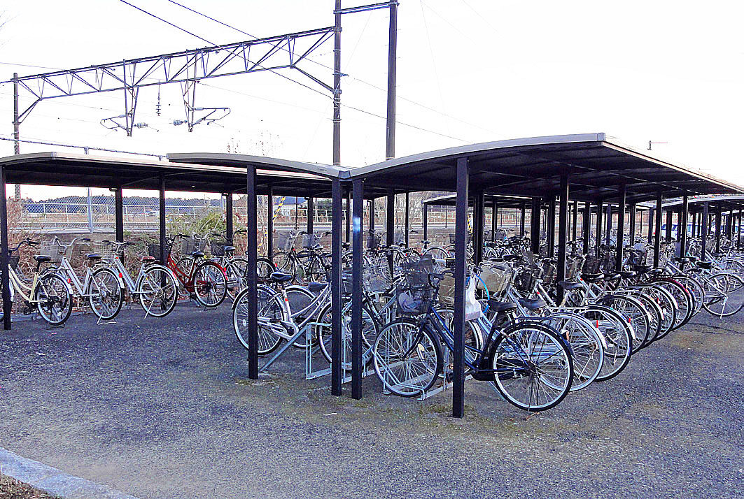
The evacuation order for Odaka Ward has not been lifted and the main street in front of the station is quiet, but people are allowed to come and go only during the day. Since last year, bicycles left at the bicycle parking lot at the time of the earthquake had been removed. The entire station has also been renovated. It seems that JR is proceeding with the construction work in line with the government’s policy to fully open the JR Joban Line by the spring of 2020, before the Tokyo Olympics and Paralympics.
There is a Futabaya Inn next door.
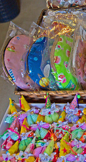 In front of the station, a small store called “Kira,” a local goods store, was open for business.
In the store, goods made by evacuees and hand-woven silk coasters made by the women’s club of the Odaka Chamber of Commerce and Industry were on sale.
Four months later, on July 12, 2016, the evacuation order was lifted in Odaka Ward.
Mini Symposium
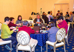
At around 4:30 p.m., we arrived at the Royal Hotel Maruya in front of JR Haranocho Station. A mini-symposium and dinner party were held here. The three speakers this time included Dr. Masaaki Kotaka, a neurologist at Minamisoma City Hospital. In addition to his medical activities, Dr. Kotaka is organizing HOHP: H=Hikikomori (Hermit), O=Otosan (Father), H=Hikiyose (Attraction), P=Project, (a men’s woodworking class and men’s cooking class to support male disaster victims who tend to be isolated in temporary housing). He also introduced a wide range of community-based activities with local patient associations and training of care workers.
Next, we heard from Ms. Akemi Suzuki, who was affected by the disaster in Ishinomaki City and Mr. Masao Sato, a survivor from Namie Town. After living in temporary housing, Ms. Akemi Suzuki now lives in reconstructed public disaster housing in the same city. Details are included in the proceedings on page 66.
After the symposium, we had a chance to have dinner and deepen exchanges with the lecturers.
Preliminary report of the 2015 census
According to the preliminary report of the 2015 national census, the population of Fukushima Prefecture decreased 5.7% (115,458) to 1,913,606 compared to the previous census 10 years ago, largely due to the accident at the Fukushima Daiichi Nuclear Power Plant of the Tokyo Electric Power Company. The population of the four towns of Okuma, Futaba, Tomioka and Namie, all of which are under evacuation order, is zero. By municipality, Naraha Town, where the evacuation order was lifted for almost the entire area in September 2003, saw its population drop by 87.3% from the previous survey to 976 inhabitants, while Kawauchi Village, (where most of the evacuation order for the eastern part of the prefecture was lifted in October 2003), saw a significant decrease of 28.3% from the previous survey to 2,021 inhabitants, indicating that the return of residents is not progressing.
On the other hand, the three cities of Fukushima, Iwaki, Soma, and the town of Miharu have seen an increase of 0.6 to 2.1%. This was due to the large number of evacuees from areas around the nuclear power plant and workers in reconstruction-related projects such as decontamination. In Fukushima Prefecture, an increasing number of people are abandoning the idea of returning to their hometowns and acquiring real estate in evacuation areas or moving there.
Matsugawaura
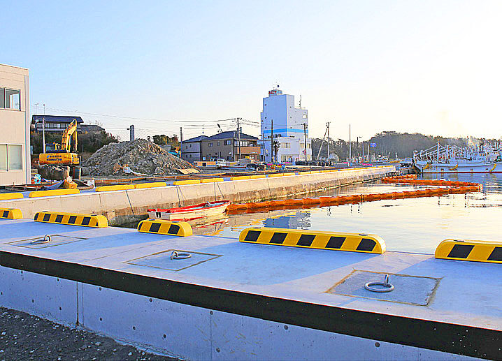
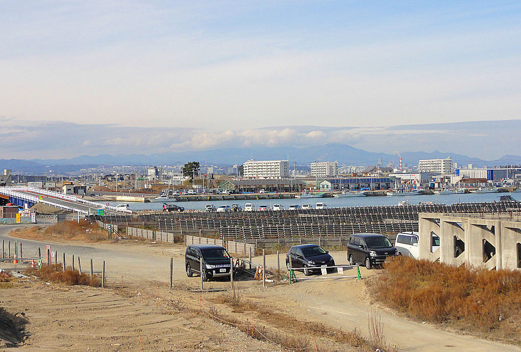
In Matsugawaura, Soma City, the renovation of the fishing port has been completed. The area in front of Minato-ya hotel (where we stayed during last year’s tour) and where the fishery direct sales center used to be, has been newly paved.
Now is the critical time for the fishery to resume in earnest. There were more fishermen in the area than last year.
The fishing industry is still in a precarious state.
In both Iwate and Miyagi prefectures, the revival of the fishing industry is underway. With the construction of fishing ports and other facilities, the volume of landings in FY2015 returned to 78% of the pre-quake level in Miyagi and 67% in Iwate. However, the recovery in sales has been slow, and the next challenge is to develop more channels of distribution.
On the other hand, in Fukushima Prefecture, the main coastal fishery continues to operate with restrictions on species. The main fishery is only operating on a trial basis, with landings in 2015 at only 15% of the pre-quake level. The trial operation started in June 2012 and the target area has been expanded. The number of fish species has increased from 3 to 72 (as of January 27, 2004), and the fish are also being shipped outside of the prefecture. From now on, the environment for full-scale operations will be ready, and the government is planning to reduce the area designated as a 20-kilometer zone for voluntary restraint in fishing. However, the fishery has been forced to suspend its operations when contaminated water leaked from the nuclear power plant, and it remains in a perilous situation.
Yamamoto Town
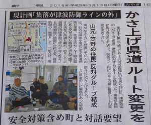
As we have been making regular inspections every year, we then headed for the former JR Yamashita Station. When we visited the Hashimoto Shop in front of the station, Mr. Hashimoto, the owner of the store, told us about the problem he was having with the residents of the town due to the relocation of the elevated prefectural road. The town of Yamamoto plans to move the prefectural road that runs along the coast up to 500 meters inland and elevating it by 4 to 5 meters to double as a seawall. However, 15 or so residents (Sasano Ward) who will be left behind on the ocean side are demanding that the prefectural road route be changed. In addition, there are several houses that had already been repaired on the new prefectural road route, but they are being evicted. Mr. Hashimoto said that the town and the prefecture are blaming each other, but they are already in the process of acquiring land for the project. The former Yamashita Station, with its tracks and other facilities removed, seemed to be gradually changing its appearance as it becomes overgrown.
Yuriage
Yuriage in Natori City is where the tsunami killed about 700 people. Near the coast, work is steadily progressing to raise the ground level, and the appearance of the area was different from what we saw last year. The construction of a huge seawall was also in progress. The Yuriage water gate of the Natori River, which could be seen for several years after the disaster, has been lost due to disaster restoration work. Many people came to Hiyoriyama to pay their respects, and we prayed for those who passed away from the top of the mountain.

From Sendai Airport to Ishinomaki City
At 12:40 p.m., the bus arrived at Sendai Airport. We parted from some of the participants here, and after lunch we headed for Rikuzentakata City in Iwate Prefecture as an optional tour. After dropping off Ms. Suzuki, who presented her experience at yesterday’s mini-symposium, at a reconstruction house in Ishinomaki City on the way, we continued driving along the long road, viewing from the window of the bus.
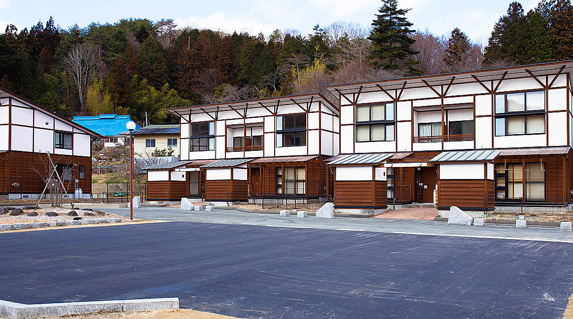
Ms. Suzuki’s residence, a patient who was affected by the disaster, was designed in a modern style for young people, which was hard to believe for a disaster public housing facility. In her experience yesterday, she said, “It is sometimes difficult for the elderly and people with disabilities to use the housing, and there are cancellations even after the move-in has been decided,” which I found understandable when I saw it in person.
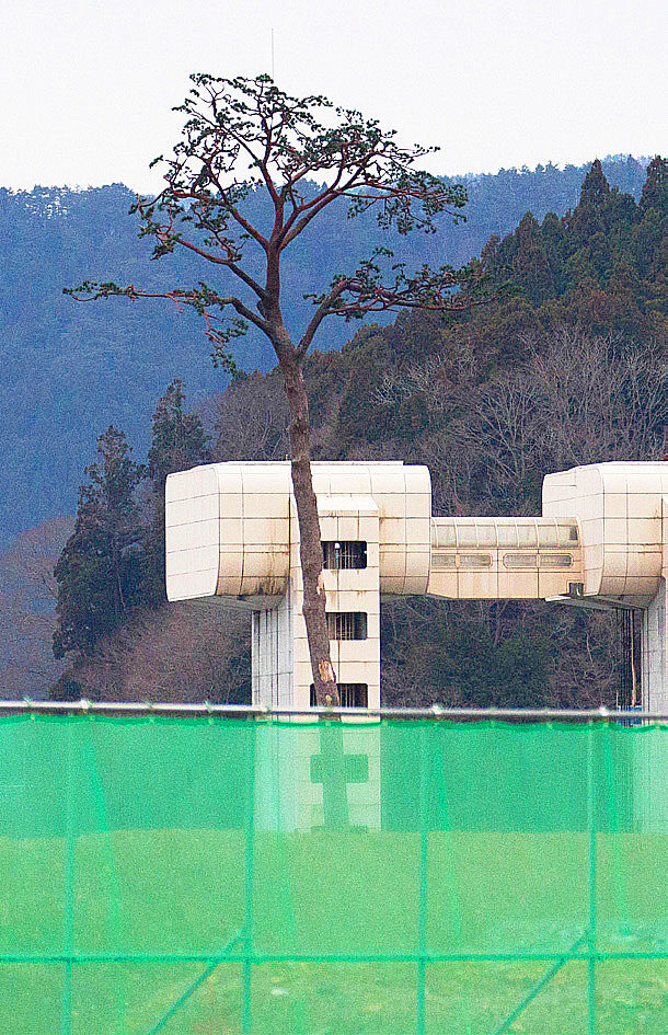
After passing Ishinomaki City, the bus took a tour of the Minamisanriku Town Disaster Prevention Office building, where a female employee who repeatedly called for evacuation on the second floor died after failing to escape; Kesen Junior High School in Rikuzentakata City; and the Miracle Pine Tree, from the bus window. Around six o’clock at nightfall, we finally arrived at our hotel in Rikuzentakata City. All of these places were often featured in newspaper and TV news reports on the disaster area, but I felt like I was going to lose my head as I passed them one after the other.
Rikuzentakata City
Upon arrival at the hotel, we had no time to rest before continuing with a meeting to listen to the stories of those affected by the disaster and a dinner party. At the hotel, we were joined by Mr. Kenichi Chiba, Representative Director of the Iwate Prefecture Council of Intractable Diseases and Related Disorders. Mr. Tadashi Sato, who has a slight eye disability and is an acupuncture and moxibustion massage practitioner, shared his experience of the disaster at his home and clinic about 250 meters from the coast. After the earthquake, he and his family immediately evacuated to higher ground in anticipation of a tsunami, and they were safe. He talked about how cold it was at the time of the disaster, how he lives now, how volunteer activities are supporting his life, and how important it is to be aware of disaster prevention on a daily basis, as it can make the difference between life and death. Details are contained in the Proceedings on page 76.

Because the hotel was located on a hill, the town was palpable when it was light the next morning. The power of a tsunami has much to do with topography. Rikuzentakata City had a V-shaped rias coastline and was surrounded by steep mountains, with houses and other structures concentrated on the plains, so although the area inundated was small, many people were lost. I realized that even with the development of civil engineering technology and science, it is difficult for humans to completely control nature. Future disaster prevention measures should also bear this in mind. More than 1,750 people were sacrificed here. This is the second largest number among municipalities after Ishinomaki City. Another feature shared by Ishinomaki City is that the tsunami ran up along the Kesen River.
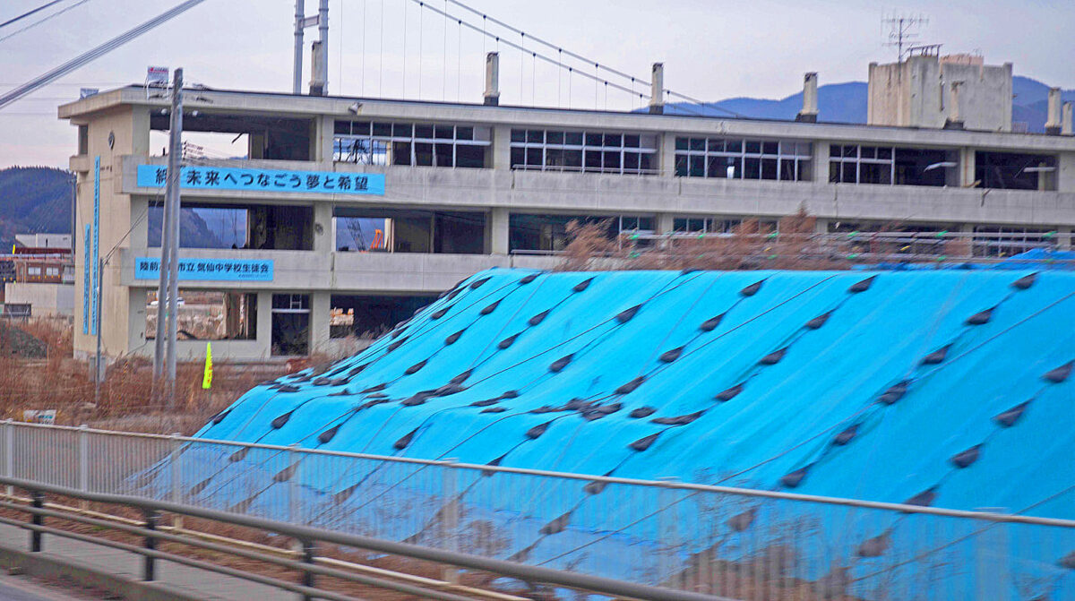
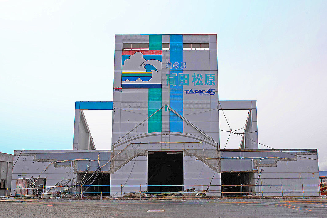
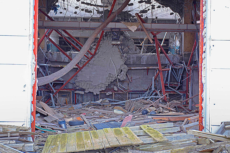
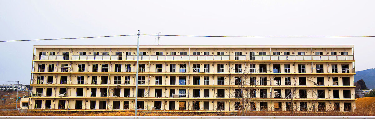
The next morning, we left at 8:30 a.m. to inspect the former Shimojyuku Settlement Housing and the former Roadside Station Takata Matsubara, both of which are preserved as earthquake disaster remains in Rikuzentakata City. Both were sufficient to convey the power of the tsunami, but the former Shimojyuku Settlement Residence, in particular, was built parallel to the coast and was inundated to the fourth floor of its five-story building (14.5 meters), clearly showing the horror of the tsunami.
Otsuchi Town
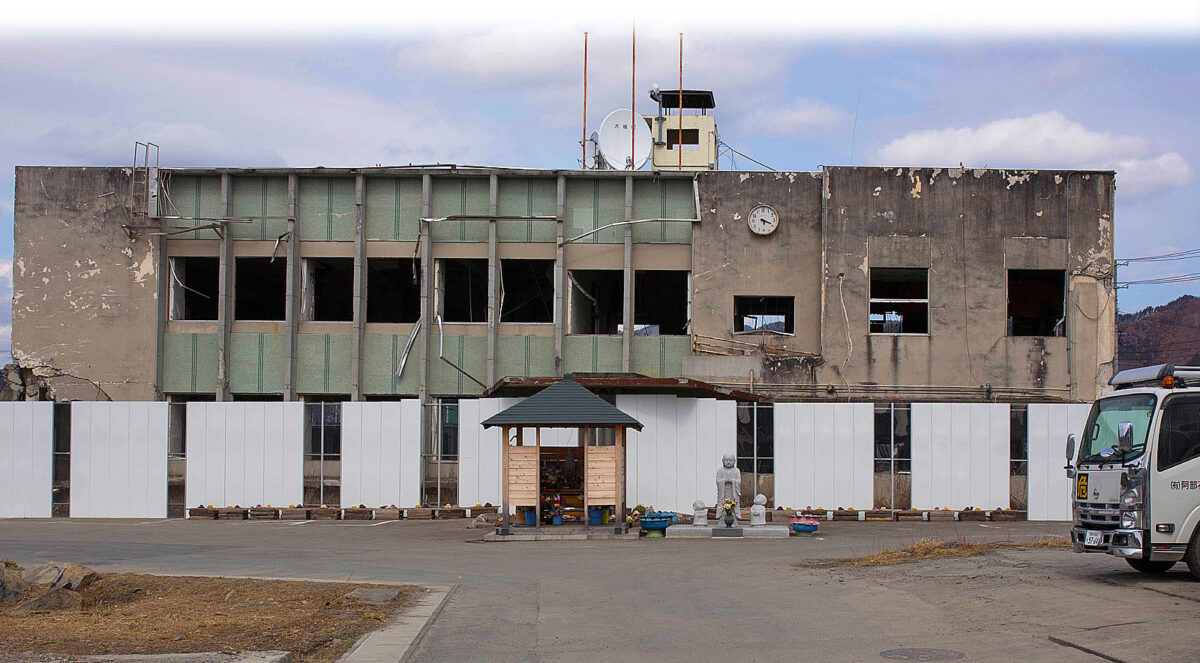
The bus left Rikuzentakata City and drove along the Sanriku Expressway toward Kamaishi and Ofunato, joining Route 45 at the end of the route, passing through Kamaishi and entering Otsuchi Town, Iwate Prefecture. The scenery seemed to have changed considerably since before the earthquake, with roads being newly replaced and the surrounding area being raised with fill. The severed railway line is still intact. In Otsuchi Town, we visited the old town hall building where the mayor and 40 others died. Seeing the building from close up, I could not help but feel an indescribable sense of dread at the cruel sight of it. The third day of the tour had a great impact on my body, which was beginning to feel fatigue. As of December 2019, the death toll from the disaster in Otsuchi, including related deaths, stood at 1,286.
Demolition of the old Otsuchi Town Hall
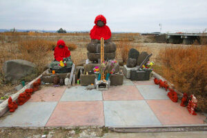
The old town hall building was debated to be preserved or demolished, but in February 2019 it was dismantled and turned into a disaster prevention park. The town turned it into a green space in anticipation of using it as a disaster prevention park and a place where people could leave their cars in the case of a disaster. The only remaining evidence of that time is a flower offering stand and a Jizo statue donated by someone from outside the town. Each municipality has a different approach to dealing with the remains of the earthquake. Otsuchi Town, which demolished the old town hall building, may be asked how it will pass on the disaster to future generations.
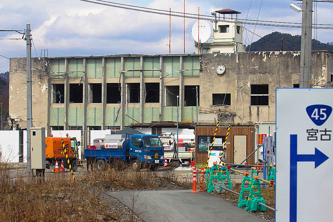
It was eerie.
Yamada Town
From Otsuchi Town, we continued north on Route 45 and descended through mountainous terrain until we came to Yamada Town (Iwate Prefecture), the final site of our inspection. The seismic intensity of the Great East Japan Earthquake in this town was just under 5 (observation point: Hachiman-cho area), but this town also has the characteristics of a rias coast, and the town was devastated by the tsunami.
The situation at the time of the disaster and future reconstruction plans were explained to us by Mr. Goichi Tamura, a friend of Mr. Kenichi Chiba (Iwate Prefecture Council of Intractable Disease and Related Disorders) and a town councilor of Yamada Town. We were given a special tour to the roof of the Yamada Town Hall, where we could see the cleared town at a glance. Mr. Tamura spoke as follows. The reconstruction is a multiple disaster prevention method: a 9.7 meter seawall will be built on the coast, and the inner part of the seawall will be raised and used for commercial facilities. Then, houses will be built on higher ground. However, immediately after the earthquake, residents were in favor of the high seawalls because they were afraid of the sea, but after things calmed down, more and more people began to wonder if it was not necessary because they were living on higher ground. There is also the fear of not being able to see the sea from land. People will disappear and only the seawall will remain.”
As of November 2018, there were 824 deaths from the earthquake in Yamada Town, including related deaths.
After the visit, we had lunch in Kamaishi and disbanded at JR Shin-Hanamaki Station. Some of the participants left at Hanamaki Airport. Participants from Miyagi and Fukushima returned with the bus.
(P.S.: Mr. Goichi Tamura passed away in July 2017 due to pancreatic cancer. We pray for his soul rest in peace.)


 Although we traveled around in a hurry over the three days, we were still unable to visit all of the affected areas. Once again, we realized the extent of the damage caused by the Great East Japan Earthquake. We were particularly struck by the extent of the damage caused by the tsunami.
(Reported by Masaru Fujiwara)
The 5th “Great East Japan Earthquake Tour” (3.11) Fukushima, Japan
| Ministry of Health, Labour and Welfare (MHLW) subsidized project "Nanbyo Patient Support Project" in 2016 | |
| Dates | Saturday, March 10, and Sunday, March 11, 2017 |
| Co-sponsored by | The Fukushima Prefecture Council of Intractable Disease Organizations Miyagi Prefecture Patients and Families Association (NPO) Iwate Prefecture Council of Intractable Diseases and Related Disorders |
| Participants | 8 people |
| Accommodations | Royal Hotel Maruya (Haramachi, Minamisoma City) |
| Itinerary (Day 1) | Depart JR Koriyama Station (10:00 a.m.) → Kawamata Town → Iitate Village → Minamisoma City (JR Odaka Station) → Namie Town (Exhibition Hall of Memories, Farm of Hope) → Minamisoma City (Coastline of Odaka District) |
| Itinerary (Day 2) | Depart from hotel (9:00 a.m.) →Yamamoto Town, Miyagi Prefecture (New JR Yamashita Station, ruins of old JR Yamashita Station, Yaegaki Shrine) →Yuriage, Natori City (Hiyoriyama area) →Departure at JR Sendai Station |

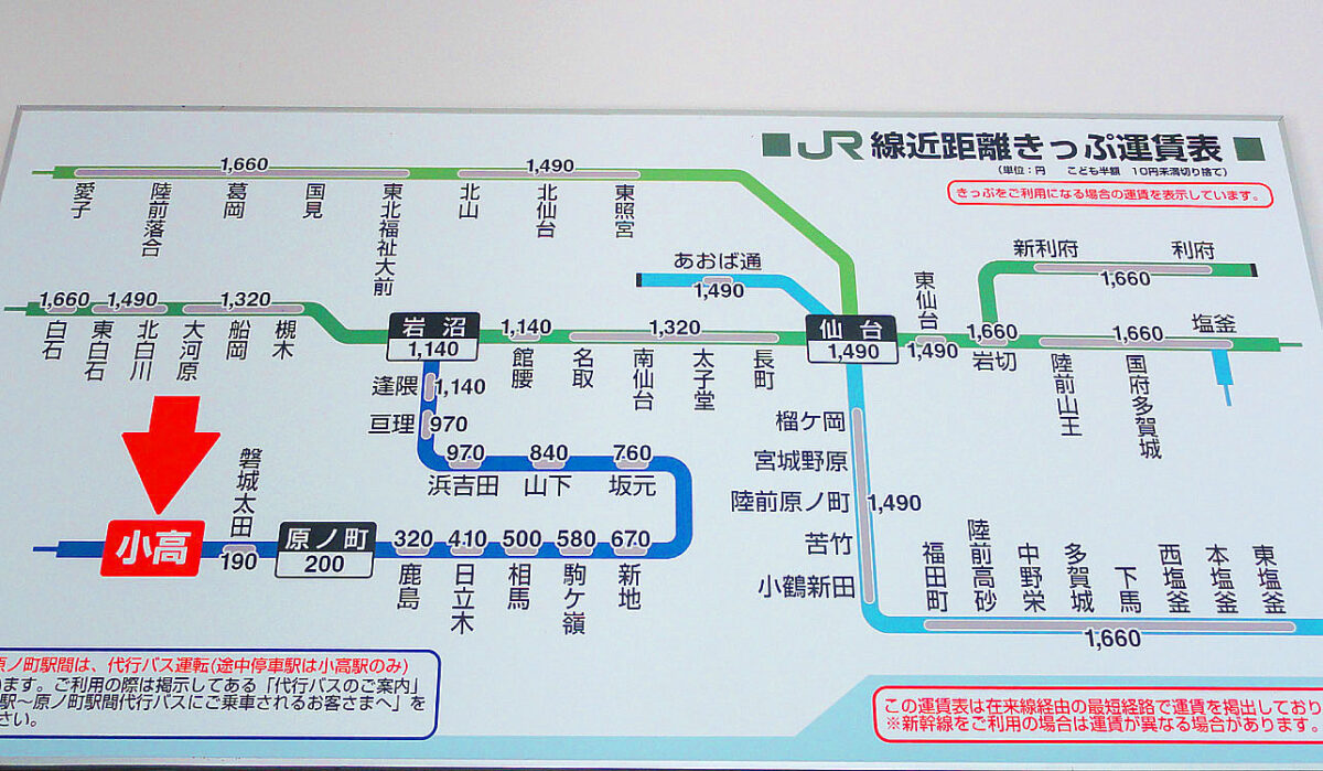
In December 2016, operations between Soma and Hamayoshida stations resumed, thus connecting Iwanuma station to Odaka station (Fukushima Prefecture).
From JR Koriyama Station through Kawamata Town to Iitate Village
Mr. Watanabe was waiting for us in the van at Koriyama station. There were only six of us this time, not that many, but it was a good number for a 10-seater van. On the way to the station, we stopped at the usual “thin skin” bun shop. Mr. Watanabe of the Fukushima Intractable Disease Association always treats us to steamed buns in the car.
Immediately after the earthquake, there were bumps at the joints of Route 4 and we could feel the vibration when we got on the train. Along the main road, you can’t see any traces of the earthquake. However, once you leave the main road, the scenery changes. Flexible container packs full of debris were becoming more and more visible. There are many uncovered black packs, but there are also countless large trapezoidal chunks covered with large green sheets. What used to be farmland has become a field of flexible containers and dead grass.
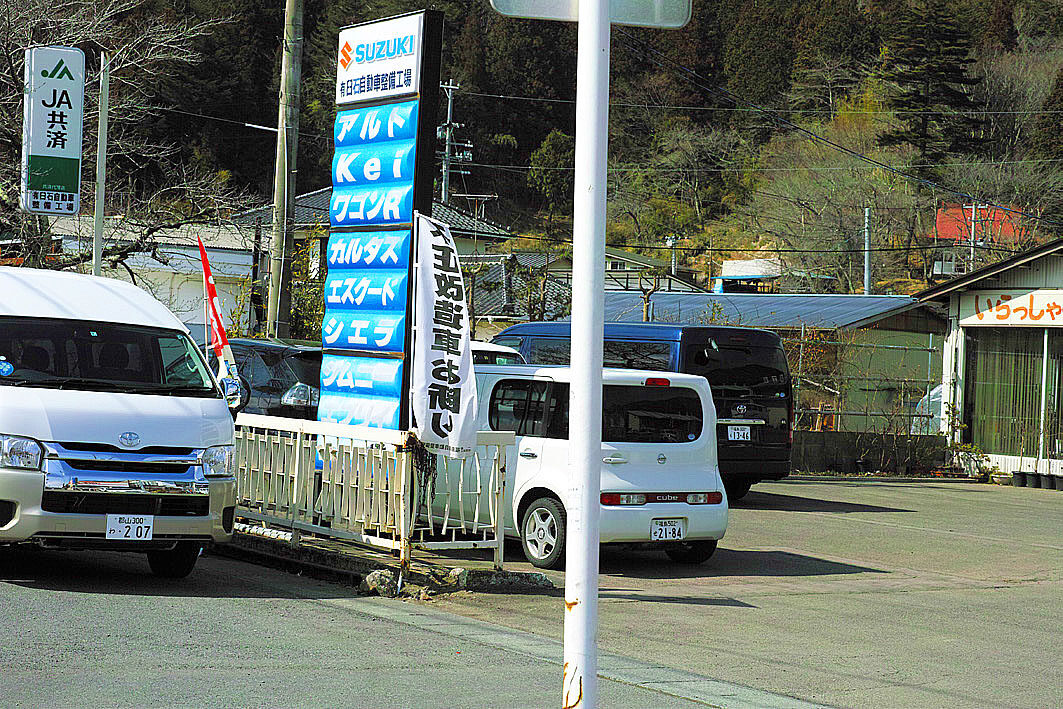
We took a rest at “Roadside Station Kawamata” then headed for Iitate Village. In Iitate Village, the Ususeki Automobile Factory was in operation. The radiation level was about twice the allowable dose of 0.23 μSv/h.
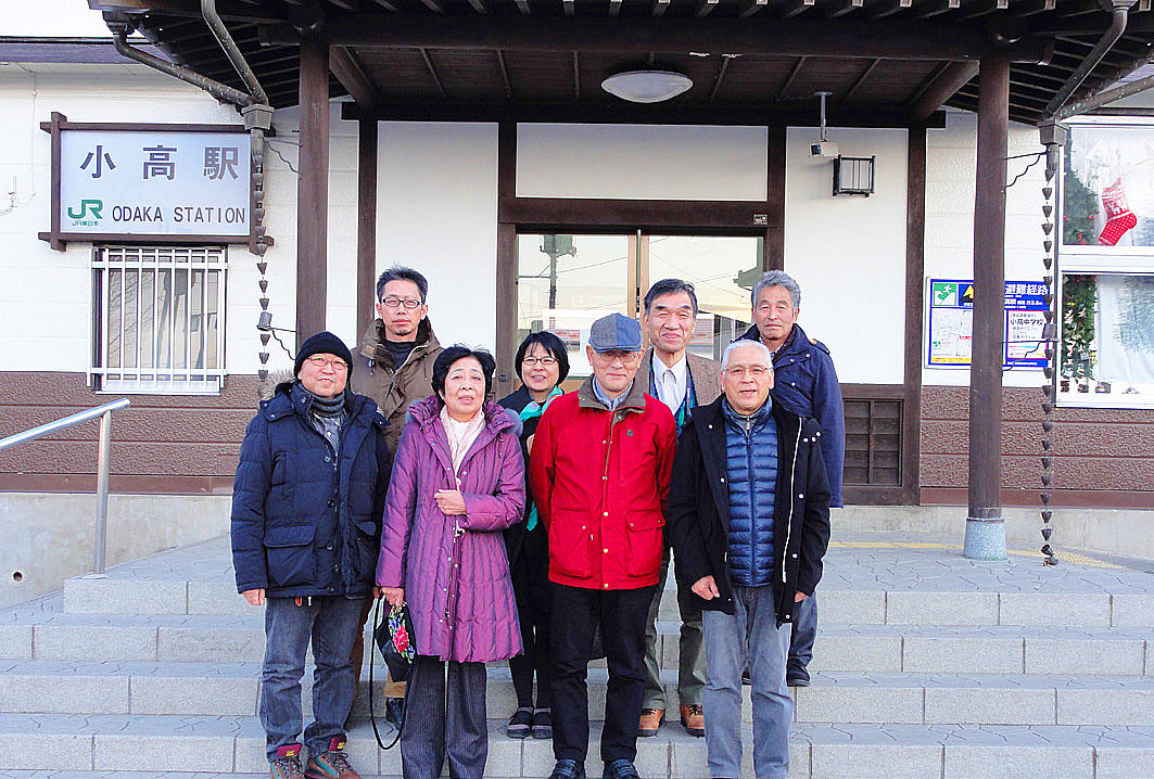
JR Odaka Station, Minamisoma City
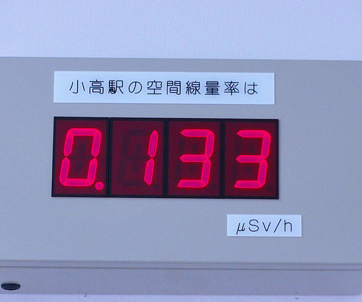
The JR Odaka station has been transformed, and the Joban Line has been opened from Iwanuma Station to Odaka Station. The inside of the station was cleaned up and a new route map and timetable were hung. A radiation dosimeter hung on the wall, indicating that “this is Fukushima”. You can’t enter the station without permission, as was the case right after the earthquake.
The bicycle parking area has been moved a bit and rebuilt, and many of the bicycles that had been left there since March 11, 2011 have been removed and new bicycles, though fewer, have replaced them. I felt a little relieved to know that the residents of Odaka are coming back.
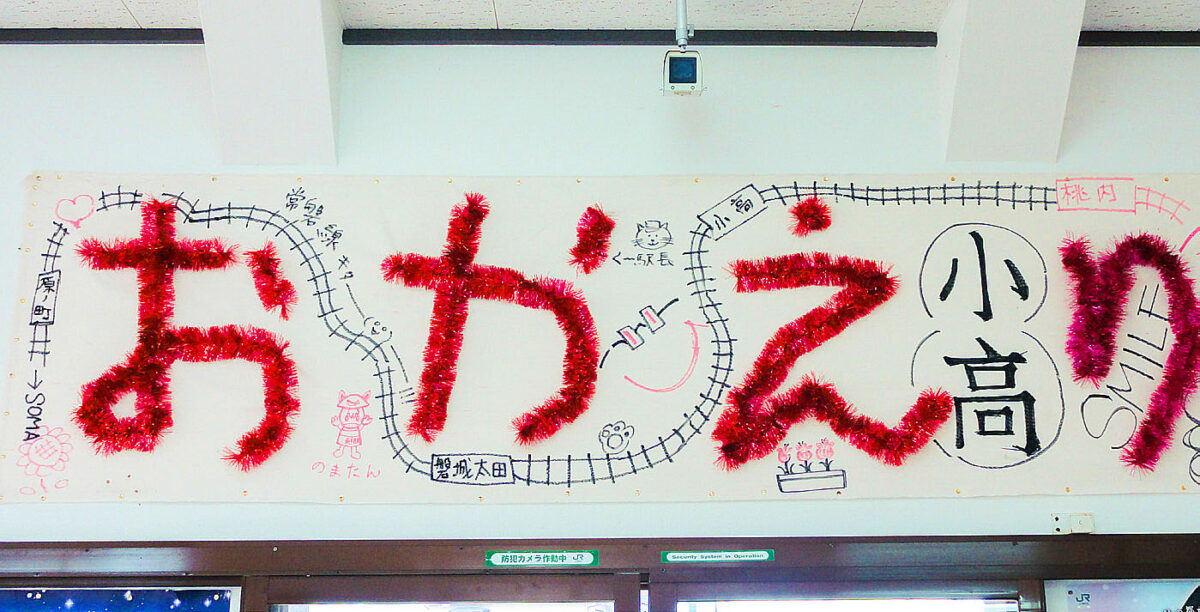
In the station, there are handmade signs celebrating the opening of the Joban Line. The small store in front of the station, where I usually stop, has a flyer for a documentary film about Eisaku Sato, the former governor of Fukushima Prefecture. It made me feel indescribably happy.
Namie Town
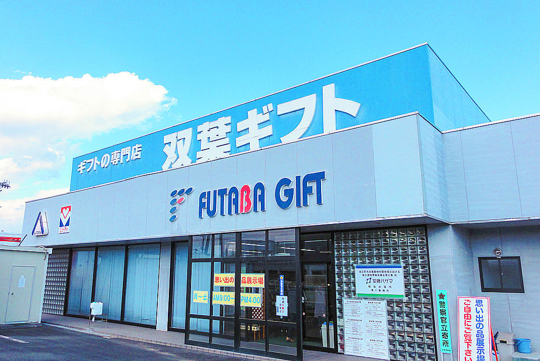
Inside the former Futaba Gift store along Route 6, there is an exhibition of memorabilia that was found in the tsunami-affected areas. I felt awestruck to think that each one of them has people’s thoughts and feelings. I remembered that when I was volunteering in the disaster area, people earnestly asked me to take photos of them at the temporary housing. Everything had been washed away.

 We went to the Hope Farm, located on the border of Namie and Odaka, which we always visit. We were greeted by cows that were still alive. In the office, there are photos and other materials from right after the disaster, as well as a picture book about this place. Mr. Yoshizawa, the representative of the ranch, spoke plainly about the ranch at that time and the situation of the cows that died while tied up.
Odaka Coastline
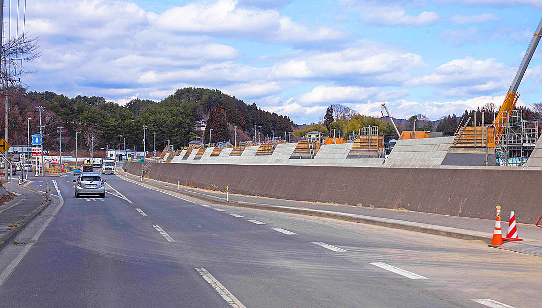
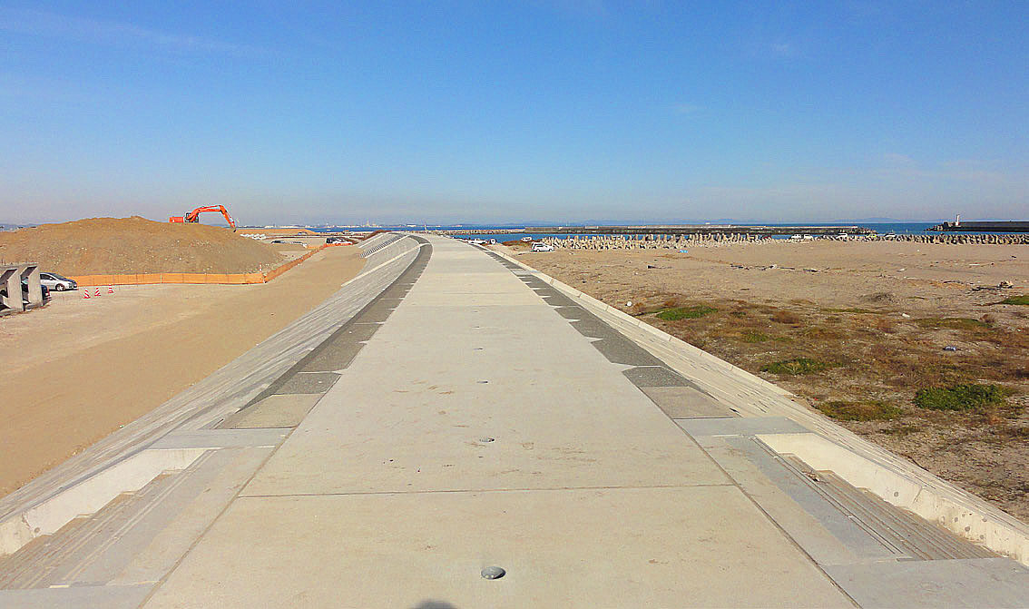
On the road from the Hope Farm to the beach, there are signs everywhere that say “Decontamination work in progress”. Patrol cars are also in the area. Immediately after the disaster, police cars from outside the prefecture were conspicuous, but now most of them have Fukushima plates. The coastline is now much improved. You can’t see any houses that were still damaged by the tsunami and only the roads are brand new. However, the construction of levees in progress, is obscuring the beautiful Pacific coastline view beyond the rice paddy fields. I don’t see the point of building levees that would not have managed the 3.11 tsunami. We need better solutions against nature.
At the edge of the coastal cliffs, there are traces of what used to be beautiful pine forests. There are still “lone pines” left. I believe that each “lone pine tree” has its own story.
Yamamoto Town
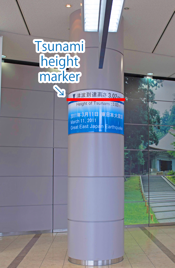
 The next day, March 11, we headed north on Route 6. Fishing boats and cars that had been moved by the tsunami into the fields and rice paddies have been cleared and cleaned up. However, there are few signs of cultivation. When you get to the high ground, you can see signs everywhere that say “tsunami inundation up to here”, indicating that the National Hospital Organization Miyagi Hospital, located on the high ground, managed to avoid flooding. I remember Dr. Imai (Dr. Takashi Imai of the ALS Care Center, Miyagi Hospital) mentioning such things during the earthquake.
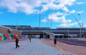
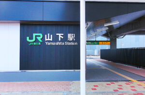
We left the national highway and headed for the old Yamashita station. The new Yamashita Station is located much further inland and is beautifully maintained. However, this large and beautiful station building in the middle of sparse residential areas seemed strange and surreal. When I arrived at the old Yamashita station around 10:30, they were preparing for the ceremony to inaugurate the monument there. At the site of the ceremony, there was a sign that read “Yamamoto Town Great East Japan Earthquake Cenotaph Unveiling Ceremony,” and the arc-shaped stone monument with names engraved on it and the cone-shaped monument were covered with a white cloth. Present were volunteers ranging from high school students to senior citizens, and around the monument you could see candles in cut bamboo tubes and paper lanterns. At the old Yamashita station, where only the platform remains, the yellow faded Braille blocks covered with sand remind us of the six years that have passed. In front of the station, the Hashimoto Shop has a signature cat that is very charming.
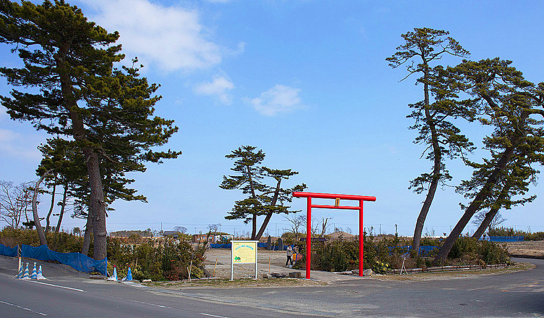
We departed so as not to interfere with the ceremony and headed for Yaegaki Shrine in town. The shrine grounds were empty except for a red torii gate and a single shrine. The shrine was being rebuilt, and the building was covered with a construction shroud. We paid our respects at the small shrine. I think we will see the new shrine next year.


Yuriage
Yuriage’s Mt. Hiyoriyama is located in the middle of the wilderness, and since it was March 11, the cameras of TV stations were busy and also many visitors were laying their hands on the cenotaph. Whenever I come here, I always feel that it is hard to imagine that before 3.11, there were so many houses around and it was so crowded.
Looking towards the sea from the top of Mt. Hiyoriyama, I could only see the dirt at the construction site and the bridge. There used to be a bicycle center surrounded by many pine trees. It used to be crowded with many enthusiasts, and I used to enjoy participating in “normal” bike races with my friends.

(Report by Mr. Osamu Koseki)
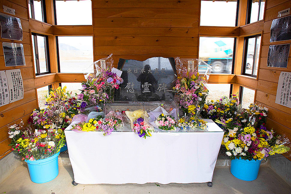
The “Tower of the Earth”, a cenotaph in Yamamoto Town
This cenotaph was built to commemorate the victims of the Great East Japan Earthquake and to pass on the memory of the disaster to future generations.
The “Tower of the Earth” cenotaph is designed to represent the thoughts of “comfort,” “recovery,” “memory,” and “wish” growing out of the earth like the underground stem of a bamboo tree. The height of the tower is 3.11 meters, representing the date of the earthquake, and every year at 2:46 p.m. on March 11, the shadow of the tower overlaps the “crystal” embedded in the engraved nameplate to pass on the memory of the earthquake.
(Excerpt from the Yamamoto Town website)
The 6th “Great East Japan Earthquake Tour” (3.11) Fukushima, Japan
| Ministry of Health, Labour and Welfare (MHLW) subsidized project "Nanbyo Patient Support Project" in 2017 | |
| Dates | Saturday, December 9, and Sunday, December 10, March 11, 2017 |
| Co-sponsored by | The Fukushima Prefecture Council of Intractable Disease Organizations Miyagi Prefecture Patients and Families Association (NPO) Iwate Prefecture Council of Intractable Diseases and Related Disorders |
| Participants | 8 people |
| Accommodations | Royal Hotel Maruya (Haramachi, Minamisoma City) |
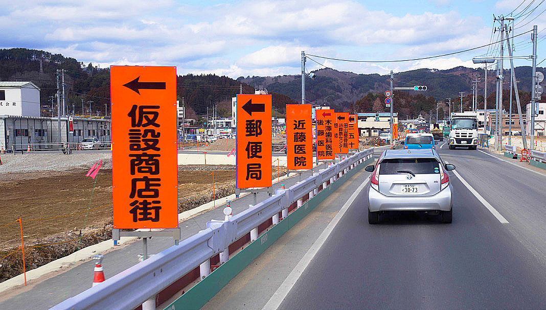
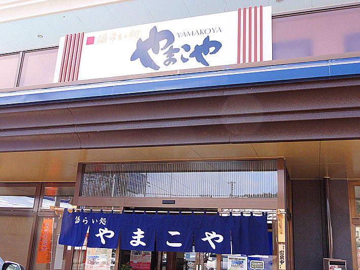
| Itinerary (Day 1) | Depart JR Koriyama station (10:00 a.m.) → Kawamata town (Yamakiya area, lunch at Yamakoya) → Namie town (Tsushima area, Sato family, Hope Farm) → Minamisoma city (JR Odaka station, coastline) → Arrive at hotel, social gathering |
| Itinerary (Day 2) | Depart from hotel → Yamamoto Town, Miyagi Prefecture (JR Yamashita Station, Yaegaki Shrine) → Yuriage, Natori City (Hiyoriyama area) |
At the time of the disaster, about 8,000 people evacuated to Tsushima Ward, which had a population of about 1,400 and was thought to be relatively safe due to the lack of accurate information.
However, it turned out that this area was also dangerous, so then many evacuated to Nihonmatsu.
From JR Koriyama Station to Kawamata Town (Yamakoya District)
This time, I asked my friend Mr. Kaiko to be our driver, and we decided to drive from Miyagi Prefecture. In the early morning, we drove to Koriyama Station in a 10-seater van. After meeting the tour participants at Koriyama station, we drove to Kawamata, where the scenery of the city seemed to have returned to normal compared to the days immediately after 3.11. The dosimeter in front of the station seems to be back to normal. However, as we got off the main road, we began to see piles of flexible containers with contaminated materials, accumulating.
Along the road to Kawamata town, there is a hastily made office with a sign that reads “Compensation Consultation Service”. Eight years have passed, but for some reason, the sign that reads “TEPCO (Tokyo Electric Power Company) Compensation Consultation Service” is just printed on a regular printer and taped to the window. I’ve never seen a professional sign which seems to reflect the TEPCO attitude. After lunch near Silkpia in Kawamata Town, we headed for Namie Town, where we saw signs along Route 114 prohibiting access to side roads. The radiation levels on the dosimeters started to rise.


Namie Town
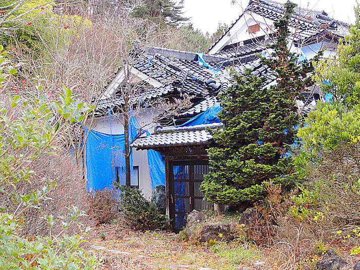
As we entered Namie Town, there were many signs and fences prohibiting access to side roads. There were always guards standing at the off-limits areas, but it must be difficult on a cold day. The blue sheeting on the tiled-roofed houses in Tsushima Ward has been torn off over time, reminding us of the six years or so that have passed since the disaster. The red berries of the nanten trees planted in the garden were strangely beautiful. As usual, there are guards at the fork in the road to prevent people from entering. We detoured toward Namie Town, and a sign for Futaba on our right.
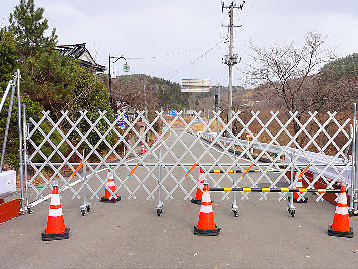
Near the Tsushima Community Center in Namie Town, the dosimeter continued to ring, reading 2.79 µSv/h (more than 10 times the annual allowable radiation dose). Route 114 on the way to Route 6, the road to Futaba Town is closed. We headed for Mr. Masao Sato’s house in the preparation zone. There is a big difference in the decontamination work between the preparation zone and the areas that are not in the preparation zone. The other side of the road is covered with weeds, while this area has been mowed for decontamination. It’s very strange. Along the way, there are several collection sites for decontaminated materials that are about 1 hectare in size. They are surrounded by a white wall about 5 meters high to obscure the view. Inside, contaminated flexible container bags were piled up. The stone torii gate of a nearby shrine is still damaged, even though it was repaired and rebuilt as soon as possible in the area where people live.
Mr. Sato’s house has been renovated and is beautiful. The sunken hearth with a traditional suspended hook shows his deep love for his home and community. When you look out from the house toward the ocean, you can see the flexible container storage area looking like the horizon. I feel that six years is too long to still have this scene.
Since the earthquake, Hope Farm has been raising beef cattle that cannot be shipped for consumption. The ranch was opened by Mr. Yoshizawa’s father, an abandoned Manchurian representative. Hearing his story, I could understand how he felt when he couldn’t leave without his cows. It reminds me of a line in a movie about the Great East Japan Earthquake disaster. An actor modeled after Mr. Yoshizawa looks at the beef cows he is raising and says, “I’ve never seen cows live this long.”


Evacuation of Nagadoro District
 The Act regarding Special Measures against Radioactive Substances Contamination, which came into effect in January 2012, positions the national government as responsible for dealing with the environmental contamination caused by the nuclear power plant accident following the Great East Japan Earthquake, and has promoted measures such as decontamination of soil.
However, it seems that these decontamination activities have recently reached a turning point.
Of the areas that are difficult to return to, only 8% have been designated by the government as recovery and revitalization centers. In the Nagadoro area in the southern part of Iitate Village, 17% of the area has been designated as a “recovery and revitalization sites” and will be decontaminated and released in 2023, but the remaining over 80% has been designated as “outside the site” with no prospect of being released. One of the reasons for this is that the cost of decontamination is enormous. The total cost of decontamination to date is 3 trillion yen.
On the other hand, Iitate Village, which is located 40 km northwest of the nuclear power plant, has submitted a request to the government to lift the evacuation order that designates Nagadoro area as a difficult-to-return area in 2023. This is because there is a risk of confusion between the village inside and outside of the base.
The radiation level in the Nagadoro area was 50 mSv per year immediately after the accident, but it is now below 20 mSv per year, which is the government’s standard for lifting evacuation orders, due to natural radiation decay. The government assumes that by lifting the evacuation order further decontamination of the environment isn’t necessary if people do not move back. But Iitate Village accepts this “as long as certain conditions are met. This has led the government to consider introducing a method of lifting evacuation orders that would eliminate the need for decontamination under certain conditions, such as no people living in the area in the future. However, there is a strong opinion among local governments that the national government should decontaminate the entire area.
The “Specific Reconstruction and Revitalization Zone” is an area where the evacuation order can be lifted and residents can be allowed within the off-limit area where they had been restricted prior.
Minami Soma City
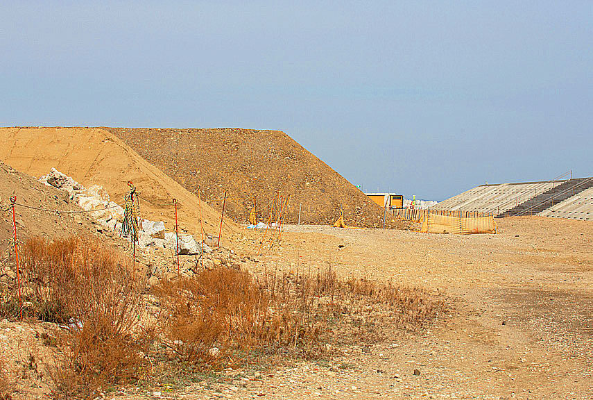
On the way to the shoreline, I saw a lone pine tree that was not washed away by the tsunami. Most of the pine forests on the Pacific Ocean side are gone, but there are still some lone pine trees in each area. The seawalls under construction are so large that they make it impossible to see the ocean, which makes me feel uneasy. At Odaka Station, where I always stop, they are preparing for the full opening of the Joban Line. In 2013 many bicycles were abandoned in the lot. But now it has changed and new bicycles are parked there.
Now, after the tour, we headed to our lodgings for the day. At dinner, we talked about our respective experiences of the earthquake. Some of them said that the tsunami running up the river was terrifying. After the dinner, we listened to Mr. K, who has been working at the nuclear power plant since the earthquake. He noted that the working environment is quite harsh.

Yamamoto Town
On the second day, we left the Inn at Haranocho and headed north on Route 6 to Miyagi Prefecture. We passed by the National Hospital Organization’s Miyagi Hospital. At the site of the former JR Yamashita Station, there was a cenotaph for the victims of the Great East Japan Earthquake, named the “Tower of the Earth”, and a stone monument with the names and ages of the victims, many of which were young children and people over 60. The former Yamashita station is still there, the station building and tracks are gone, but the platform is still the same as it was after the earthquake. The braille blocks on the floor were faded. At the Hashimoto store in front of the JR Yamashita Station, there is an exhibition of photos taken during the earthquake as well as photos of the Nakahama Elementary School, the only remaining structure from the disaster in the Sennan area.
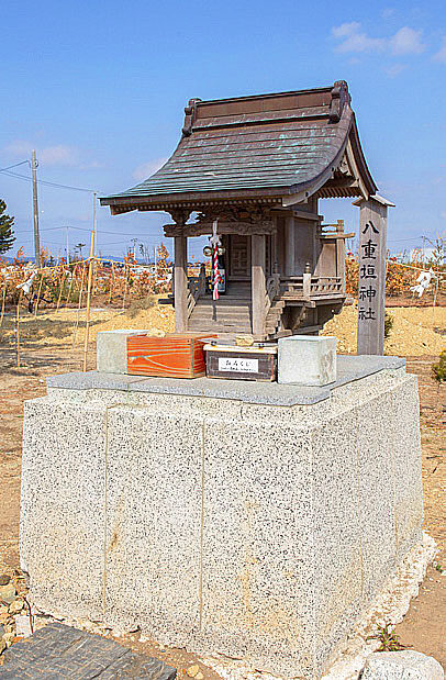
Yaegaki Shrine has been beautifully rebuilt. There was nothing but a magnificent pine tree in the middle of nowhere, but the spirit of the residents can be felt in the brand new white wooden shrine.


The names and ages of those who died in Yamamoto Town are inscribed on the stone monument.
Yuriage
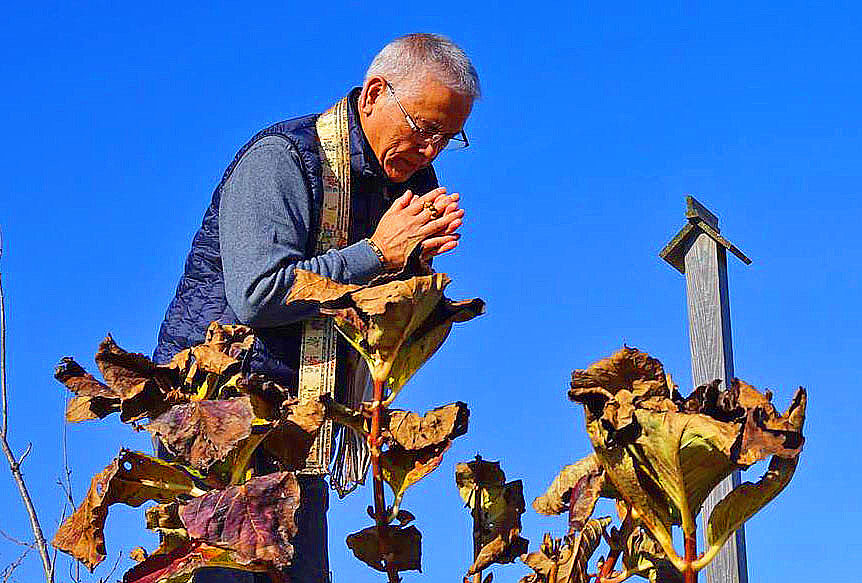
The area around Hiyoriyama in Yuriage is being developed and the landscape is changing every time I visit. The sluice gates that used to mark the arrival point of the tsunami that could be seen from Hiyoriyama have disappeared and a new, imposing, and large levee has been built. After the earthquake, there were large piles of debris along the coastline that were being disposed of, but now they are gone. The only reminder of the original town is the damaged fish processing plants. The bridge leading to Yuriage fishing port is being replaced with a new one. A bicycle race course that we used before the disaster is under construction. The stone monuments of Ishinomaki and Genshoishi that were carried and dropped by the tsunami are still underneath. One of the monuments reads, “If there is an earthquake, beware of the tsunami”. In the grass nearby, there is only the rusty foundation of a streetlamp. At Mt. Hiyoriyama, Mr. Yoshitsune Morita (a participant from Wakayama Prefecture) was reciting a sutra. We all joined hands.
We had lunch at a restaurant that specializes in beef tongue that was recommended by Mr. Tateo Ito, it was delicious. After that, we broke up at Sendai Airport. I have participated in this conference every year since 2013, and I feel that the reconstruction of Fukushima has many unique problems that are difficult to solve compared to the reconstruction efforts in Miyagi Prefecture. The other day, I visited Suzuki Shuzo, a sake brewery in Nagai City, Yamagata. Unfortunately, there is no trace of the sake brewery that was in Namie Town, however, I was relieved to hear that they are planning to rebuild.
The top of the dike has a flat surface of about 3 meters, which can be walked on freely.
(Report by Mr. Osamu Koseki)
The 7th “Great East Japan Earthquake Tour” (3.11) Fukushima, Japan
| Ministry of Health, Labour and Welfare (MHLW) subsidized project "Nanbyo Patient Support Project" in 2018 | |
| Dates | Saturday, December 9, and Sunday, December 10, March 11, 2017 |
| Co-sponsored by | The Fukushima Prefecture Council of Intractable Disease Organizations Miyagi Prefecture Patients and Families Association (NPO) Iwate Prefecture Council of Intractable Diseases and Related Disorders |
| Participants | Seven |
| Accommodations | Hotel Nishiyama (Asahimachi, Haramachi, Minamisoma City) |
| Itinerary (Day 1) | Depart JR Koriyama station (10:00) → Kawamata town (rest at Silk Pier, lunch at Yamakiya area) → Namie town (Tsushima ward, Tsushima junior high school, Namie town office area, Oedo fishing port) → Minamisoma city (JR Odaka station area, temporary housing for Ms. Enei) → Arrive at hotel (17:30), social gathering |
| Itinerary (Day 2) | Depart from the hotel (9:00) →Yamamoto Town, Miyagi Prefecture (around the former Yamashita Station) →Yuriage, Natori City, Miyagi Prefecture (around Mt. Hiyori and the coast) →Departure at JR Natori Station and Sendai Airport (14:00) |
From JR Koriyama Station to Kawamata Town (Yamakoya District)
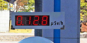
There were many cabs and private cars boarding at JR Koriyama station, and the young people waiting for the bus were very lively. The radiation dose at the monitoring host was 0.128μ Sv/h, which is still a bit high as Tokyo is around 0.038μ Sv/h.
We left at 10:00 a.m. in a 10-seater rental van. We took the same route as last year, from Route 4 to Prefectural Route 51 and Route 114, and headed for Namie Town from the Yamakoya area in Kawamata Town. During our previous visits, we had seen many flexible container bags (waste containing radiation generated by decontamination, etc.) piled up in the open, which had been removed, and the landscape was no longer reminiscent of a nuclear disaster. It was thought that the flexible container bags were being transported to the interim storage facilities built in Okuma and Futaba, the municipalities where the nuclear power plants are located.
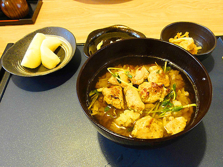
On March 31, 2017, the evacuation order was lifted for the Yamakiya area, which had the highest radiation levels in Kawamata Town. However, the number of cars and people passing through this area has decreased. Yamakoya Elementary School, which was forced to evacuate due to the accident at the Fukushima Daiichi Nuclear Power Plant, has resumed classes locally as an integrated elementary and junior high school as of spring 2018, but the elementary school has no students. As of July 2020 the junior high school had only three students. We had lunch at a soba restaurant that has reopened for business in the Yamakoya area, and it was quite delicious.
Namie Town
The Tsushima district of Namie Town (an off-limits area) was almost the same as it was after the earthquake, and there were no people in sight. The Tsushima district is about 28km away from the Fukushima Daiichi Nuclear Power Plant, but radiation levels are still high and we measured 2.67μ Sv/h in the grass. It was the area with the highest level of contamination we visited so far this year. The Tsushima Junior High School which used to be used as a temporary storage for flexible containers in Namie Town is now closed. After the nuclear accident, many townspeople evacuated to the school and spent several days there, not knowing that radioactive materials had been carried away by the wind, but now it was quiet.

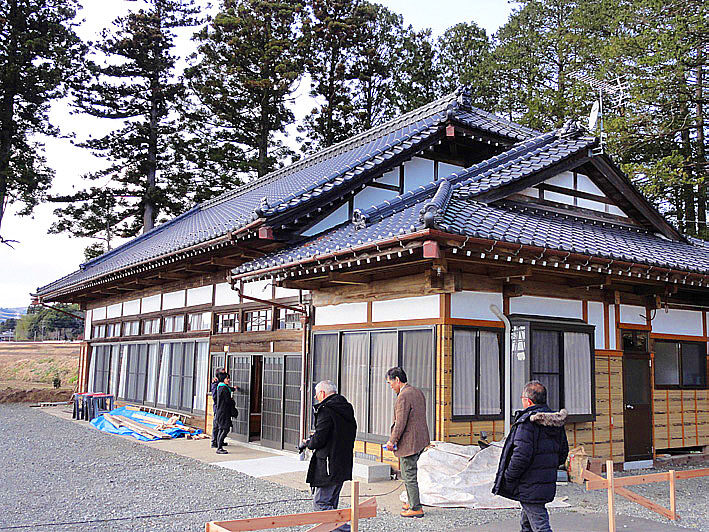
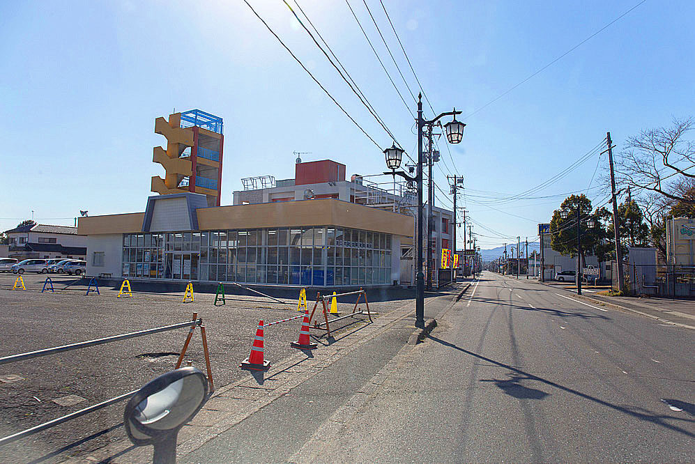
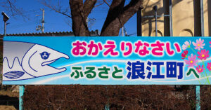 The main office building of the Namie Town Hall resumed operations in April 2017. On the premises of the town hall, a temporary commercial complex called “Machi-Nami-Marushie” (restaurants, mini-live shows, etc.) was working hard to promote the reconstruction. The bright blue signboard at the town hall that says “Welcome back to your hometown, Namie Town” caught my attention. However, around the main office, there were still many buildings that were not inhabited. The main road, Route 6, was busy with cars and dump trucks, but once you exited route 6, it felt empty. According to a questionnaire conducted by Namie Town, the main factors preventing people from returning to their homes are anxiety about radiation, inconvenient shopping and inadequate medical care.
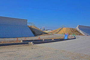
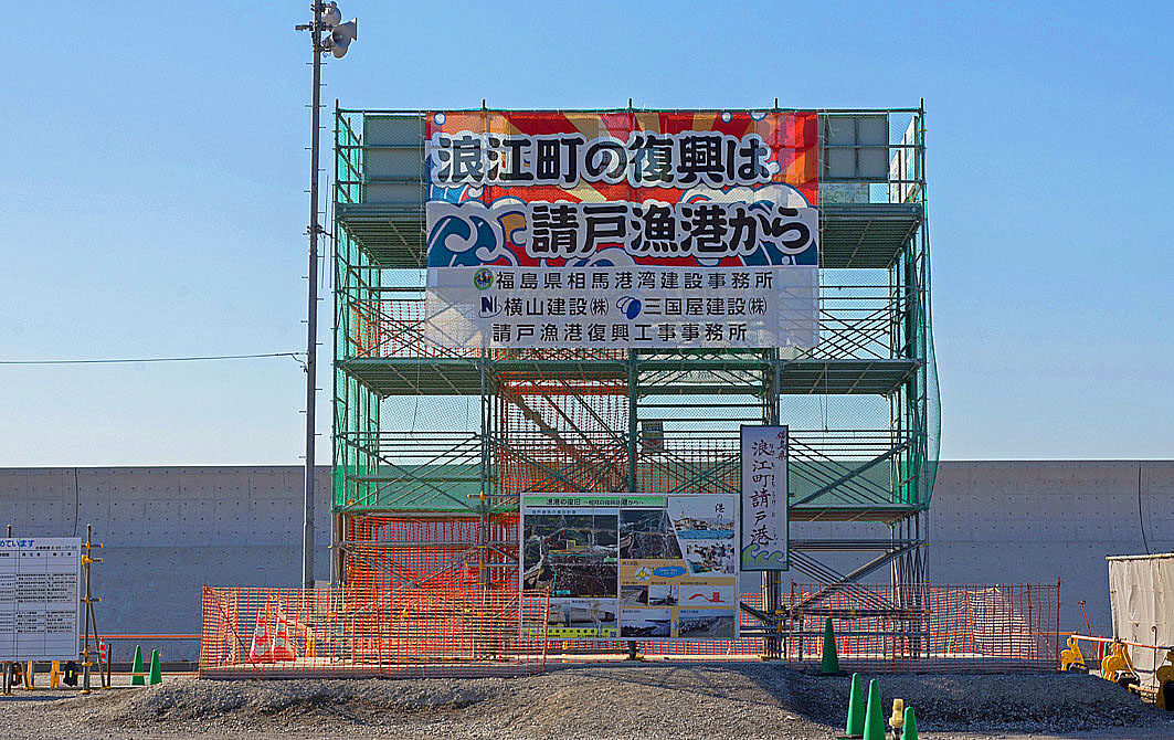
Namie Town’s Kamito Ukedo fishing port is located on the Pacific coast about 6 km north of the Fukushima Daiichi Nuclear Power Plant. Therefore, in addition to the devastation caused by the tsunami, many people were forced to live as evacuees due to the nuclear accident. When we visited the area, the dikes and fishing-related facilities were in the middle of restoration work. However, much of the area around the fishing port was left vacant with only the foundations of collapsed houses remaining, showing the deep scars of the disaster. During the disaster, fishing boats were swept away by the tsunami and after many were evacuated to other fishing ports but they returned to Namie in February 2017 when the evacuation order was lifted. The enthusiasm of the people involved can be felt from the large sign that says, “Namie Town’s recovery starts with the Nameto fishing port. To revive the fishing industry, it is important to overcome the reputational damage caused by the nuclear accident, but the government is considering releasing the increasing amount of contaminated water from the Fukushima Daiichi Nuclear Power Plant into the ocean.
Victims of the Ukedo district
In the Ukedo district, 127 people died and 27 are registered as missing. Many fishermen lost their boats so most of the fishing boats that came back to the port were new. At Namedo Elementary School, the tsunami surged up to the ceiling of the first floor, but the 80 children in the school building were quickly evacuated to the mountains along with the teachers and staff and all were safe.
Minami Soma City
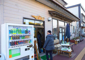
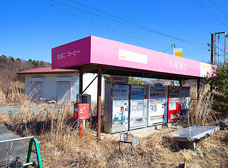
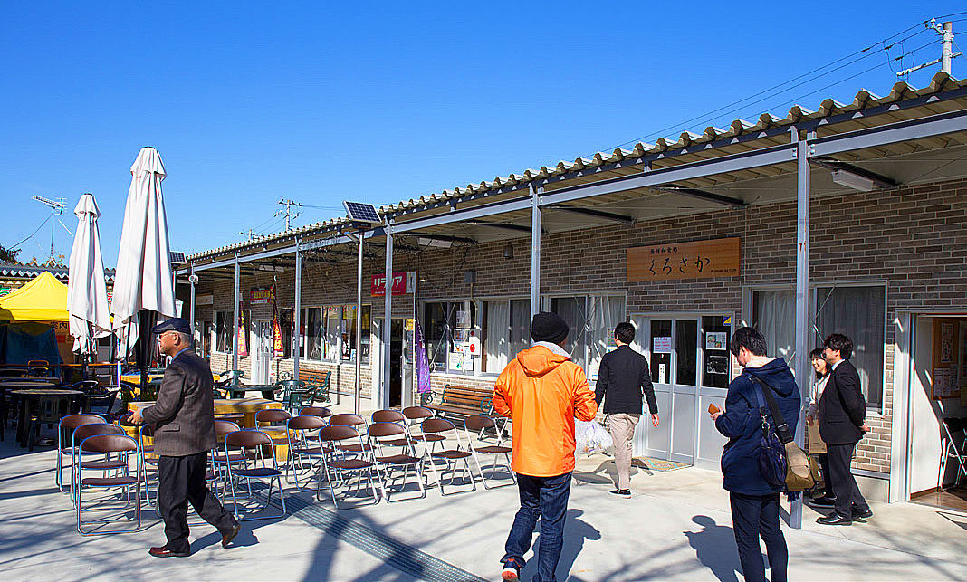
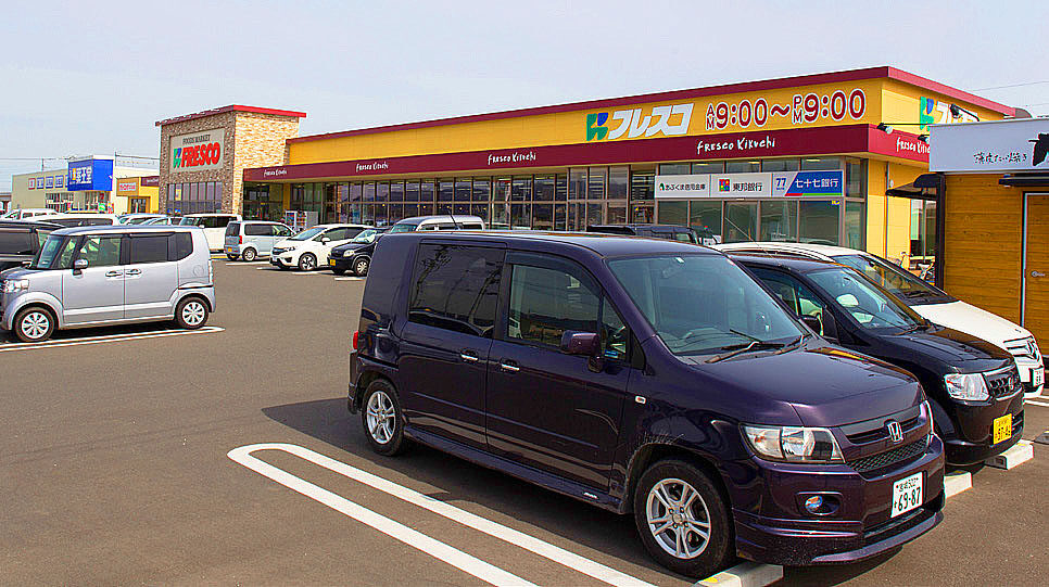
The Joban Line’s 6.9 km between Tatsuta Station (Naraha Machi) and Tomioka Station (Tomioka Machi) resumed operation on October 21, 2017. The JR Odaka station was cleaned up, but the area around the station was still deserted. We visited a small store in front of the station called “Kirakira,” which sells local agricultural products and folk crafts. We exchanged a few words with the elderly woman who tends the store. The owner of the shop is also the owner of the Futaba Ryokan, which is next door and she told me that it is not very profitable, but she continues to operate it for the reconstruction of the town. We also stopped by Full House, a bookstore opened in April 2018 by author Yu Miri. It was a small store with a pleasant atmosphere.
Next, we visited Ms. Keiko Enei, a member of the Rheumatism Friends Association, who lives in a temporary housing complex next to the roadside station “Minamisoma”. Ms. Enei will be moving out of the temporary housing she has lived in for seven years and returning to her home in Odaka by the end of March, so we interviewed her about her current state of mind.
Ms. Enei had undergone artificial shoulder joint surgery last year due to a fall and had also had the misfortune of losing her mother. Even so, she seemed to be in good spirits. She said, “Even if I go home, I won’t be able to farm anymore, so all I can do is drink, eat and sleep. Her voice sounded lonely as she said this.

Yamamoto Town
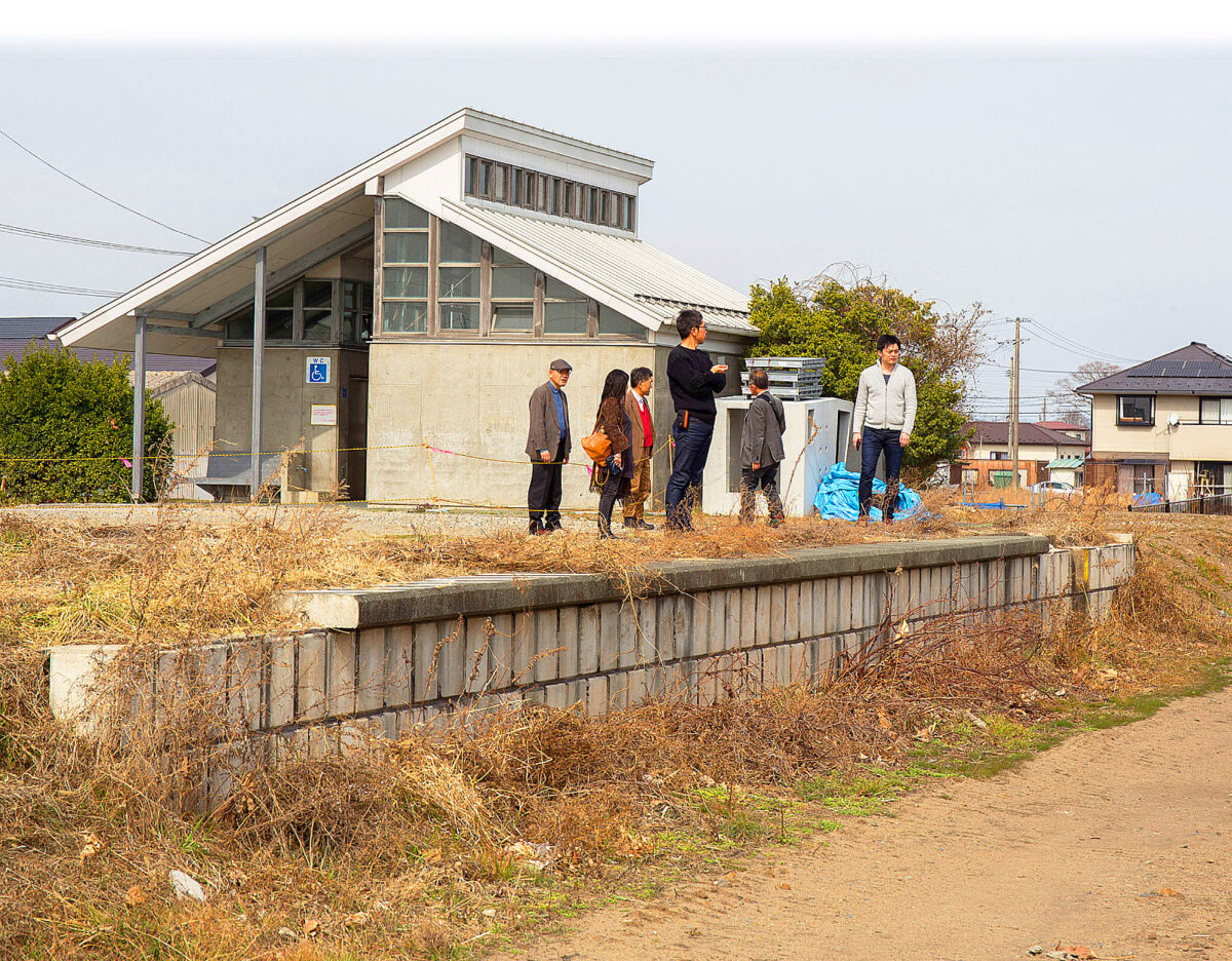
The remains of the former JR Yamashita Station in Yamamoto Town, where 637 people lost their lives in the earthquake, are disappearing except for the few remaining concrete platforms and toilets. (See the photo on page 48.) Just south of the station, the remains of the railroad tracks are about to become a road. Unfortunately, the Hashimoto store in front of the old station was closed for the day. On the inland side, where reconstruction is underway, roads are being widened and new houses are being built, but there are still many vacant lots.

Most of the inhabitants have moved inland.

Population of Yamamoto Town
The total population of Yamamoto Town before the disaster (October 2010) was 16,704, but as of the end of February 2019, the total population was 12,235 and the disaster has accelerated the depopulation process. The specialty food of Yamamoto Town is strawberries, but the majority of strawberry farmers were affected by the tsunami. However, in 2018, the growing area of strawberries has recovered to 75% of the pre-earthquake level and the yield to 92% thanks to the introduction of state-of-the-art greenhouses. However, the number of farmers has been halved to 65 from 129 before the disaster.
(From Yamamoto Town’s website)
Yuriage
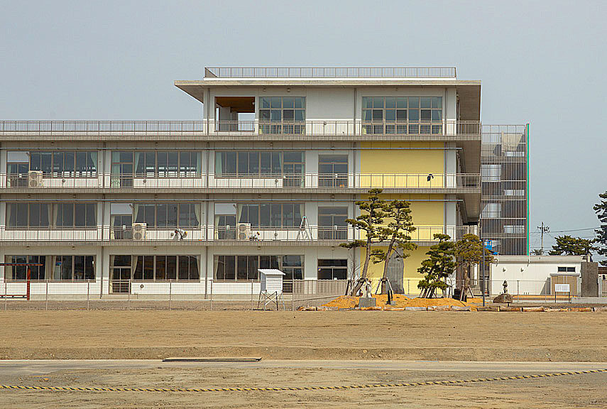
On our way to Hiyoriyama in Yuriage, we passed by Yuriage Elementary School and Yuriage Junior High School (newly opened in April 2018), which is an integrated elementary and junior high school now, both of which were damaged by the tsunami. The school now has various disaster preparedness measures in place, such as stockpiling food and equipment on the fourth floor.
The area around Hiwamiyama has been changing little by little over the years. However, I got the impression that it will still take a few more years before it is reborn as a new town. A red torii gate was built at the entrance of Hiyoriyama. The seawall along the coastline had been completed, but the work to raise the seawall was still going on. In November, the Eastern Sendai Reconstruction Road (10.2km from Gamo, Miyagino-ku to Fujizuka, Wakabayashi-ku) will be fully opened to traffic.
Population of Yuriage
Yuriage’s pre-earthquake (February 2011) population was 7,103; February 2017 was 2,159; February 2018 was 2,373; as of February 2019, the population is 2,645. The population is showing a gradual recovery trend due to Natori City’s activities to promote settlement, but it has decreased significantly compared to before the earthquake.
(From Natori City’s website)
When we visited the affected areas, the reconstruction through civil engineering work was visually obvious. However, it was also clear that population decline was a major issue, with many deserted residential areas. Particularly in the affected areas of Fukushima Prefecture, the impact of the nuclear power plant accident has been a major hindrance to reconstruction. Although it has not been widely reported, we must not forget the victims that have been affected mentally and to remember those who died alone in temporary housing this is a “reconstruction of the soul”. Reconstruction of the soul cannot be bought with money but must be considered in conjunction with the basic policies of what kind of society Japan should aim for in the future.
(Report by Masaru Fujiwara)
The 8th “Great East Japan Earthquake Tour” (3.11) Fukushima, Japan
| Ministry of Health, Labour and Welfare (MHLW) subsidized project "Nanbyo Patient Support Project" in 2019 | |
| Dates | Saturday, March 7, and Sunday, March 8, 2020 |
| Co-sponsored by | The Fukushima Prefecture Council of Intractable Disease Organizations Miyagi Prefecture Patients and Families Association (NPO) Iwate Prefecture Council of Intractable Diseases and Related Disorders |
| Participants | 8 people |
| Accommodations | Accommodations: Hotel Nishiyama (Asahimachi, Haramachi, Minamisoma City) |
| Itinerary (Day 1) | JR Koriyama Station (10:00) → Tamura City → Okuma Town (Otosawa Chuo-dai near Fukushima Daiichi Nuclear Power Plant) → Namie Town (JR Namie Station area, Kondo Fishing Port) → Minamisoma City (JR Odaka Station area, Ms. Enei's house) → Arrive at hotel, social gathering |
| Itinerary (Day 2) | Depart from the hotel (9:00) →Yamamoto Town, Miyagi Prefecture (near JR Yamashita Station) →Yuriage Area, Natori City (near Mt. Hiyoriyama) →Sendai Airport and JR Sendai Station (14:00) |
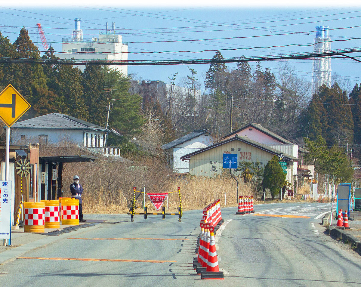
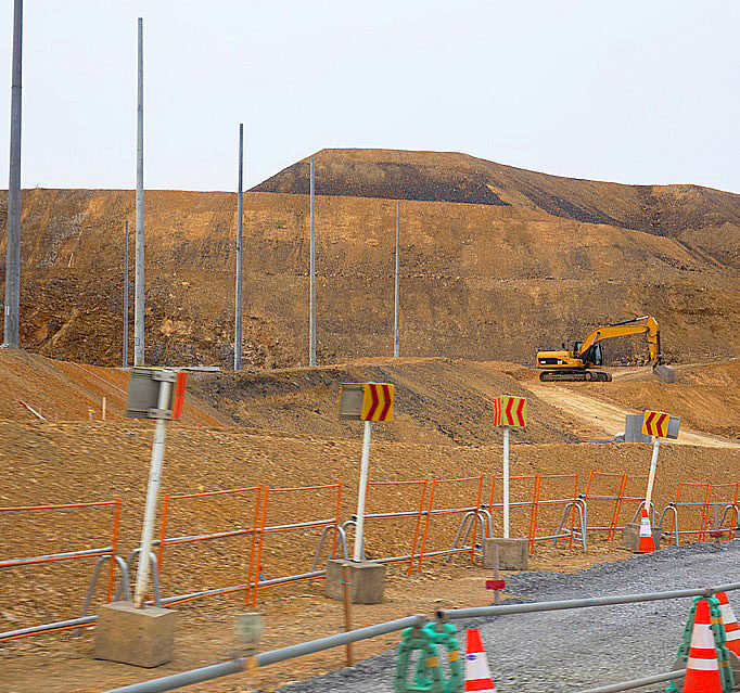
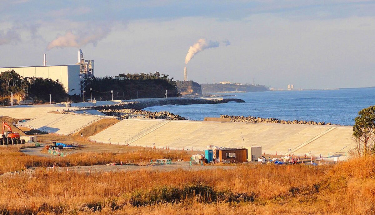
From here on, we can only enter with a special pass. The white nuclear power plant facility can be seen in the background.
From JR Koriyama Station towards Miharu and Tamura City
This was the last tour. Following is the comprehensive report.
(Along the national highway in Furumichi, Tamura City)
As usual, we left JR Koriyama Station at 10:00 a.m. in a 10-seater rental van. This time, we decided to go further than previous tours. We drove east on Route 288 through Futaba Town, where the evacuation order for the “off-limit area ” was partially lifted on March 4, and Okuma Town, where the evacuation order was partially lifted around JR Ono Station on March 5, toward the Fukushima Daiichi Nuclear Power Plant. On the way, we came across several places where they were repairing roads that had been damaged by the heavy rains caused by Typhoon No. 19 in October last year, which caused the rivers to flood. The damage was so severe that the repair work was on going. The heavy rain caused an accident in which 90 flexible container bags filled with decontaminated waste spilled into the river from temporary storage sites (Tamura City, etc.) before they were relocated to the intermediate facilities in Futaba and Okuma. It was noted that there was no impact on the radiation level or water quality in the area, but I am sure that people in the area were nonetheless worried.
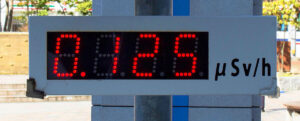
As our car drove towards Futaba and Okuma, the radiation level was a concern: 0.125 µSv/h at JR Koriyama station and measured, 0.77 µSv/h in Miyakoji-cho, Tamura City when we passed through Miharu-cho along the old road.

About Flexible Container Bags
On the night of October 12, 2019, Typhoon No. 19 hit Fukushima Prefecture, causing some of the flexible containers (storage bags filled with decontamination waste) stored at temporary storage sites in Tamura City, Nihonmatsu City, Kawauchi Village, and Iitate Village to spill into rivers.
In November 2016, the government began construction of an interim storage facility to transport decontaminated waste to Futaba Town and Okuma Town, which began full-scale operations in October 2017. This has reduced the number of temporary storage sites and the amount of decontaminated waste, but there are still about 9.3 million cubic meters of waste still stored at about 730 temporary storage sites in the prefecture. (As of January 2020)
A similar accident occurred in Iitate Village in the fall of 2015, when heavy rains flooded a storage area in the village and 448 bags spilled. This time it happened again. Even if the amount of radiation from the decontaminated waste that leaked into the river had almost no impact on the environment, the state of the storage system will be questioned.
Regarding the history of the construction of the interim storage facility, in 2011 the government requested the eight towns and villages in the Futaba group to consider the construction of an interim storage facility to transfer the waste from the temporary storage site. The towns of Futaba (January 2015) and Okuma (December 2014) accepted the construction on the condition that all waste be taken out of Fukushima Prefecture within 30 years. In return, the government granted a total of 301 billion yen to the prefecture and the two towns. However, there is still no final disposal site in Japan to take the waste out of Fukushima Prefecture. Currently, about 70% of the land for the construction of interim storage facilities has been acquired. The government hopes to complete the delivery to the interim storage facility by March 2022. The total project cost related to the interim storage facility will be 1.6 trillion yen.
Reference materials: Asahi Shimbun evening edition, “To the scene,” January 20-24, 2020; Ministry of the Environment website;
Okuma Town
Passing by JR Ono Station, we drove over the north-south National Highway No. 6 to the seaside on Prefectural Road No. 252, and arrived at a point about 1.2 km from the Fukushima Daiichi Nuclear Power Plant. Please refer to the photo on page 54. (Okuma became the first municipality in a nuclear power plant location to lift evacuation orders for some areas on April 10, 2019, and the JR Ono Station area was lifted on March 5, 2020.)
The radiation level in the vicinity was 6.47μ Sv/h, which was quite high. There was a manned gate, and from here on, you could not enter without a special pass. Police cars were patrolling the area frequently. We could see part of the plant from the road. The surrounding houses were uninhabited and seemed to be in the same condition as nine years ago or even worse. Weeds were growing wildly and there was no evidence of recovery at all. Incidentally, the radiation level in the air around the building of the Daiichi Nuclear Power Plant is about 120μ Sv/h, which is high enough to reach the annual radiation exposure limit for an average person in 8 hours. According to reports, it has been nine years since the accident, but the work to remove the nuclear fuel has been quite difficult.
The JR Joban Line between Tomioka and Namie stations (20.8 km), which had been closed due to the accident at the Fukushima Daiichi Nuclear Power Plant, was opened on March 14, thus restoring the entire line. However, even though the area around the station has been decontaminated, the train will still pass-through areas such as Okuma and Futaba where radiation levels are high and almost no one resides. According to the Fukushima radioactivity measurement map, the radiation dose at Futaba station was 0.28μ Sv/h, but a few hundred meters away at the Tanimachi meeting place, it was 4.38μ Sv/h.
The government’s guideline for lifting the evacuation order is 3.8μ Sv/h (20 millisievert [mSv] per annual cumulative dose) or less. However, even 3.8μ Sv/h (20 millisievert [mSv] per year) is quite high, since the long-term target is 1 mSv or less. Although it may be concluded that there is no problem in measuring the air dose rate inside the train, but I can’t help conclude that the entire line was opened to coincide with the Olympic venue that was to be used in the area.
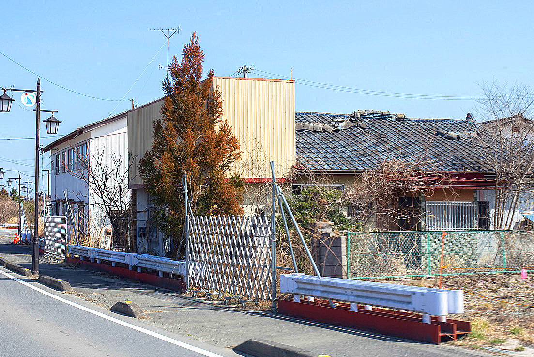
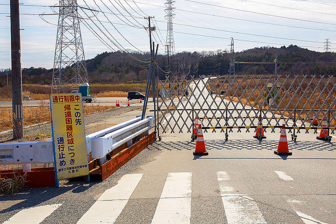

The Joban Line tunnel can be seen in the upper right.
Evacuation order lifted in Futaba Town
In Futaba Town, where the Fukushima Daiichi Nuclear Power Plant of the Tokyo Electric Power Company (TEPCO) is located, the evacuation order that had been in effect for the entire prefecture was partially lifted at midnight on March 4, 2020.
In Futaba Town, the evacuation order was lifted for the northeastern area, which had been designated as a “Preparatory Area for Lifting the Evacuation Order” with relatively low levels of radiation. The roads around JR Futaba Station, which were in an “off-limit area” with relatively high levels of radiation but had been decontaminated and radiation levels were reduced. The total area is 2.4 square kilometers, which is 4.7% of the town’s total area.
Futaba Town was the only municipality that had been under evacuation orders for the entire area following the nuclear power plant accident, and this is the first time that such orders have been lifted in the nine years since the accident. This is also the first time that the evacuation order has been lifted in the off-limit area. However, since the infrastructure for daily life, such as water supply, has not been developed in the areas where the orders were lifted, there are no residents returning.
Namie Town
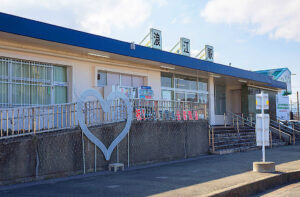
In front of JR Namie Station, several restaurants were open for business and we had lunch there. The radiation dose in front of the station was 0.21μ Sv/h (according to the Fukushima Prefecture radiation measurement map), which was low due to decontamination. The evacuation order for Namie town was lifted in March 2017, except for areas where it is difficult to return. However, as of the end of February 2019, there were 17,526 people registered as residents in the town, but the population was only 910.
The next stop was the Ukedo fishing port, which we visited for the second time since last year. At present, test operations are being conducted for all types of fish and shellfish in Fukushima Prefecture except for those that are restricted for shipment. Last year, the Namie fisheries joint use facility, which will serve as an evacuation center in case of disaster, was under construction. It is a very impressive building. Fishing boats that had been evacuated to other fishing ports have returned, and the long-awaited auction will resume at this facility in April.
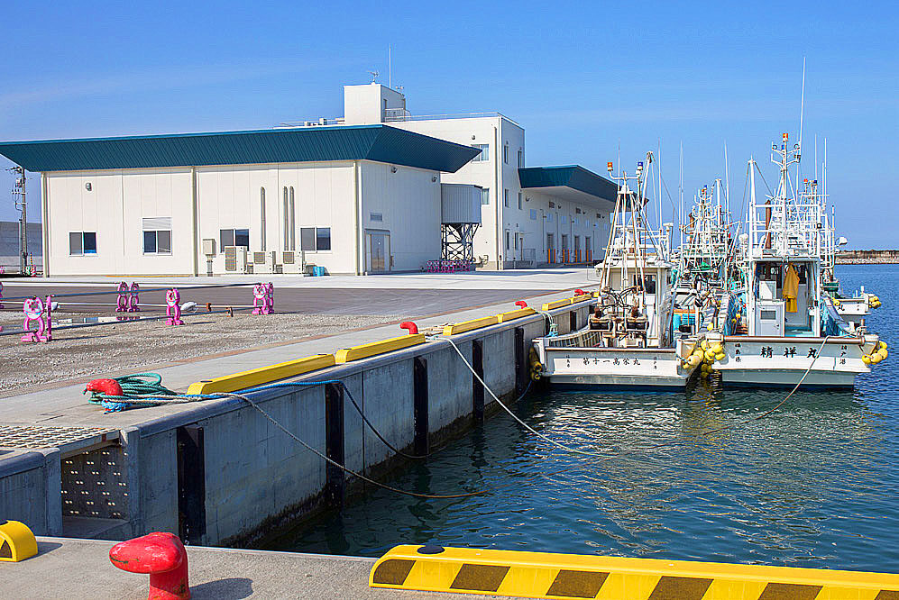
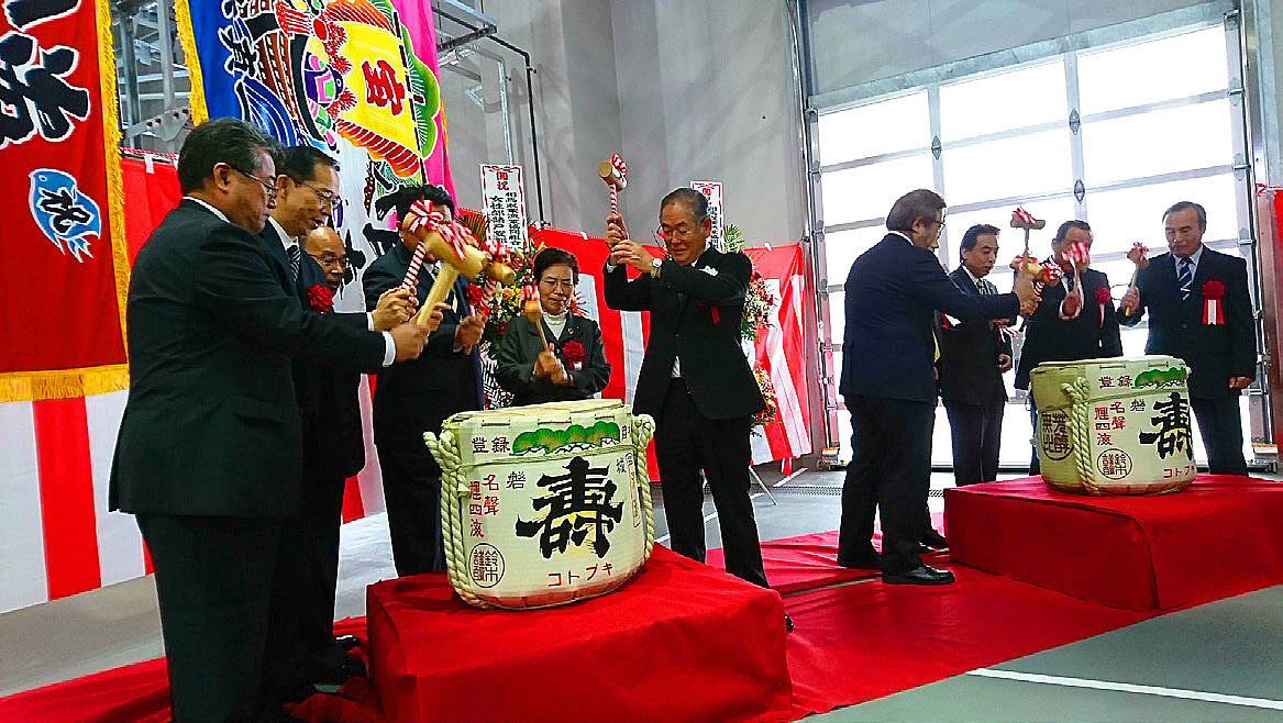
The number of fish landed in Fukushima Prefecture is only about 20% of pre-disaster levels, but the slumping prices are gradually increasing (and then dropped again due to the Corona disaster). The recovery of the fishing industry is just beginning, but since the government is considering releasing contaminated water that has accumulated on the premises of the Fukushima Daiichi Nuclear Power Plant into the sea, some people in the fishing industry are concerned about the spread of harmful rumors, saying, “All the efforts we have made so far will go down the drain”.
Although the three hazards of radiation, tsunami, and earthquake occurred in Ukedo, the radiation levels have become much lower, and the infrastructure seems to have improved over the past year, with the construction of a seawall around the fishing port, underway. However, the area around the fishing port is still untouched, and it seems that it will take a few more years before all of the infrastructure is in place. There is a plan to relocate all the houses in the area to higher ground.

Ukedo wholesale market reopened
On April 8, the Ukedo local wholesale market reopened for the first time in nine years, and an auction was held at Ukedo fishing port in Namie Town, which was severely damaged by the tsunami of the Great East Japan Earthquake. The reopening of the market is expected to reduce the transportation burden on fishermen and revitalize the fishing industry. According to the Soma Futaba Fisheries Cooperative Association, on April 8th, 23 boats belonging to Ukedo and one boat belonging to Tomikuma (Tomioka Town) went fishing. About 2 tons of flatfish and flathead flounder were landed and auctioned after 9:00 am. As the shouts of the fishermen’s association staff echoed in the air, brokers bid for the fish one after another.
The price of Hirame (flatfish), which was 2,000 yen per kilogram around March, dropped to 100-800 yen per kilogram that day. The fishermen’s cooperative says that Covid-19 caused a drop in consumption at restaurants and sushi stores in and around the Tokyo metropolitan area, resulting in an imbalance between supply and demand.
(Excerpt from Fukushima Minpo, April 9, 2020)
Minami Soma City
In Minamisoma, there is a complicated issue regarding the area being divided because of the radiation levels, causing mixed feelings among the residents due to compensation. In Minamisoma, we were most concerned about Odaka Ward immediately following the earthquake. At the time, the population, which is entirely within the 20km zone, was 12,842. Although the evacuation order was lifted in July 2016, the population is expected to further decline in the future since about half of the people who returned are elderly. Although a certain amount of infrastructure for daily life, such as schools, medical facilities, and stores, has been established. Securing local employment is a major concern in order to attract the younger generation.
Nevertheless, the area around JR Odaka Station on the Joban Line, where I have been conducting a fixed-point inspection every year since 2014, gave me a slightly different impression from last year. The first thing that surprised me was that now there were taxi cabs waiting for customers in front of the station. Station staff were also on duty there in preparation for the opening of the entire line. There were already many vacant lots and uninhabited houses, but I also saw a few people here and there. OMSB (Odaka Micro Stand Bar), a small cafe in front of Odaka station, was crowded with families and young people. Takashi Moriyama, from Osaka Prefecture was preparing coffee in the shop that he and his friends opened three years ago, 18 months after starting out with a kitchen car. They wanted to create a place where people could gather by themselves. We also took a break here. It’s a very relaxing place. A boy in his third year of high school, who came from the neighboring town of Haramachi, said he enjoys his time here so much that he comes every week. I guess people naturally gather in places where they feel comfortable.
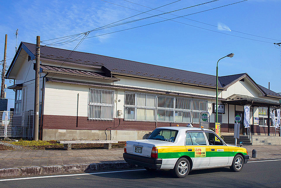
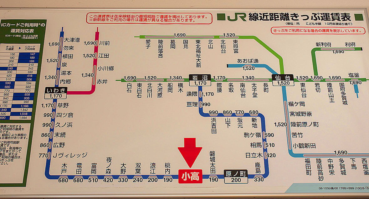
Cafe OMSB on Facebook
Cafe OMSB’s Facebook page has a lot of interesting information.
https://www.facebook.com/odakao.msb/
 It was closed in April due to Covid-19 but resumed operations on June 2. While they were closed, they were still broadcasting live on the Internet about how to make coffee. Currently, they are doing their best to survive the pandemic by selling sandwiches from their new menu.
I have high hopes for everyone involved.
The last stop of the day was a visit to Ms. Keiko Enei’s home in Odaka Ward. When we visited the temporary housing in Minamisoma on last year’s tour, Ms. Enei was moving out and preparing to return to her home for the first time in eight years. Last year, she said, “Even if I go home, I can’t do anything but eat and sleep,” so I was a little curious about how she was faring. I hadn’t seen her in a year, but she had lost her father last August. Even so, I was relieved to see that she seemed to be in good spirits, saying that she was busy cleaning up the mess. Odaka Ward had to be evacuated due to its proximity to the Fukushima Daiichi Nuclear Power Plant, but Enei’s house was on slightly higher ground, so it escaped the tsunami damage. The house has stables and three large horses. During the evacuation, she took great pains to come and take care of them. The horses seemed to welcome us, as if they missed human contact since their master had been away for so long.
We arrived at our hotel in Haramachi, Minamisoma at around 5 p.m. and had a social gathering at a nearby restaurant. The number of repeat participants in the Fukushima tour has been increasing every year, and I felt the solidarity getting stronger amongst them.


Yamamoto Town
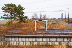
On the second day, it was raining. This was the first time it had rained during the eight Fukushima tours. Today, we visited Yamamoto-town, Watari-gun, Miyagi Prefecture (around the former JR Yamashita Station) and Yuriage, Natori City, Miyagi Prefecture, which we have been visiting since the first tour.
Yamamoto Town, which specializes in strawberries, has a population of 12,235 (as of February 2020). This is a decrease of 52 people compared to the same month last year, so the population has decreased slightly but not significantly. The area around the former JR Yamashita Station did not look much different from what we saw last year, with only a few crumbling platforms remaining (the platforms and toilets will be removed later, but we did not know that at the time). We were able to talk to a local man who was just visiting the area as well.
When I visited here on the fourth Fukushima tour in 2016, Yamamoto Town was planning to move a prefectural road running along the coast inland and raising it by 4-5 meters to act as a seawall. The prefectural government demanded the eviction of 15 households that were on the route and would be left behind on the ocean side, but the residents demanded that the prefectural road route be changed. I was wondering what happened after that, but a local man told me that the matter was settled through discussion.
A memorial ceremony has been held here every year on March 11 since the cenotaph was built in 2017, but things were different this year. When I visited last year, the town staff and others were out preparing for the memorial ceremony, but this year, there was hardly anyone there. In the end, to prevent the spread of Covid-19, they decided not to hold a ceremony and set up a flower donation table instead. I can only imagine the disappointment the bereaved families must have felt.
Challenges in maintaining local communities
The town of Yamamoto was the first to accept residents back in the prefecture for some of its public disaster housing in 2013, but because the town adopted a lottery system for moving in, the original residents were scattered. Residents complained that the government had abandoned the affected areas and prioritized town development. In the earthquake, 3,300 houses were damaged representing more than 50%. The town set up a “compact city” as part of its earthquake reconstruction plan, and decided to relocate the six affected villages to three locations. Considering the local characteristics and the relocation of the JR line, the “Shin-Yamashita Station” area was chosen as the relocation site, but the opinions of the residents were not reflected in the selection of the site.
Under the government’s disaster prevention, group relocation promotion project, communities with more than five houses were supposed to be relocated as they were before the Great East Japan Earthquake. However, by lottery, Yamamoto Town relocated houses outside of the community. As a result, there are many people who are not familiar with the new district and are facing difficulties building local communities.
Yuriage
The last stop was Yuriage, Natori City. As usual, we inspected the whole area from the 6.3-meter Hiyori-yama, which has become a symbol of the memorial. My first impression was that the land had been further cleared. The front of Mt. Hiyori-yama, which was under construction last year, had been neatly paved and the parking lot had been completed. Looking from the mountain, I could see that the land had been cleared for quite a distance. Now that the foundation of the town is in place, the question for the future is, how many residents will return or whether we can attract new ones. In other affected areas, such as Rikuzentakata in Iwate Prefecture, there are issues common to all affected areas, such as the fact that although urban development has been completed, vacant land remains because people have not returned.
This is the end of our tours that started in 2013. We are a little sad, but we will never forget the experience. We said goodbye while praying for the recovery of the affected areas. Thank you all for your hard work.
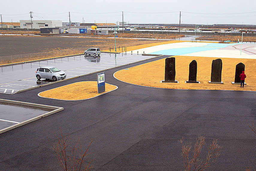
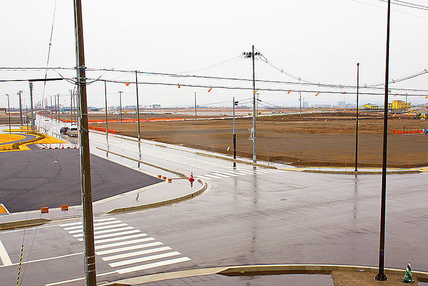
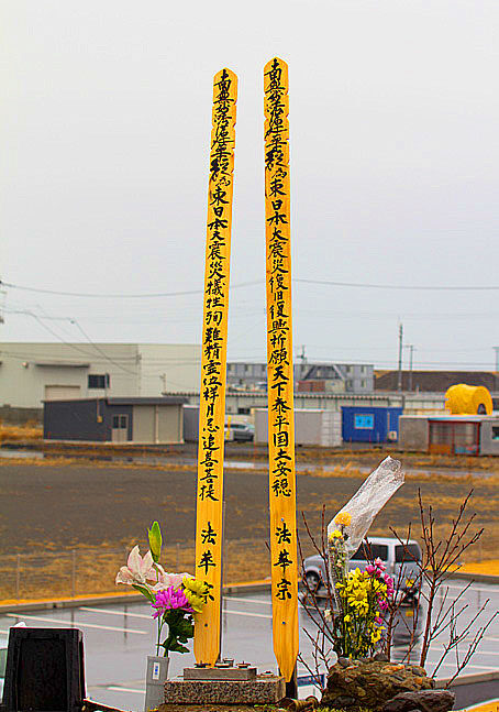
Natori City declares reconstruction complete
On March 30, Natori City issued a “Declaration of Accomplishment of Reconstruction,” stating that it had almost completed (1) The reconstruction of victims’ homes, infrastructure, and public facilities. (2) Preventing the disaster from fading away and creating a safe and secure town (3) Revitalizing and developing local industries (4) Attracting businesses to the former disaster-relocation site (5) Promoting the settlement of people in the Yuriage area and increasing the population of the coastal region.
 On the second day of the tour, we went to a restaurant that specializes in beef tongue (Gyutan) called “Ikkyu” in Natori City which we previously visited many times for lunch over the eight years. It seemed to be a famous restaurant in the local area, and customers kept coming in.
On the first tour, we almost ate and drank without paying for it, mistakenly thinking that the cost of the meal was included in the trip price.
Since the earthquake and tsunami of March 11, 2011, the Fukushima Daiichi Nuclear Power Plant has been in a dangerous “state” of meltdown, where the nuclear fuel stored inside the reactor core melted due to high temperatures, dissolving or damaging the core. It was only in December 2011 that the government declared the “accident under control” with the term “cold shutdown” due to water injection and other operations. The term “cold shutdown” originally meant that the water temperature had stabilized at less than 100 degrees Celsius due to the shutdown operation of the reactor. However, it is unreasonable to apply the term to damaged reactor where the fuel melts down and radioactive materials continue to leak. Therefore, we added the word “state” and created our own definition, such as the fact that leakage has been greatly suppressed.
Since the cold shutdown, the government has prepared a decommissioning timetable (medium to long-term roadmap) and revised it five times by December 2019, saying that decommissioning and other measures will be carried out while continuously reviewing the timetable. Decommissioning work has been delayed as of 2020, but for some reason, even after the revision, the goal of completing decommissioning in 30 to 40 years remains unchanged. It has already been nine years since the accident, and according to the itinerary, decommissioning should be completed in another 20 to 30 years. However, many experts believe that it will be difficult to complete the decommissioning by this time. The debris, which still emits high levels of radiation and has the potential to cause another nuclear radiation accident, must be safely removed and stored, but there is no established technology to do so and the process is still in a state of limbo. There is also the problem of disposing of the waste generated by the decommissioning. Local governments, including Fukushima Prefecture, are demanding that the waste be shipped out of the prefecture, but I wonder if there are any local governments that will manage the waste.
Originally, the government and TEPCO had not clarified what constitutes the completion of decommissioning. Will the buildings be dismantled and returned to the land, as is the case with ordinary nuclear power plants, or will the buildings and other components remain? The Three Mile Island nuclear power plant in the U.S.A. announced in 2019, 40 years after the accident, that it would be decommissioned over the next 60 years. At the Chernobyl nuclear power plant, plans are underway to completely cover the sarcophagus, which encapsulates the nuclear fuel in concrete, with a huge cover that will last 100 years. Based on these examples, it is unlikely that the decommissioning of the Fukushima Daiichi Nuclear Power Plant will be completed in 30 to 40 years after such a massive accident. Also, according to experts, even if all the facilities and contaminated soil are removed, the amount of radioactive waste generated will amount to 8 million tons. Where to put it is a major issue. It is time for the government and TEPCO to seriously consider the future of the crippled nuclear power plant.
(Report by Masaru Fujiwara)
Map(Miyagi, Iwate)
★:ViewPoint
Miyagi
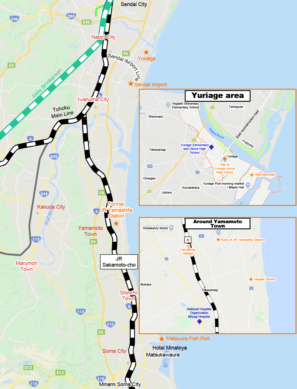
Iwate