[Report] 20/9/20-22/2020 Current Situation in the Affected Areas
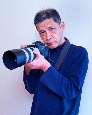
Report: Masaru Fujiwara (Editorial board member, “3.11 Great East Japan Earthquake & A 10-year record of tours to experience Fukushima Firsthand”)
- Dates of coverage:
- September 20 (Sun.) to 22 (Tue.), 2020
- Places covered:
- Disaster-stricken areas in Fukushima, Miyagi, and Iwate prefectures.
- Transportation:
- Private car
- Objective:
- To observe the current situation in the affected areas and investigate the state of reconstruction, etc., before the 10th anniversary of the Great East Japan Earthquake (March 11, 2011).
1. Fukushima Prefecture
Okuma Town
Sunday morning, September 20
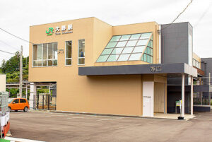
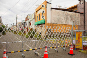
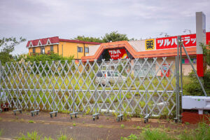
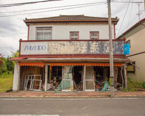
The area around JR Ono Station (248 Shimonokami Ono, Okuma-machi, Futaba-gun), located approximately 3 km west of the Fukushima Daiichi Nuclear Power Plant, is off-limits, and much of the area was barricaded off except for roads leading to the station. Some barricades were relatively new and were thought to have been set up to distinguish between evacuated and non-evacuated areas around the station. The other buildings near the station were in the same state as they were at the time of the earthquake, and no pedestrians were seen.
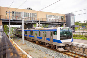
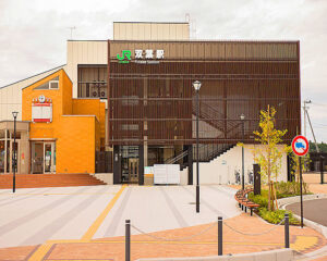
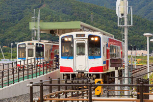
The JR Ono Station and surrounding area were decontaminated and the evacuation order was lifted on March 5, 2020 as a special restoration base area, and the main building was so beautifully restored that it looked new. The radiation level in front of the station after decontamination was 0.363 μ Sv. Business resumed on March 14, but during our 8:00 a.m. visit, there were only two passengers on the regular train.
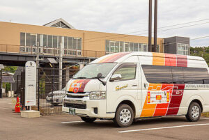
Between JR Ono Station and JR Tomioka Station, a 10-seater, fare-free, Ono Town Life Circulation Bus serviced, Ono Town Hall, Okawara Reconstruction Housing, Tomioka Post Office, Tomioka Central Hospital, Sakura Mall and Tomioka Clinic.
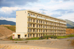
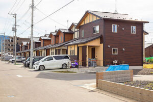
On June 1, people began moving into public disaster housing (reconstruction housing) in the Okawara district in the southern part of Okuma Town in Fukushima Prefecture. Evacuation orders were partially lifted in April following the accident at the Fukushima Daiichi Nuclear Power Plant of Tokyo Electric Power Co. Nearby, a new town hall building has begun operations, and a temporary commercial facility will also be constructed. Sixty-eight people from 45 households are scheduled to move in. Residents are moving their goods into their new homes with high hopes for their future.
(Mainichi Shimbun, June 1, 2020)
Futaba Town
Sunday morning, September 20
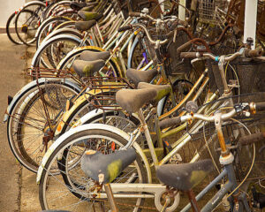
On March 4, Futaba Town, the JR Joban Line and JR Futaba Station were removed from the preparation zone, evacuation order. The main building at JR Futaba Station (Oaza Nagatsukacho Nishi, Futaba-machi, Futaba-gun), like Ono Station, was beautifully restored and also looked new. Many of the buildings around the station were left in the same condition as they were at the time of the earthquake, but there were no barricades like those around JR Ono Station. The radiation dose in front of the station was slightly lower than that at JR Ono Station at 0.299 μSv. The mechanical clock at Station Plaza Futaba, a community facility attached to the station building, remained stopped at the time of the earthquake. At the station’s bicycle parking lot, dusty and rusted bicycles were left behind, silently testifying to the state of the area at the time of the earthquake.
The station looked somewhat more open than JR Ono Station, and although there were no station staff, there were people who looked like guards. There were five free rental bicycles at the station, and two car-sharing services were also available. Car-sharing service is a service where customers can go directly to a parking lot and unlock/lock their cars with a registered IC driver’s license, rather than at a store reception desk like a rental car service. At the time of the visit, four rental bicycles and one car sharing service were already in use. Visitors used the bicycles to visit “The Great East Japan Earthquake and Nuclear Disaster Memorial Museum” which opened on September 20 in the coastal area of the town (about 2 km from JR Futaba Station).
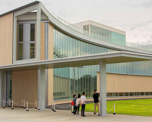
The Museum at 39 Aza Takada, Oaza Nakano, Futaba-machi, Futaba-gun, was built approximately 4 km north of the Fukushima Daiichi Nuclear Power Plant as a facility to collect, pass on records and lessons learned from the Great East Japan Earthquake and the nuclear disaster. The total construction cost of 5.3 billion yen was covered by the government. The “Fukushima Innovation Coast Organization” is in charge of the operation. Admission is 600 yen for adults. However, of the approximately 240,000 artifacts collected, related to the earthquake and nuclear power plant, only about 170 are on permanent display, but I don’t feel that they adequately represent the key essence of the event. The impression is that the prefectural government has started by selecting less relative examples. Nothing in the exhibits clarified the essential issues of the nuclear accident, and we hope to see more focused exhibits in the future. On opening day, 1,051 people visited the museum (from the museum’s website).
Also, according to their website, the Fukushima Innovation Coast Initiative, a national project that aims to build a new industrial base in order to restore industries in the Hamadori region and other areas that were lost due to the Great East Japan Earthquake and nuclear disaster, many of them from outside the prefecture. In the future, the Fukushima Prefecture Reconstruction Memorial Park is expected to be located in close proximity to the Memorial Museum, but at this time there is no sign of construction.
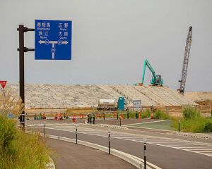
The seawall around the Museum was under construction. In addition, near the Fukushima Daiichi Nuclear Power Plant, a number of temporary storage facilities for decontaminated waste and an access road were being constructed.
There are several such buildings.
Namie Town
Sunday, September 20, Afternoon
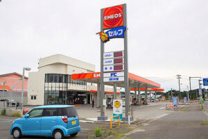
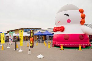
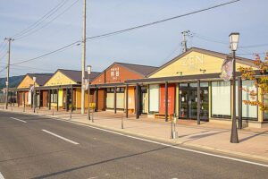
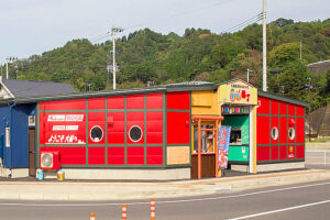
As my drive from Kyoto was about 750 km, I needed to refuel. I stopped at the new gas stand near the Namie Town Hall that had reopened for business under a new company name. Next to the gas stand, ” Roadside Station Namie” (60 Chimeiji Aza Ikuzehashi, Namie Town) had reopened on August 31 as a symbolic facility for reconstruction, and was crowded with visitors. The facility featured a direct sales area where fresh vegetables and seafood were sold, and a food terrace where visitors could enjoy meals using fresh local ingredients, such as shirasu (baby sardines) which was landed at the nearby Ukedo fishing port. Sales seemed to be going well.
In Namie Town, the evacuation order due to the nuclear accident was partially lifted in 2017, and rice cultivation resumed inland. Although delayed, in the coastal areas, rice cultivation began in some rice paddies in 2020, after which the first harvest since the disaster, took place. This suggests that during this tour, with the exception of Tsushima Ward, which is in the difficult-to-return zone, there are signs of recovery.
There were many customers inside.
Minamisoma City, Kotaka Ward, Coastal Division
Sunday, September 20, Afternoon
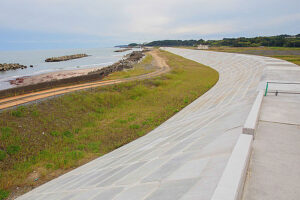
The seawalls around Murakami and Tsukahara in Odaka-ku, Minamisoma were almost completed. The few remaining remnants of house foundations, along the coast, had been removed, and pine saplings were planted at the site of the disaster. Houses that collapsed due to the tsunami remained demolished, and there were no signs of reconstruction at this time. In the hilly areas of the city, houses that survived the tsunami were evidently returned to their original occupants.
Matsukawaura, Soma City
Sunday, September 20, Afternoon
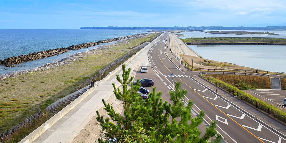
Matsukawaura, Soma City, had recovered considerably by the time of the fourth tour in 2016. Furthermore, the Matsukawaura Bridge and the road circling Sekiko Lagoon had been restored, and the landscape had recovered as a natural park. There were scenes of everyday life unimaginable in the years after the earthquake, such as parents and children leisurely fishing at the port.
2.2. Miyagi Prefecture
Yamamoto Town
September 21 (Holiday Monday) Morning Visit.
Since the March 2020 tour, six months earlier, the restrooms and few remaining platforms had been completely cleared at the former JR Yamashita Station site. Hashimoto Shoten in front of the old station is still in business, and for the first time in several years, we were able to talk with the owner, Mr. Hashimoto. Due to the expansion of the road (east-west) connecting the new station inland to the old station, Hashimoto Shoten will be closed next year and relocated across the street next to the old station.
The surrounding area is under construction, and according to Mr. Hashimoto, the town of Yamamoto has purchased the site of the old railway line from JR and is constructing a town road (north-south). The site of the former JR Yamashita Station will be at the intersection with the east-west road.
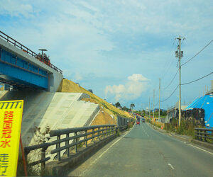
The coastal area from the former JR Yamashita Station site has many vacant lots and uninhabited houses as most of the surviving residents have relocated inland. There were many houses that had been repaired but were vacant. Near the sea, a “raised prefectural road” (two-lanes) was under construction with a 5-meter embankment for tide protection. In the coastal area further from this road, new construction permits are not granted, but remodeling is possible and people can continue to live there. On the seaward side of the road, Fumonji Temple of the Soto sect has been reconstructed in a spacious area where an elderly man came to lay flowers at the cemetery. Near the seawall, there is an evacuation hill (9 meters above sea level) made of fill, which was built in preparation for any future tsunamis.
In 2014, (19) households in the Sasano area (southeast of the former Yamashita Station) who had repaired their houses on the seaward side of the raised prefectural road requested a change in the plan, claiming that the road would be dangerous in the event of a large tsunami. It took a long time to resolve the issue, but after discussions among the prefecture, town, and residents, the residents agreed in August 2017 to a proposal that does not change the route but will build an additional embankment of 5 meters on the seaward side and lower part of the raised road. It should be noted that there were some who questioned whether a raised prefectural road was necessary in the first place.
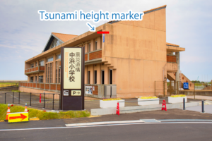
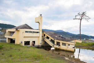
Southeast of JR Sakamoto Station, the Nakahama Elementary School (22-2, Aza Kune, Sakamoto, Yamamoto Town), a relic of the earthquake, was scheduled to re-open on September 26. Unfortunately, we could not enter the building, but the school was well-preserved, and even from the outside it is impressive enough as a reminder of the earthquake. According to the information board, when the school building was constructed in 1989, the entire site was raised by about 2 meters in response to the wishes of local residents. This alteration saved the lives of 90 people who evacuated to the roof in the nick of time. It seems that Yamamoto Town should be proud of its earthquake legacy for future generations.
Yuriage, Natori City, Japan
September 21 (Monday, holiday) morning
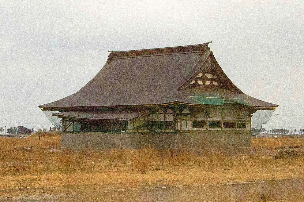
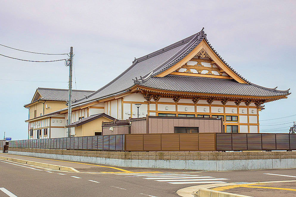
On the way to the coastline in Yuriage, we checked out the spacious main hall of Tozenji Temple, which was rebuilt in 2018 despite being wrecked by the tsunami. Tozenji was rebuilt by the eldest son of the temple’s chief priest and his wife, who survived the tsunami. I was deeply moved by the temple’s reconstruction having seen it in its damaged state during my first tour of Fukushima in 2013.
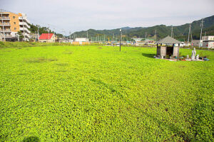
Many people were enjoying walking on the seawall along the coast. The Natori River sluice gate had been replaced with a new larger one, and the levee had been upgraded. Although there were many vacant lots near the coastline, new houses were being built throughout Yuriage, and many people were driving to large shopping areas and restaurants. Some of the roads were crowded with cars, and this was the most visible sign of rejuvenation during the visit.
Finally, we looked for the Yuriage Junior High School, which was severely damaged by the tsunami, but could not find it because the town had changed so much, including the replacement of roads.
Minamisanriku Town
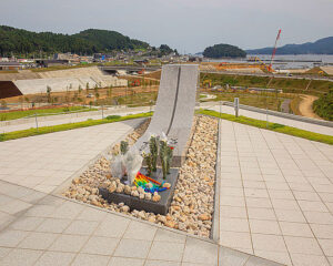
The Sanriku Expressway, which starts from Sendai City, is now free of charge until Miyako City in Iwate Prefecture after passing Matsushima, a tourist destination. From Matsushima, traffic volume decreases and the road becomes more of a trunk road connecting local towns. Heading toward the coast from the Shizugawa IC (Interchange) in northern Miyagi Prefecture, the road comes out next to the Minamisanriku-cho Earthquake Reconstruction Memorial Park, which was partially opened in December 2019.
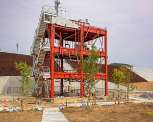
This park is a place of mourning and repose for the victims of the earthquake, as well as a place to pass on the memories and messages of the devastation and to pray for the recovery of the area. The entire park is scheduled to open this fall, but at the time of our visit, construction was still underway. Only the reinforced framework of the original disaster prevention office building remains, where 43 town employees, including a woman who repeatedly called for evacuation, were killed.
During the 4th Fukushima tour in 2014, we passed by the government building by bus, but the surroundings have changed dramatically and do not match our memories of that time. The town decided to dismantle the disaster prevention office building based on the financial burden and the voices of the bereaved families, but in a reversal, the prefectural government decided to preserve the building by making it a protected property. However, since the building was neatly organized and the framework was painted with brand-new paint, it hardly looked as it would of, immediately after the earthquake. Perhaps because the park was only partially open, there were only a few visitors.
↓
3. Iwate Prefecture
Rikuzentakata City
Afternoon, September 21 (Monday, holiday), Morning, September 22 (Tuesday, holiday)
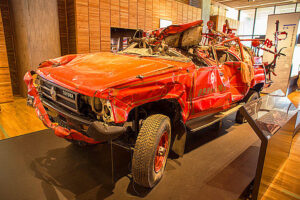
After a two-hour drive from Minamisanriku, we arrived at Rikuzentakata City. Crossing the Kesen River, we saw the Great East Japan Earthquake Tsunami Memorial Museum and the roadside station “Takata Matsubara” which opened in September 2019.
In the vicinity are the Rikuzentakata Youth Hostel, a replica of the Miracle Pine, Tavic 45 (former “Roadside Station Takata Matsubara”), and the Shimojyuku Settlement Promotion Housing, all of which has been developed as the Takata Matsubara Tsunami Reconstruction Memorial Park. Tavic 45 (former “Roadside Station Takada Matsubara”) and the Shimojyuku settlement promotion housing were still under construction when we visited, but the museum and roadside station were bustling with visitors. Although the Miracle Pine is a replica, all the other facilities, preserved in their original state, since the disaster, were well worth seeing. The combination of the Tsunami Memorial Museum and Roadside Station was successful in attracting visitors.
Admission to the Tsunami Memorial Museum was free. Once inside, the museum displayed the history of tsunami disasters, an overview of the Great East Japan Earthquake, lessons learned to protect lives, and gratitude for domestic and international support overcoming the disaster.
Inland is a commercial area centered on Abasse Takata (1 Tate-no-oki, Takata-cho, Rikuzentakata City), a commercial and library complex that opened on April 2017 and is in the center of town. Abasse Takata housed restaurants and a variety of stores necessary for civic life, but the only bank was an ATM. About 50 stores were operating in the surrounding area. Several free public parking lots are conveniently available. Even so, during our visit on the evening of Monday, March 21 (national holiday), the number of customers was sparse and it didn’t feel busy. The main residential district is located further inland, but overall the area appeared to be quiet. As is true of all disaster-affected regions, even though it seemed somewhat crowded during the daytime with visitors, especially the folklore centers and roadside stations, the true state of the town becomes apparent around dusk when they return home.
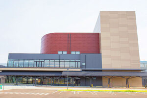
The “Rikuzentakata Civic Cultural Center, Miracle of One Pine Tree Hall” next to Abasse Takata is a very handsome building, which fits in nicely with its surroundings.
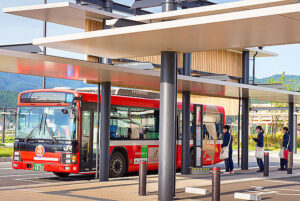
The JR Ofunato Line has been out of service since the Great East Japan Earthquake, and was replaced by the Bus Rapid Transit (BRT) system in March 2013. The railroad line was closed in April 2020, but Rikuzentakata Station (110 Aza Tate-no-oki, Takata-cho, Rikuzentakata City) has been rebuilt, with a bus stop next to it. During our inspection on March 22, we saw seven people, all students waiting for the bus at 7:00 a.m. Most of them had been dropped-off by a family member.
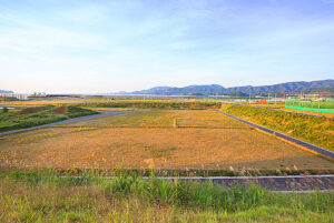
The Capital Hotel 1000 (60-1 Nagasuna, Takada-cho, Takada City), where we stayed during the 4th Fukushima tour in 2014, offered a panoramic view of the coastal area. The land development work around the hotel had already been completed, and although a part of the hotel had been turned into an athletic park, most of the land was still vacant. When asked about additional plans for the area, a staff member said, “It might also become a commercial facility, but that is not certain either”.
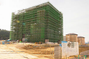
Due to covid-19, the hotel was completely inactive as restaurants were closed. It also hampered the recovery efforts. In the inland area, construction of a new 7-story Rikuzentakata City Hall was underway, but it still seemed unbalanced with the appearance of the town. In the future, we hope that the new government building will be reconstructed so that it will not look inferior to the old one.
Otsuchi Town
September 22 (Tuesday, holiday) morning visit
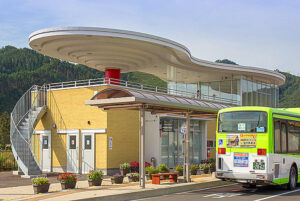
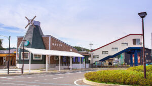
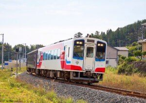
Otsuchi Station (1 Honmachi, Otsuchi Town) on the JR East Japan Yamada Line became a third-sector railroad called the Sanriku Railway Rias Line, after the earthquake and resumed operations in March 2019. The station building was newly built in the image of Hyotanjima, the symbol of the town. At 8:00 a.m. on the 22nd, it only had a few passengers.
In front of the station was the Sanriku Yatai Mura, with only about nine restaurants, but public housing and new houses were beginning to be built in the surrounding area. Since the roads had been replaced and the town had changed significantly since the fourth tour in 2014, we parked our car in front of the station and toured the site of the former Otsuchi Town Hall building and its surrounding area on foot, asking locals for directions. The old town hall building was demolished in January 2019 and now transformed into a vacant lot for disaster prevention purposes. Perhaps intentionally, there was nothing to indicate that this was the site of the old town hall building. No one visits the site, it’s like a forgotten place. The barely remaining flower stand and Jizo will be moved to a new memorial facility to be built by the town.
Residents were divided on what to do with the old town hall building. Forty employees and others lost their lives in the tsunami at the Otsuchi Town Hall building, but it is unclear why no evacuation order was given to them. Throughout the visit, I felt a lingering sense of regret for the town government that such issues were left unidentified and addressed. Mayor Hirano announced that he would begin an investigation into the deaths of employees and others in February 2020, eight years after the disaster and after the demolition of the old town hall building.
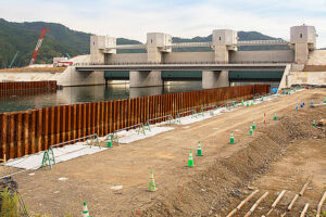
At the mouth of the Otsuchi River, the huge “Otsuchi River Sluice Gate” (project owner is Iwate Prefecture) was completed and river construction in the surrounding area was ongoing. Since April 2020, the Otsuchi and Kozuchi River sluice gates have been equipped with the latest “automatic sluice and land lock closure system” using satellite links in the event of a disaster. Iwate Prefecture plans to carry out similar maintenance work on approximately 220 sluice gates and land locks in the future.
Yamada Town
September 22 (Tuesday, holiday) morning
Yamada was the last town we visited during our fourth Fukushima tour in 2014, and it was also the last place we visited this time. Most of the coastal plain area of Yamada Town was destroyed, and although vacant lots are still scattered, a certain number of stores and residences were rebuilt around Rikuchu Yamada Station (1-2, Nagasaki, Yamada Town) on the Sanriku Railway Rias Line. Several six-story townhouses could also be seen. The town hall building remained as it was before. The compact town seemed somewhat cohesive as the supermarket in front of the station was crowded with shoppers, and some elderly people came by cab to also shop.
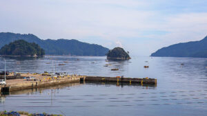
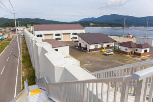
Many aquaculture crafts were floating in Yamada Bay, indicating the revival of the fishing industry, the town’s main business. The Yamada Town website was advertising for fishermen, and it could therefore be inferred that there was a labor shortage for qualified workers. Fisheries-related facilities were located outside the seawall, and stairs were installed every few dozen meters to allow evacuation inland in the case of a large earthquake in the future.
There are no particular remains of the earthquake visible or any memorial facilities in Yamada, however, the impression was that the town has been steadily rebuilding, although not impressively in my opinion. Yamada town is known for its scenic beauty, but there were few tourists.
4. Impressions after three days of touring the affected areas
It was a holiday weekend when the “Go To Travel” Campaign (excluding Tokyo) was implemented, and tourist destinations such as Matsushima seemed to be crowded with many people, but there were not so many people visiting the affected areas in Tohoku, therefore no traffic congestion.
Our previous Fukushima tours have shown that the reconstruction gap between the areas damaged by the nuclear accident in Fukushima Prefecture and those in Miyagi and Iwate prefectures is widening, made evident by our visits to the areas around JR Ono Station (Okuma Town) and JR Futaba Station (Futaba Town).
The government has launched a project called the Fukushima Innovation Coast Initiative to support the reconstruction of Fukushima Prefecture, but this does not necessarily seem to be the grassroots measure the disaster victims were hoping for. One example is the Great East Japan Earthquake and Nuclear Disaster Memorial Museum that opened in Futaba Town. A newspaper article on October 7, 2020 revealed that the recording of “Testimonies of Prefectural Citizens” was made under the condition that criticism of TEPCO or the government was suppressed. When I actually visited the museum, I did wonder what the un-suppressed thoughts of the people were. On September 30, 2020, the Sendai High Court ruled in a class action lawsuit filed by more than 3,600 residents of Fukushima Prefecture over the accident at TEPCO’s Fukushima Daiichi Nuclear Power Station, harshly condemning the government’s response and TEPCO’s responsibility. The government and TEPCO must take this decision very seriously.
In the affected areas, memorial facilities are being built, future plans are being made, and the preservation of the earthquake’s remains is underway. However, there are differences of opinion on the preservation and demolition of the structures that caused many victims. The remains of the earthquake will serve as a tourist resource as well as a way to pass on the reminder of the damage, and it is likely that the victims have mixed feelings about such things. Many structures were actually demolished. The former town hall building in Otsuchi town was demolished after a long period of debate, while the disaster prevention building in Minamisanriku was preserved. Some towns, such as Yamada, did not preserve any significant earthquake remains in their reconstruction projects. Regional differences within the same town should also be noted, with non-affected areas remaining intact and affected areas being transformed into new towns.
The Sanriku Expressway, which is free of charge, is highly convenient and is expected to serve as a supply route in the event of a future disaster. Meanwhile, Sanriku Railway’s 163-km line from Mori Station (Ofunato City) to Kuji Station (Kuji City) became the Sanriku Railway Rias Line, which began operations on March 24, 2019, after the JR Yamada Line was discontinued and the line between Miyako Station and Kamaishi Station was transferred to this railway company.
In 2020, the spread of covid-19 had a considerable impact on the affected areas, including a drop in the price of locally landed seafood. Under these circumstances, if diverse policies are not connected as a safety net encompassing the entire society, including local areas, the damage to the weakest areas will be even greater. This may be an opportunity to rethink society as a whole. It was with these thoughts in mind that I left the disaster area.
Ten Years Since the Earthquake
This time, I visited Ofunato in September 2020 and met with two victims of the disaster. Nine and a half years had passed.
One is a man in his 50s. He had a bright smile, and was carrying portable oxygen due to pulmonary arterial hypertension.
He and his mother ran a liquor store until the earthquake, but the store was completely destroyed by the tsunami and the remains were dismantled. Later, his mother suffered from dementia. Suddenly, one day, she disappeared. Everyone searched for her, but she could not be found. After a few days, the news came that she had been found in the sea at the mouth of an estuary. He was left alone and said that sometimes the waves sound like human voices.
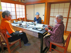 The other woman was also in her 50s. She has retinitis pigmentosa and has no vision. She was sent to visit me by her daughter who works as a nursery school teacher. Her mother is currently working at a Type B employment support office for people with disabilities. When asked what kind of work it was, she said I fold sheets of washed bedding. She works with people with intellectual disabilities, but there is no one to talk to. She said that although there are many hardships, such as the lack of instructors, she feels the joy of being able to do her job. “I don’t want to remember the tsunami. I survived it, had breast cancer surgery, and suffered so much, I can’t die now. I have to live”, she said with a smile. What a wonderful person she is. She was so refreshing and cheered us up.


